MyTopo
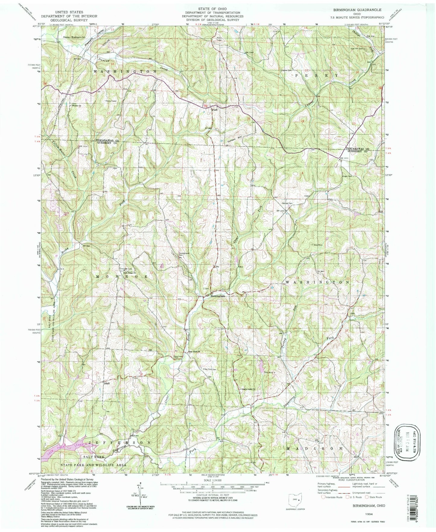
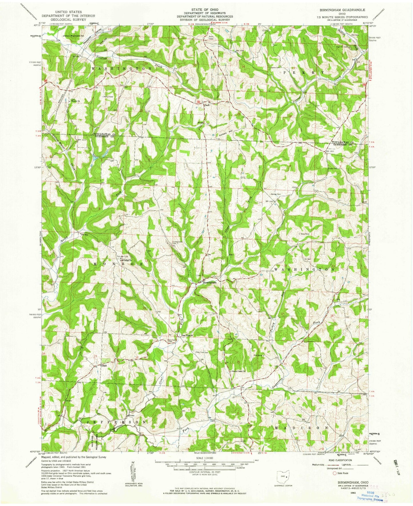
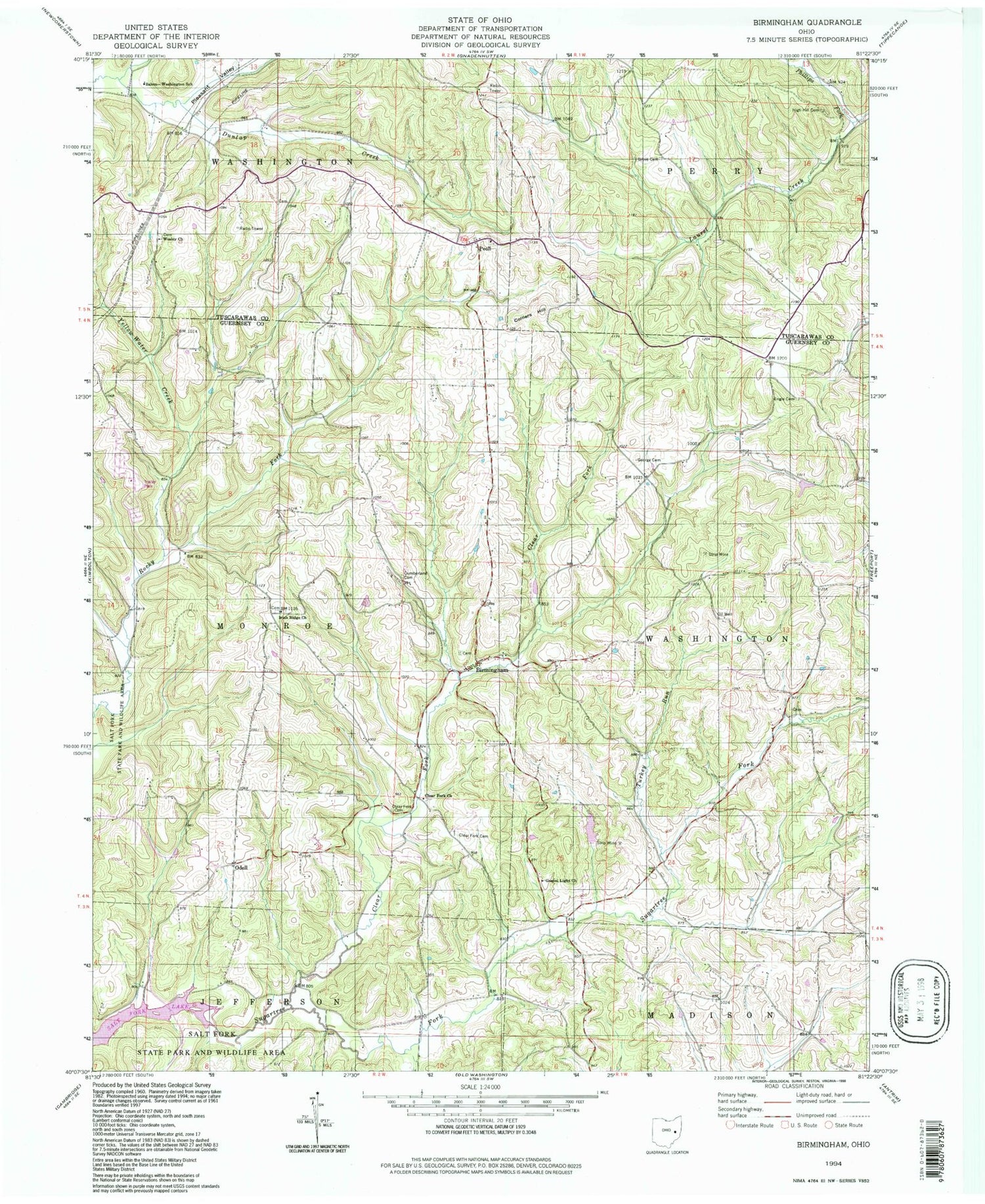
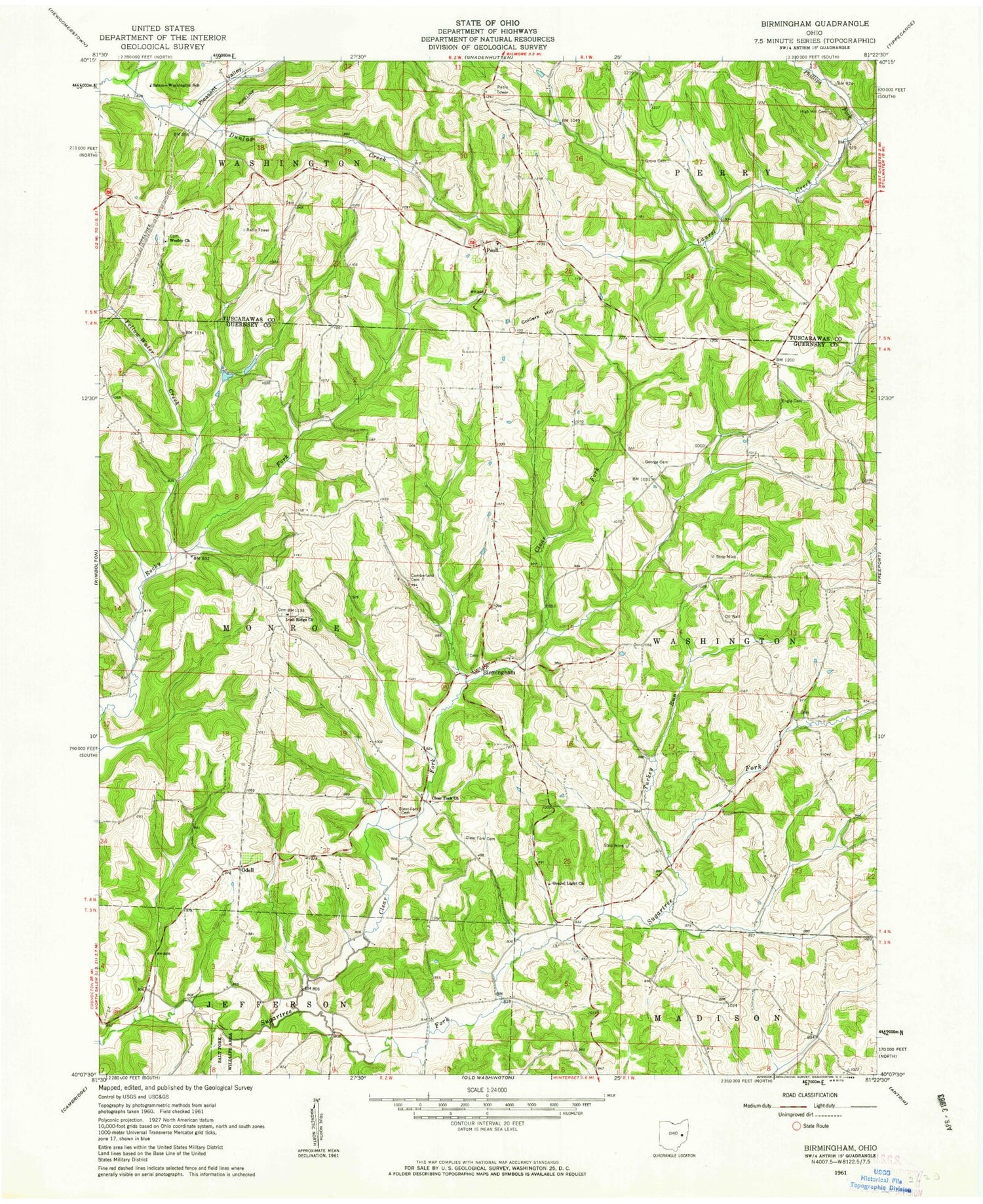
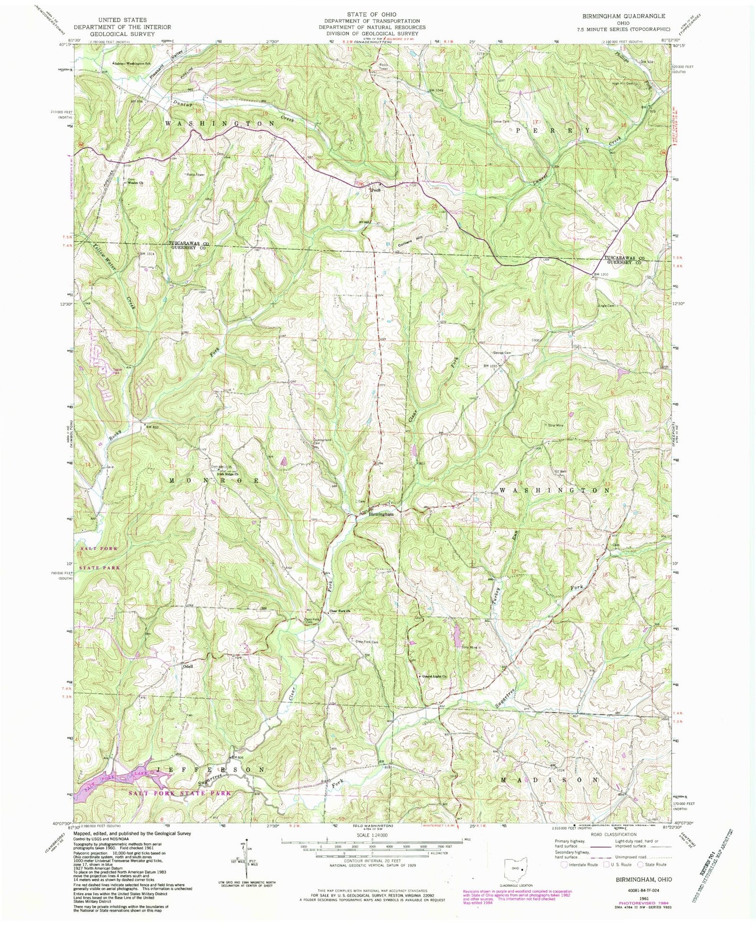
Classic USGS Birmingham Ohio 7.5'x7.5' Topo Map
Couldn't load pickup availability
Historical USGS topographic quad map of Birmingham in the state of Ohio. Typical map scale is 1:24,000, but may vary for certain years, if available. Print size: 24" x 27"
This quadrangle is in the following counties: Guernsey, Tuscarawas.
The map contains contour lines, roads, rivers, towns, and lakes. Printed on high-quality waterproof paper with UV fade-resistant inks, and shipped rolled.
Contains the following named places: Clear Fork, Clearfork Baptist Cemetery, Clearfork United Presbyterian Cemetery, Clear Fork Church, Cumberland Cemetery, Engle Cemetery, George Cemetery, Gospel Light Church, Grove Cemetery, High Hill Cemetery, Irish Ridge Church, Pleasant Valley, Salem-Washington School, Turkey Run, Wesley Church, Yellow Water Creek, Colliers Hill, Odell, Peoli, Purdue School (historical), Pleasant Grove School (historical), Moccasin School (historical), Sligo School (historical), Oak Grove School (historical), North Union School (historical), Clear Fork School (historical), Hopewell School (historical), Berwyn (historical), Peoli United Methodist Church, Phillips Fork, Hickory Hollow Lake Dam, Hickory Hollow Lake, Birmingham, Irish Ridge, Township of Monroe, Township of Washington, Birmingham Cemetery, Darby Cemetery, Irish Ridge Cemetery, Couts Family Cemetery, New Peoli Cemetery, Old Peoli Cemetery, Wesley Chapel Cemetery, Odell Post Office (historical), Peoli Post Office (historical), Clear Fork, Clearfork Baptist Cemetery, Clearfork United Presbyterian Cemetery, Clear Fork Church, Cumberland Cemetery, Engle Cemetery, George Cemetery, Gospel Light Church, Grove Cemetery, High Hill Cemetery, Irish Ridge Church, Pleasant Valley, Salem-Washington School, Turkey Run, Wesley Church, Yellow Water Creek, Colliers Hill, Odell, Peoli, Purdue School (historical), Pleasant Grove School (historical), Moccasin School (historical), Sligo School (historical), Oak Grove School (historical), North Union School (historical), Clear Fork School (historical), Hopewell School (historical), Berwyn (historical), Peoli United Methodist Church, Phillips Fork, Hickory Hollow Lake Dam, Hickory Hollow Lake, Birmingham, Irish Ridge, Township of Monroe, Township of Washington, Birmingham Cemetery, Darby Cemetery, Irish Ridge Cemetery, Couts Family Cemetery, New Peoli Cemetery, Old Peoli Cemetery, Wesley Chapel Cemetery, Odell Post Office (historical), Peoli Post Office (historical)