MyTopo
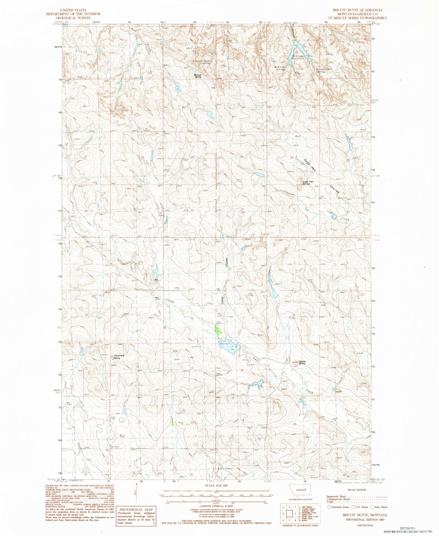
Classic USGS Biscuit Butte Montana 7.5'x7.5' Topo Map
Couldn't load pickup availability
Historical USGS topographic quad map of Biscuit Butte in the state of Montana. Map scale may vary for some years, but is generally around 1:24,000. Print size is approximately 24" x 27"
This quadrangle is in the following counties: Garfield.
The map contains contour lines, roads, rivers, towns, and lakes. Printed on high-quality waterproof paper with UV fade-resistant inks, and shipped rolled.
Contains the following named places: 19N36E03AA__01 Well, 20N36E27CCA_01 Well, B Murion Number 3 Dam, Biscuit Butte, Biscuit Butte Spring, Camel Coulee, Castle Butte, Engdahl Number 3 Dam, Fannon Number 1 Dam, Fannon Number 2 Dam, Finger Butte Post Office, Haystack Butte, Lehner Dam, Lindbergh Spring, McKrone Reservoir, McKrone Spring, Murion B Number 2 Dam, Murnion Dam, North Garfield Division, Sage Hen Buttes, Sage Hen Coulee