MyTopo
Classic USGS Bishop Mountain Idaho 7.5'x7.5' Topo Map
Regular price
$16.95
Regular price
Sale price
$16.95
Unit price
per
Couldn't load pickup availability
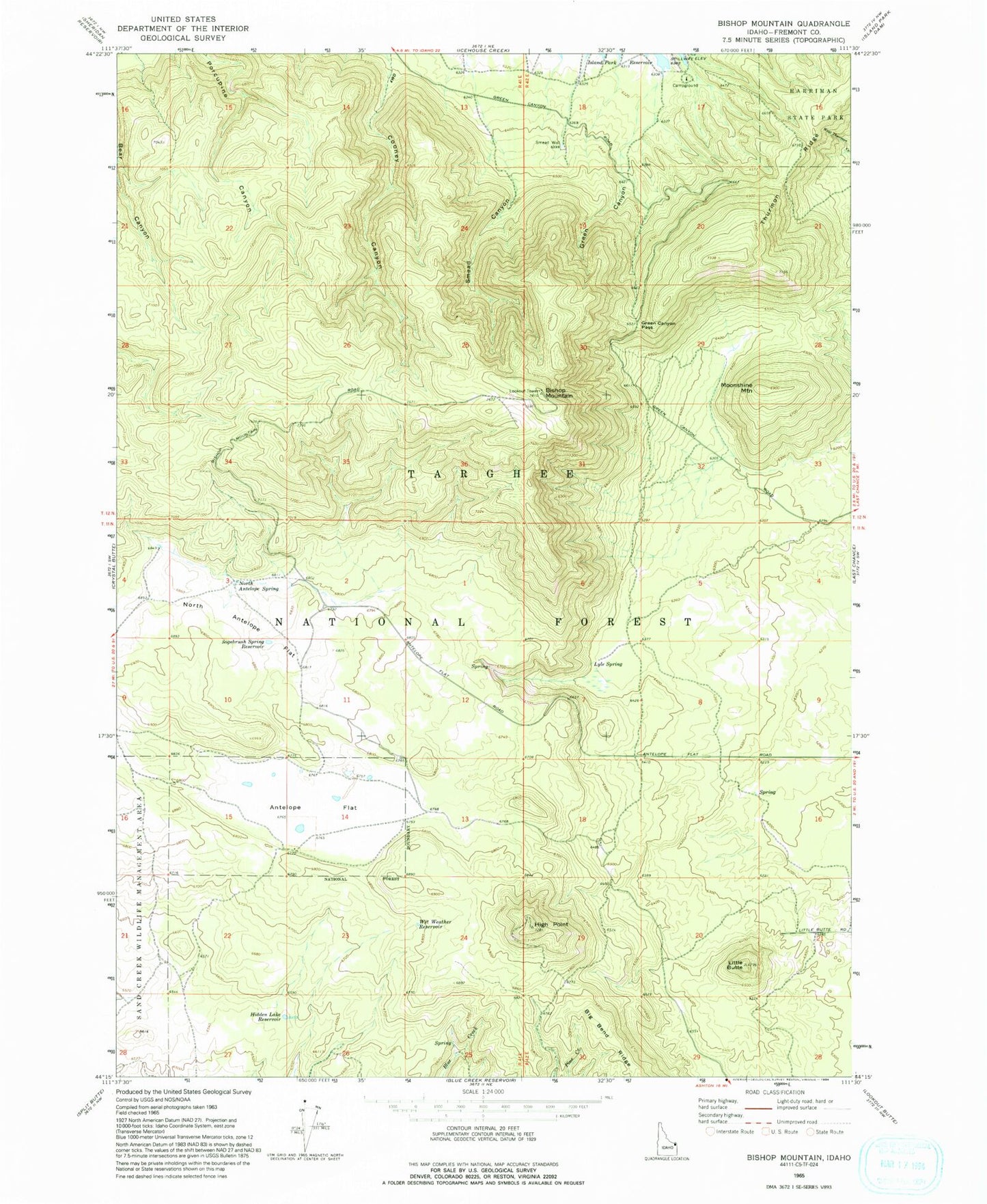
Historical USGS topographic quad map of Bishop Mountain in the state of Idaho. Map scale is 1:24000. Print size is approximately 24" x 27"
This quadrangle is in the following counties: Fremont.
The map contains contour lines, roads, rivers, towns, and lakes. Printed on high-quality waterproof paper with UV fade-resistant inks, and shipped rolled.
Contains the following named places: Antelope Flat, Big Bend Ridge, Bishop Mountain, Green Canyon, Green Canyon Pass, Hidden Lake Reservoir, High Point, Island Park Division, Little Butte, Lyle Spring, Moonshine Mountain, North Antelope Flat, North Antelope Spring, Sagebrush Spring Reservoir, Smead Canyon, Smead Well, Thurmon Ridge, Wet Weather Reservoir