
MyTopo
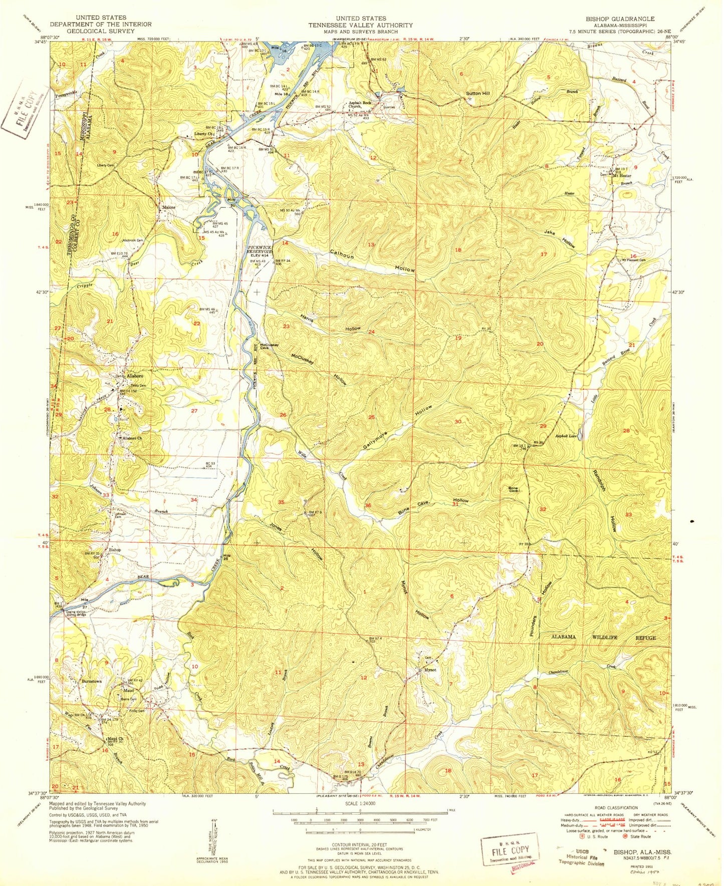
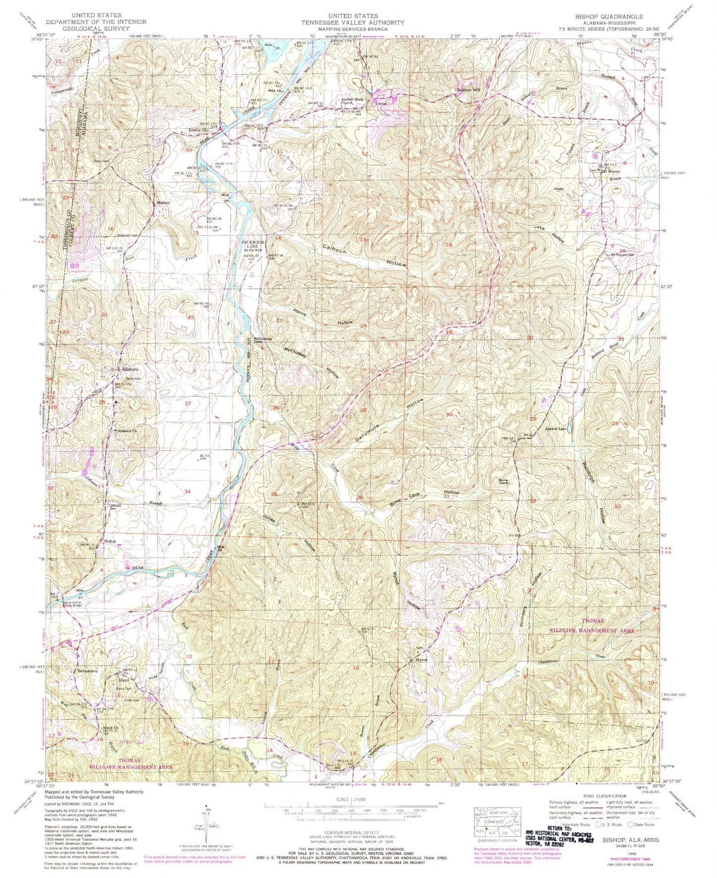
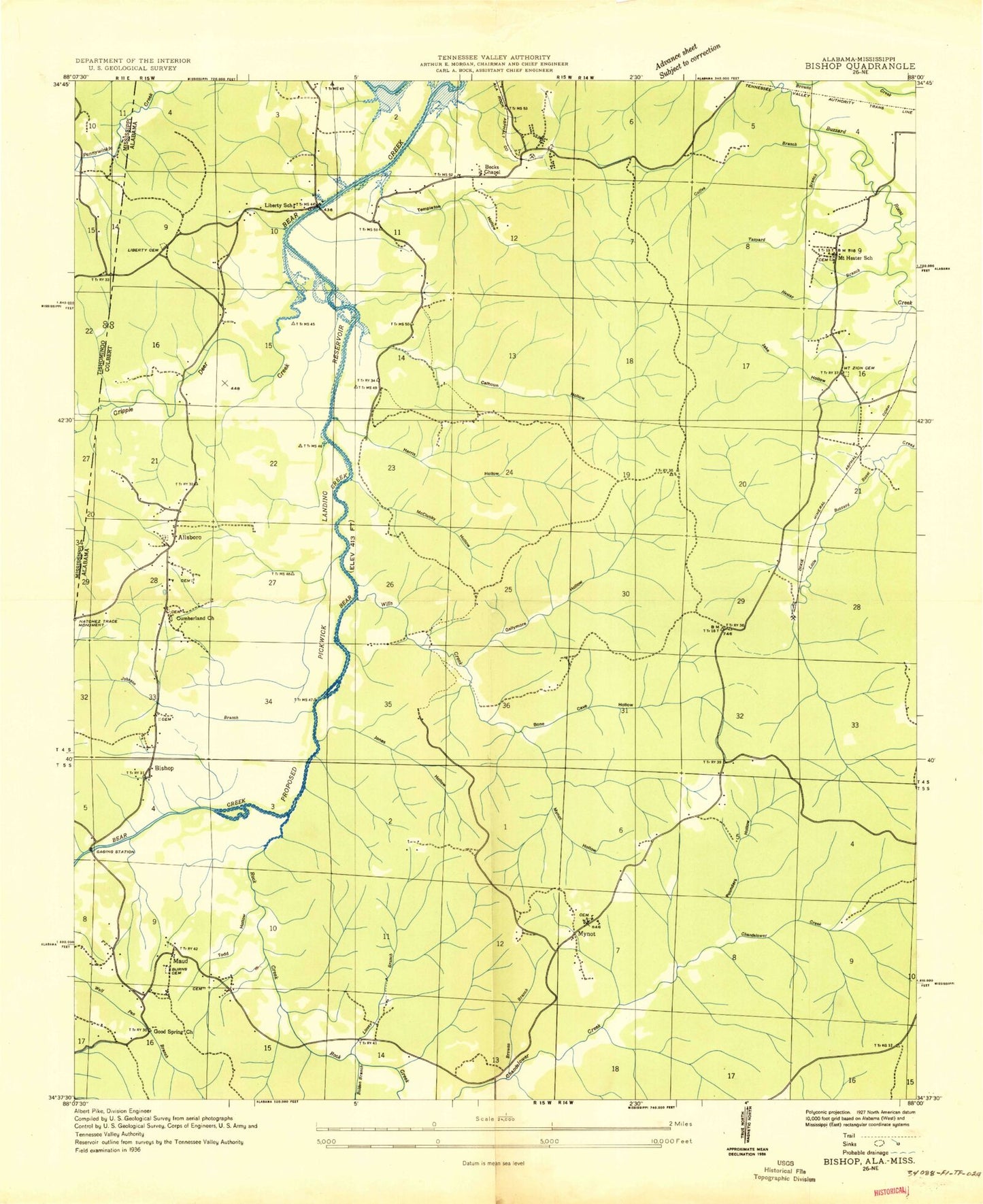
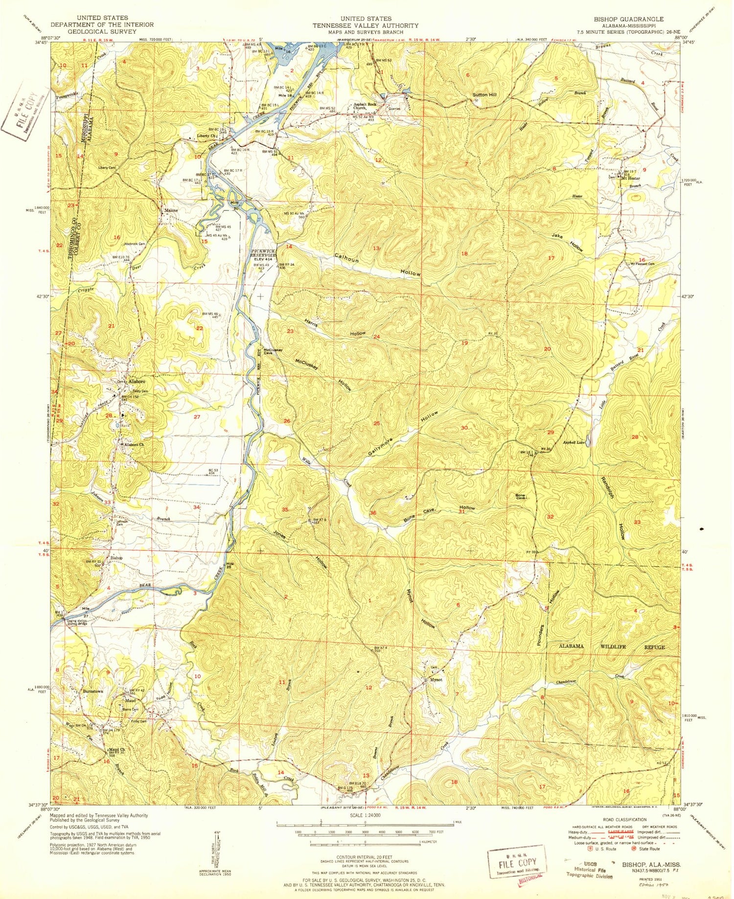
Classic USGS Bishop Alabama 7.5'x7.5' Topo Map
Couldn't load pickup availability
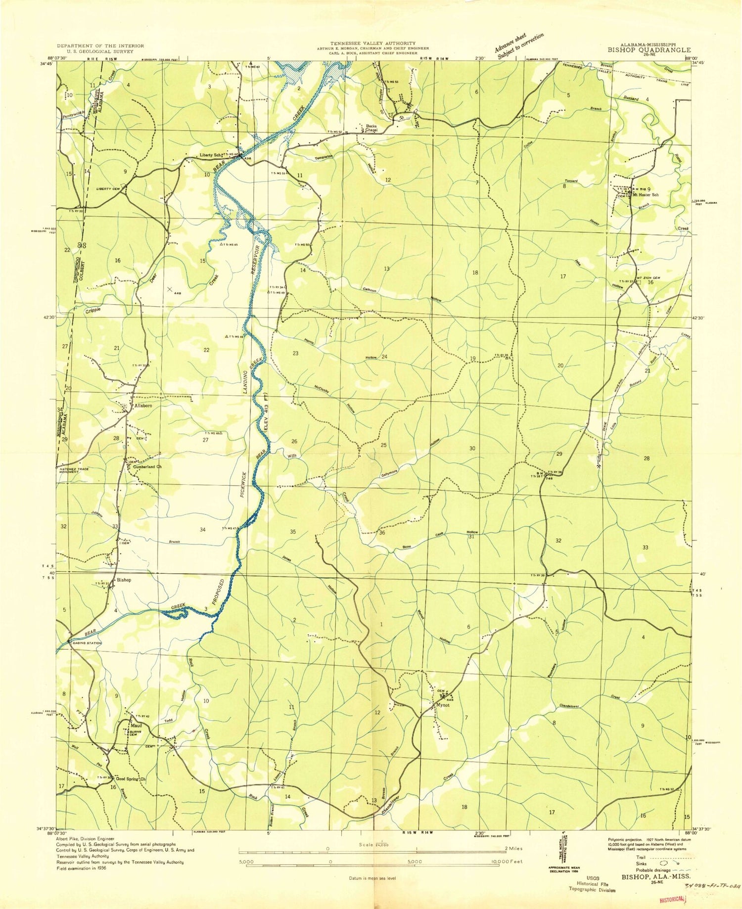
Historical USGS topographic quad map of Bishop in the states of Alabama, Mississippi. Map scale may vary for some years, but is generally around 1:24,000. Print size is approximately 24" x 27"
This quadrangle is in the following counties: Colbert, Tishomingo.
The map contains contour lines, roads, rivers, towns, and lakes. Printed on high-quality waterproof paper with UV fade-resistant inks, and shipped rolled.
Contains the following named places: Allsboro, Allsboro Church, Allsboro Junior High School, Alsobrook Cemetery, Alsobrook Church, Alsobrook School, Asphalt Lake, Asphalt Rock Baptist Church, Bishop, Boldin Mill Branch, Bone Cave Hollow, Browns Branch, Burnstown, Calhoun Hollow, Cherokee Division, Cripple Deer Creek, Finley Cemetery, Gallymore Hollow, Gibbs Branch, Good Springs, Good Springs Methodist Church, Haake Hollow Branch, Harris Hollow, Henderson Branch, Hester Branch, Jake Hollow, Johnson Branch, Johnson Cemetery, Jones Hollow, Liberty Cemetery, Liberty Methodist Episcopal Church, Liberty Missionary Baptist Church, Liberty School, Lindsey Branch, Malone, Maud, Maud - Burns Cemetery, McCluskey Hollow, Mount Hester, Mount Hester Cemetery, Mount Hester Cumberland Presbyterian Church, Mount Hester School, Mount Pleasant Cemetery, Mynot, Mynot Cemetery, Mynot Church of Christ, Mynot Hollow, Mynot School, Mynott Chapel Missionary Baptist Church, Natchez Trace Monument, Pounders Hollow, Randolph Hollow, Rock Creek, Sutton Hill, Tanyard Branch, Templeton Hollow, Todd Hollow, Twitty Cemetery, Weaver Branch, West Colbert Sportsman Club, Wills Creek, ZIP Code: 35616