MyTopo
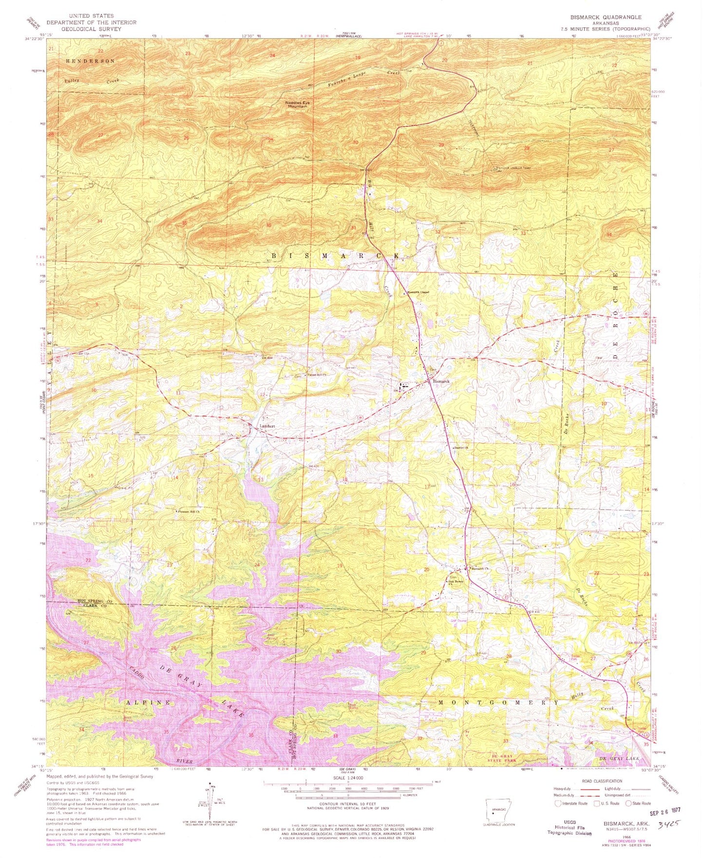
Classic USGS Bismarck Arkansas 7.5'x7.5' Topo Map
Couldn't load pickup availability
Historical USGS topographic quad map of Bismarck in the state of Arkansas. Map scale is 1:24000. Print size is approximately 24" x 27"
This quadrangle is in the following counties: Clark, Hot Spring.
The map contains contour lines, roads, rivers, towns, and lakes. Printed on high-quality waterproof paper with UV fade-resistant inks, and shipped rolled.
Contains the following named places: Alpine Ridge Recreation Area, Arlie Moore Landing Use Area, Baptist Church, Big Hill Creek, Bismarck, Bismarck Census Designated Place, Bismarck Chapel, Bismarck Church, Bismarck Elementary School, Bismarck Fire Department Main Station, Bismarck High School, Bismarck Lookout Tower, Bismarck Middle School, Bismarck Post Office, Bismarck Rural Fire Department, Bismarck Rural Fire Department, Bismarck United Methodist Church, Caddo Drive Recreation Area, De Gray Lake, Duffie (historical), Edgewood Recreation Area, Forest Hill Church, Forrest Hill Cemetery, Holly Creek, Lambert, Lenox Marcus Recreation Area, Needles Eye Mountain, Oak Bower, Oak Bower Cemetery, Oak Bower Church, Oak Bower Recreation Area, Old De Roche, Pleasant Hill Cemetery, Pleasant Hill Cemetery, Township of Bismarck