

MyTopo
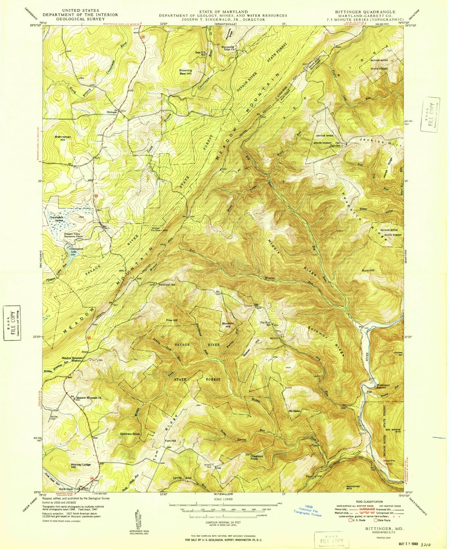
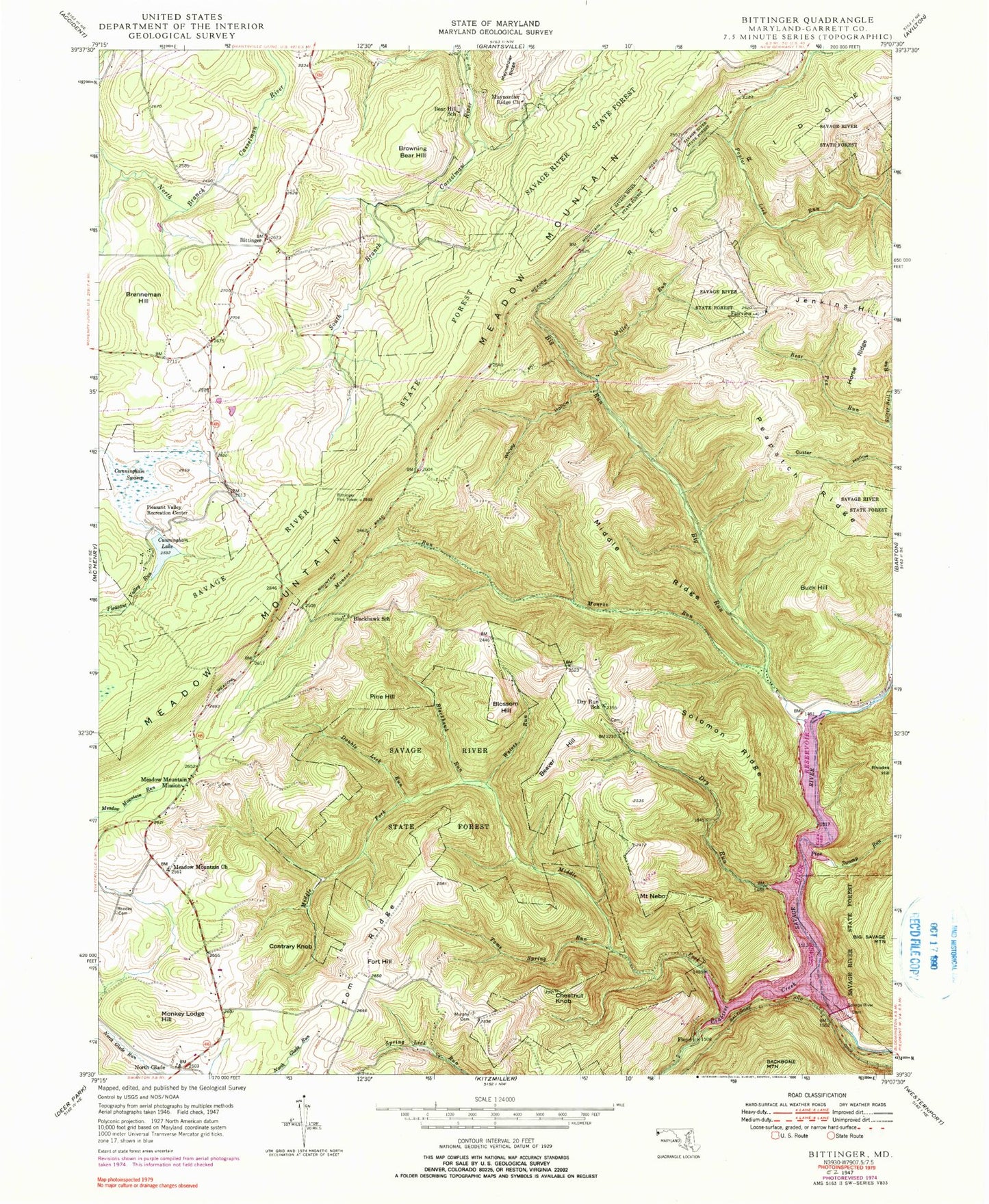
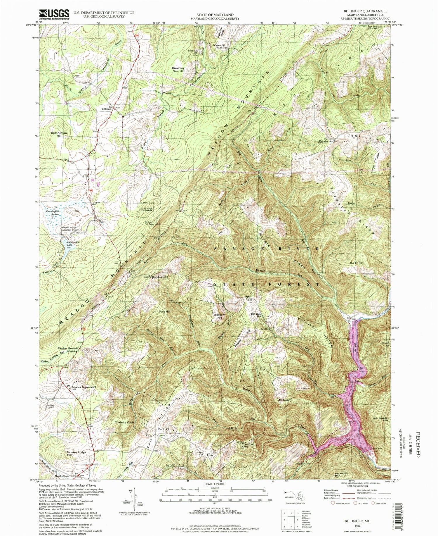
Classic USGS Bittinger Maryland 7.5'x7.5' Topo Map
Couldn't load pickup availability
Historical USGS topographic quad map of Bittinger in the states of Maryland, Pennsylvania. Typical map scale is 1:24,000, but may vary for certain years, if available. Print size: 24" x 27"
This quadrangle is in the following counties: Garrett.
The map contains contour lines, roads, rivers, towns, and lakes. Printed on high-quality waterproof paper with UV fade-resistant inks, and shipped rolled.
Contains the following named places: Bear Hill School, Big Run, Blackhawk Run, Blackhawk School, Chestnut Knob, Crabtree Creek, Cunningham Lake, Cunningham Swamp, Double Lick Run, Dry Run, Dry Run School, Maynardier Ridge Church, Meadow Mountain Church, Meadow Mountain Mission, Middle Fork Crabtree Creek, Middle Ridge, Miller Run, Monroe Run, Murphy Cemetery, Peapatch Ridge, Pine Swamp Run, Pleasant Valley Recreation Center, Rhodes Cemetery, Savage River Dam, Savage River Reservoir, Solomon Ridge, Tom Ridge, Toms Spring Run, Waters Run, Whiskey Hollow, Bittinger, Fairview, Floyd, North Glade, Beaver Hill, Blossom Hill, Brenneman Hill, Browning Bear Hill, Buck Hill, Contrary Knob, Fort Hill, Jenkins Hill, Meadow Mountain, Monkey Lodge Hill, Mount Nebo, Pine Hill, Bittinger Fire Tower, Pleasant Valley Run Dam, Cunningham Lake, Big Run State Park, Bittinger Cemetery, Bittinger Post Office, North Glade School (historical), North Glade United Methodist Church, Pritts Cemetery, District 12 Bittinger, Bittinger Volunteer Fire Department Station 90, Lake Heritage, Bear Hill School, Big Run, Blackhawk Run, Blackhawk School, Chestnut Knob, Crabtree Creek, Cunningham Lake, Cunningham Swamp, Double Lick Run, Dry Run, Dry Run School, Maynardier Ridge Church, Meadow Mountain Church, Meadow Mountain Mission, Middle Fork Crabtree Creek, Middle Ridge, Miller Run, Monroe Run, Murphy Cemetery, Peapatch Ridge, Pine Swamp Run, Pleasant Valley Recreation Center, Rhodes Cemetery, Savage River Dam, Savage River Reservoir, Solomon Ridge, Tom Ridge, Toms Spring Run, Waters Run, Whiskey Hollow, Bittinger, Fairview, Floyd, North Glade, Beaver Hill, Blossom Hill, Brenneman Hill, Browning Bear Hill, Buck Hill, Contrary Knob, Fort Hill, Jenkins Hill, Meadow Mountain, Monkey Lodge Hill, Mount Nebo, Pine Hill, Bittinger Fire Tower, Pleasant Valley Run Dam, Cunningham Lake, Big Run State Park, Bittinger Cemetery, Bittinger Post Office, North Glade School (historical), North Glade United Methodist Church, Pritts Cemetery, District 12 Bittinger, Bittinger Volunteer Fire Department Station 90, Lake Heritage