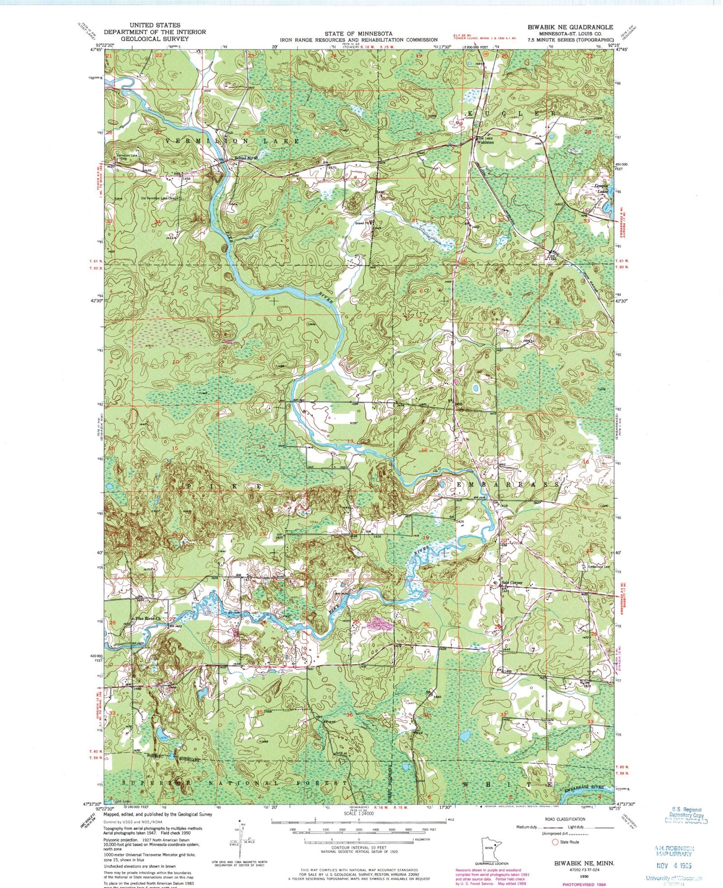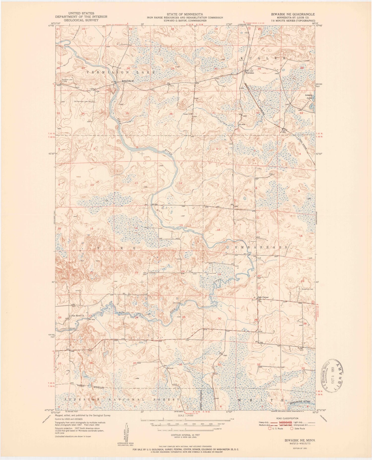
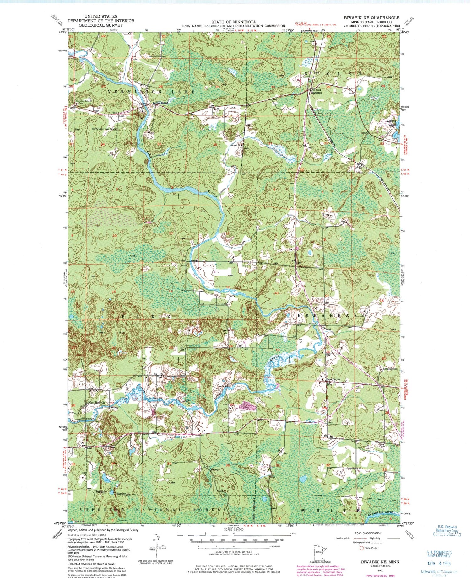
MyTopo
Classic USGS Biwabik NE Minnesota 7.5'x7.5' Topo Map
Regular price
$16.95
Regular price
Sale price
$16.95
Unit price
per
Couldn't load pickup availability
Historical USGS topographic quad map of Biwabik NE in the state of Minnesota. Typical map scale is 1:24,000, but may vary for certain years, if available. Print size: 24" x 27"
This quadrangle is in the following counties: St. Louis.
The map contains contour lines, roads, rivers, towns, and lakes. Printed on high-quality waterproof paper with UV fade-resistant inks, and shipped rolled.
Contains the following named places: Pike River Recreation Site, Pike River Recreation Site, Embarrass Cemetery, Old Vermilion Lake Cemetery, Pike River Church, Salo Corner, School Number 40, Town of Vermilion Lake Cemetery, Wahlsten, Township of Pike, Pike River Cemetery, Pike River Wayside Park