MyTopo
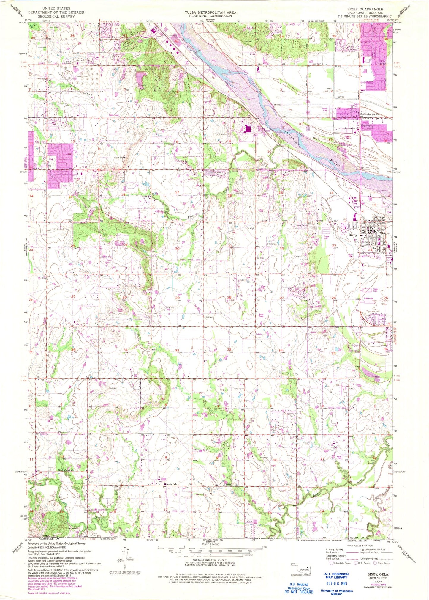
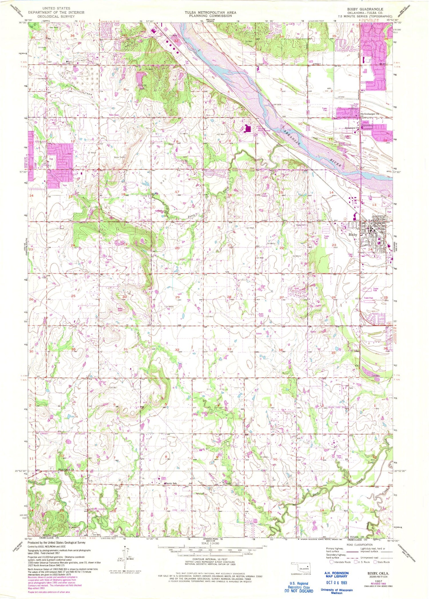
Classic USGS Bixby Oklahoma 7.5'x7.5' Topo Map
Couldn't load pickup availability
Historical USGS topographic quad map of Bixby in the state of Oklahoma. Map scale may vary for some years, but is generally around 1:24,000. Print size is approximately 24" x 27"
This quadrangle is in the following counties: Tulsa.
The map contains contour lines, roads, rivers, towns, and lakes. Printed on high-quality waterproof paper with UV fade-resistant inks, and shipped rolled.
Contains the following named places: Applegate Hill, Bixby, Bixby Cemetery, Bixby Christian Church, Bixby Fire Department Station 1, Bixby Fire Department Station 2, Bixby Freewill Baptist Church, Bixby High School, Bixby Middle School, Bixby North Elementary School, Bixby Plaza, Bixby Police Department, Bixby Post Office, Brassfield 5th and 6th Grade Center, Calvary Baptist Church, Central Elementary School, Church of Christ, Church of the Hill, City of Bixby, City of Jenks, Duck Creek, Elwood Missionary Church, Faith Free Will Baptist Church, Faith Temple Assembly, Fellowship of Christ Outreach, First Assembly of God, First Baptist Church, First United Methodist Church, Glenpool Police Department, Jehovahs Witnesses, Jenks Fire Department Station 2, Midwest Agape Chapel, Myers Field, North Heights Church of Christ, Oknoname 143008 Dam, Oknoname 143008 Reservoir, Oknoname 143009 Dam, Oknoname 143009 Reservoir, Oknoname 143010 Dam, Oknoname 143010 Reservoir, Oknoname 143011 Dam, Oknoname 143011 Reservoir, One Accord Church, Posey, Posey Creek, Prairie Gardens Cemetery, Regular Baptist Church, Riverview Church, Saint Clements Catholic Church, Saint James Presbyterian Church, Shellenbarger Church, Skyline Lake, Skyline Park, Skyline Park Dam, South Tulsa Division, Spartan Family Shopping Center, Tiger Tank Farm, Town and Country Shopping Center, ZIP Codes: 74008, 74037