MyTopo
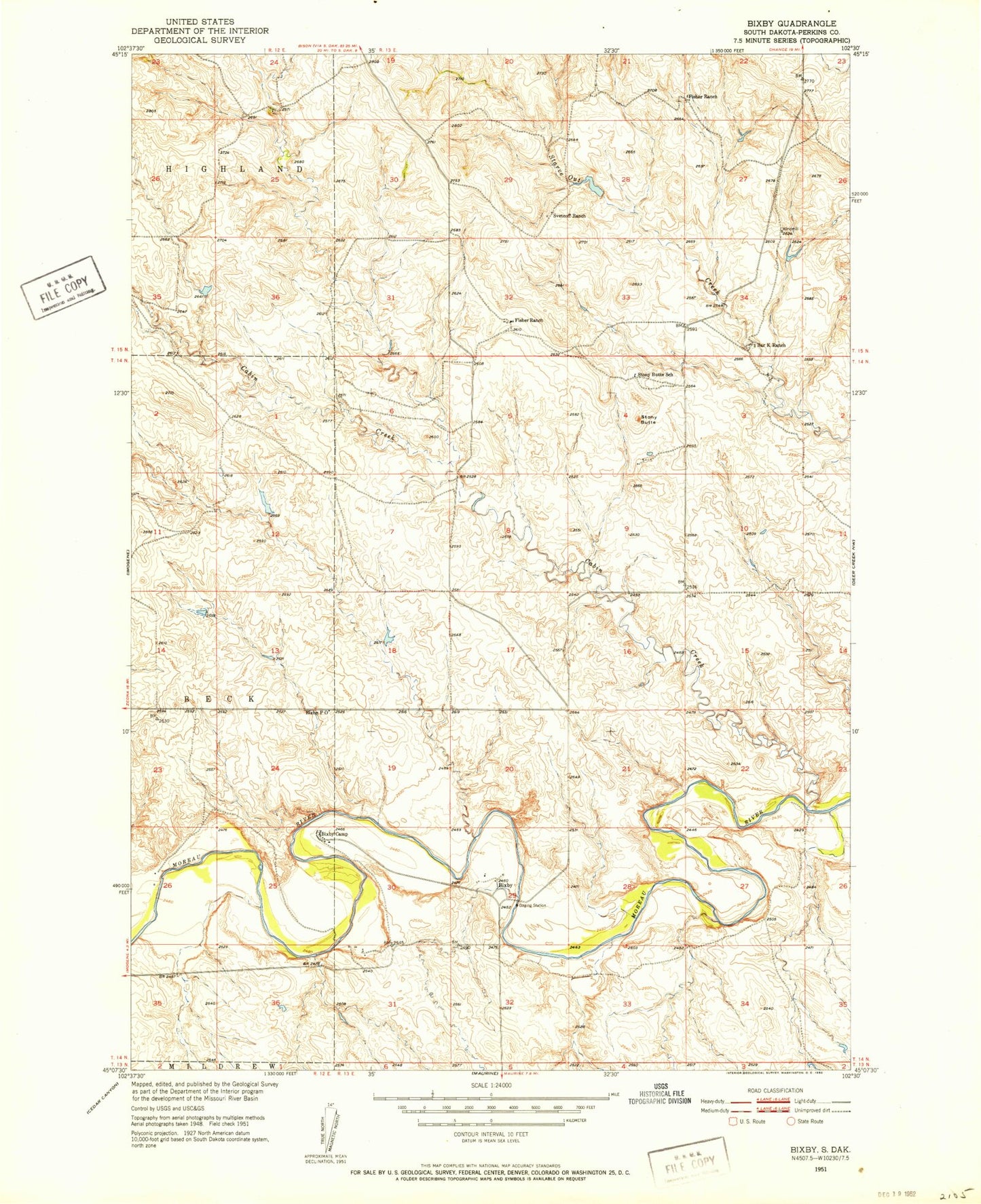
Classic USGS Bixby South Dakota 7.5'x7.5' Topo Map
Regular price
$16.95
Regular price
Sale price
$16.95
Unit price
per
Couldn't load pickup availability
Historical USGS topographic quad map of Bixby in the state of South Dakota. Map scale may vary for some years, but is generally around 1:24,000. Print size is approximately 24" x 27"
This quadrangle is in the following counties: Perkins.
The map contains contour lines, roads, rivers, towns, and lakes. Printed on high-quality waterproof paper with UV fade-resistant inks, and shipped rolled.
Contains the following named places: Bar K Ranch, Bixby, Bixby Camp, Bixby Post Office, Cabin Creek, Fisher Ranch, Mark Fischer Dam, Moreau River Badlands, Stony Butte, Stony Butte School, Svetcoff Ranch, Unorganized Territory of South Perkins, Zeke Allart Dam