MyTopo
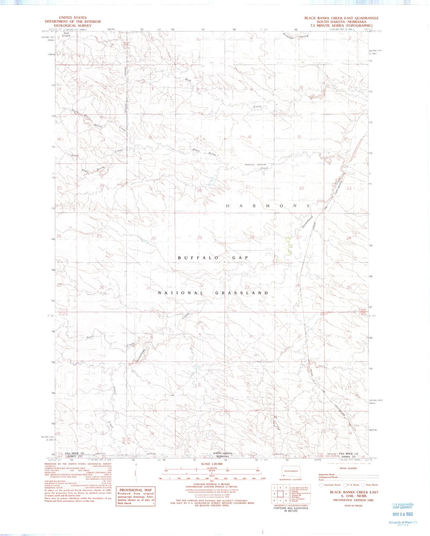
Classic USGS Black Banks Creek East South Dakota 7.5'x7.5' Topo Map
Couldn't load pickup availability
Historical USGS topographic quad map of Black Banks Creek East in the state of South Dakota. Map scale may vary for some years, but is generally around 1:24,000. Print size is approximately 24" x 27"
This quadrangle is in the following counties: Dawes, Fall River.
The map contains contour lines, roads, rivers, towns, and lakes. Printed on high-quality waterproof paper with UV fade-resistant inks, and shipped rolled.
Contains the following named places: Black Banks Creek, Bogner Field, Duck Creek, E E Pettegrew Dam, E E Pettegrew Dam Number 2, Hillcrest, Hillcrest Cemetery, North Black Banks Creek, Pettigrew Dam, Pettigrew Pond Number 2 Dam, Reaser Stock Dam, Romey Irrigation Dam, South Black Banks Creek, Township of Harmony, ZIP Code: 57763