MyTopo
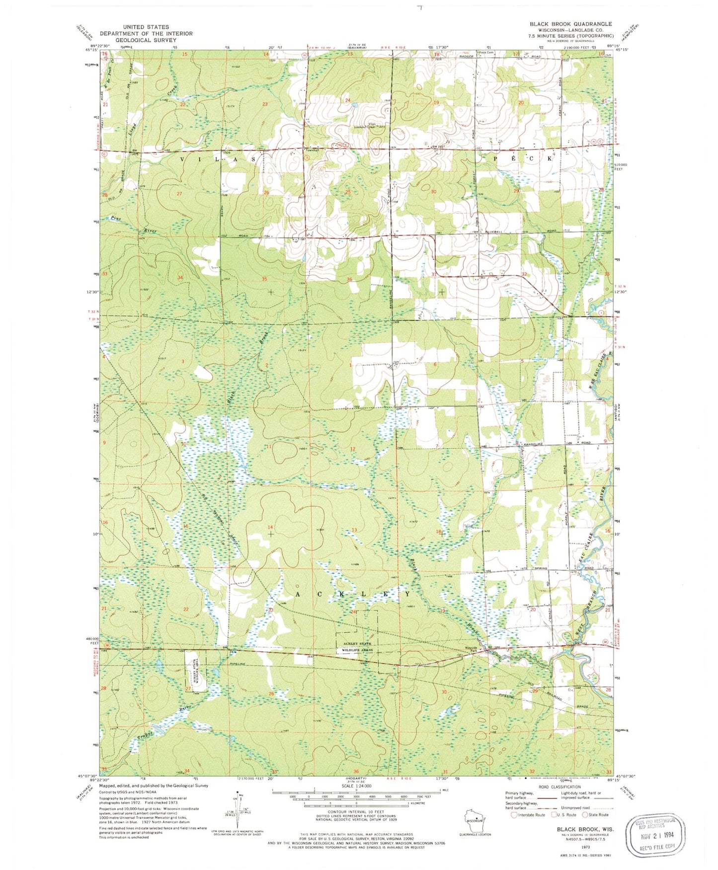
Classic USGS Black Brook Wisconsin 7.5'x7.5' Topo Map
Couldn't load pickup availability
Historical USGS topographic quad map of Black Brook in the state of Wisconsin. Map scale may vary for some years, but is generally around 1:24,000. Print size is approximately 24" x 27"
This quadrangle is in the following counties: Langlade.
The map contains contour lines, roads, rivers, towns, and lakes. Printed on high-quality waterproof paper with UV fade-resistant inks, and shipped rolled.
Contains the following named places: 1 Reservoir, Badger School, Black Brook, Bluebell School, Elmwood School, Langlade County Flowage T1063 G12 684 Dam, Langlade County Flowage T1063 G12 685 Dam, Motl 2 G12 121 Dam, Motl 3 G12 121 Dam, Peck Cemetery, Town of Ackley, Town of Vilas, Vilas Lookout Tower, Vilas Townhall