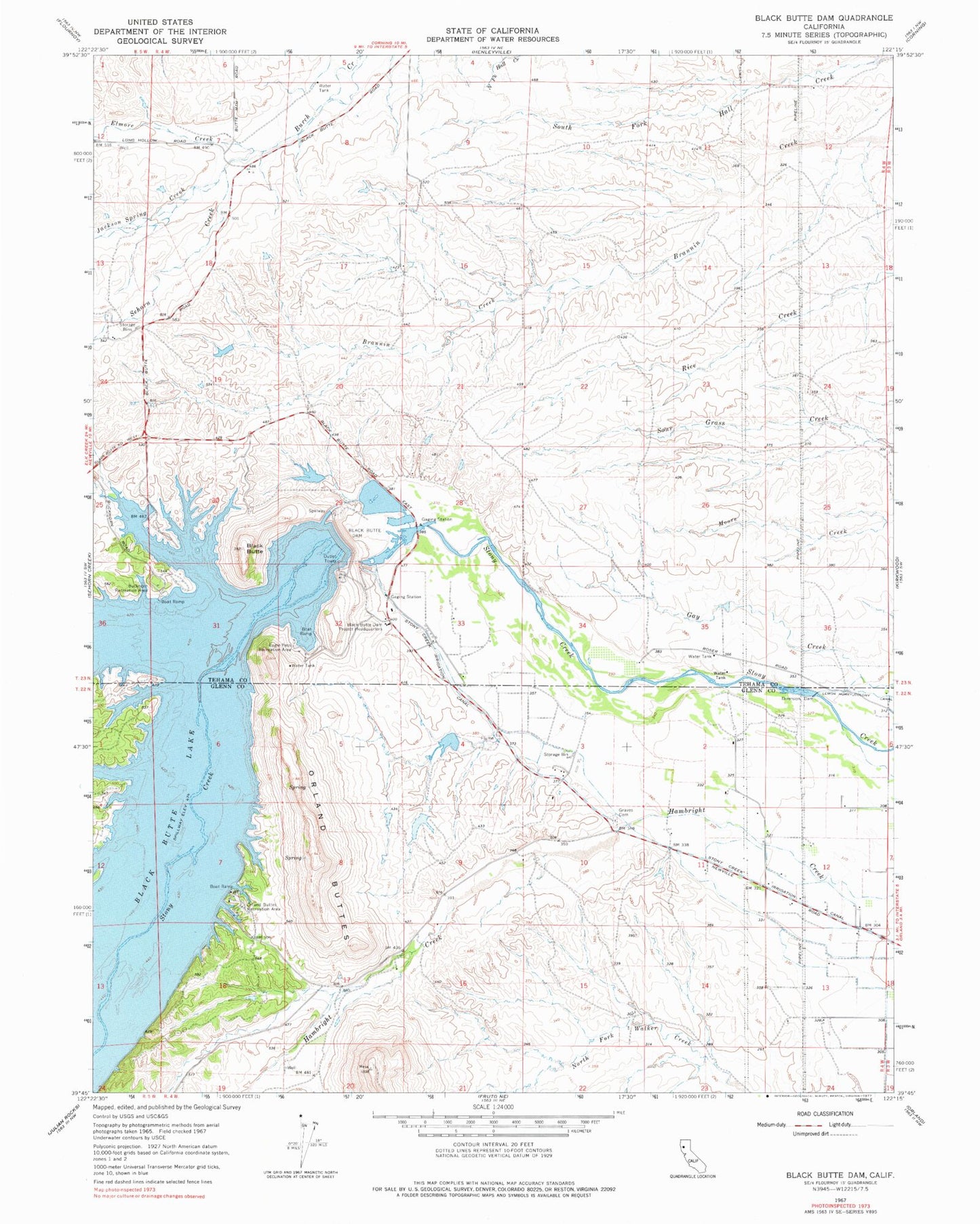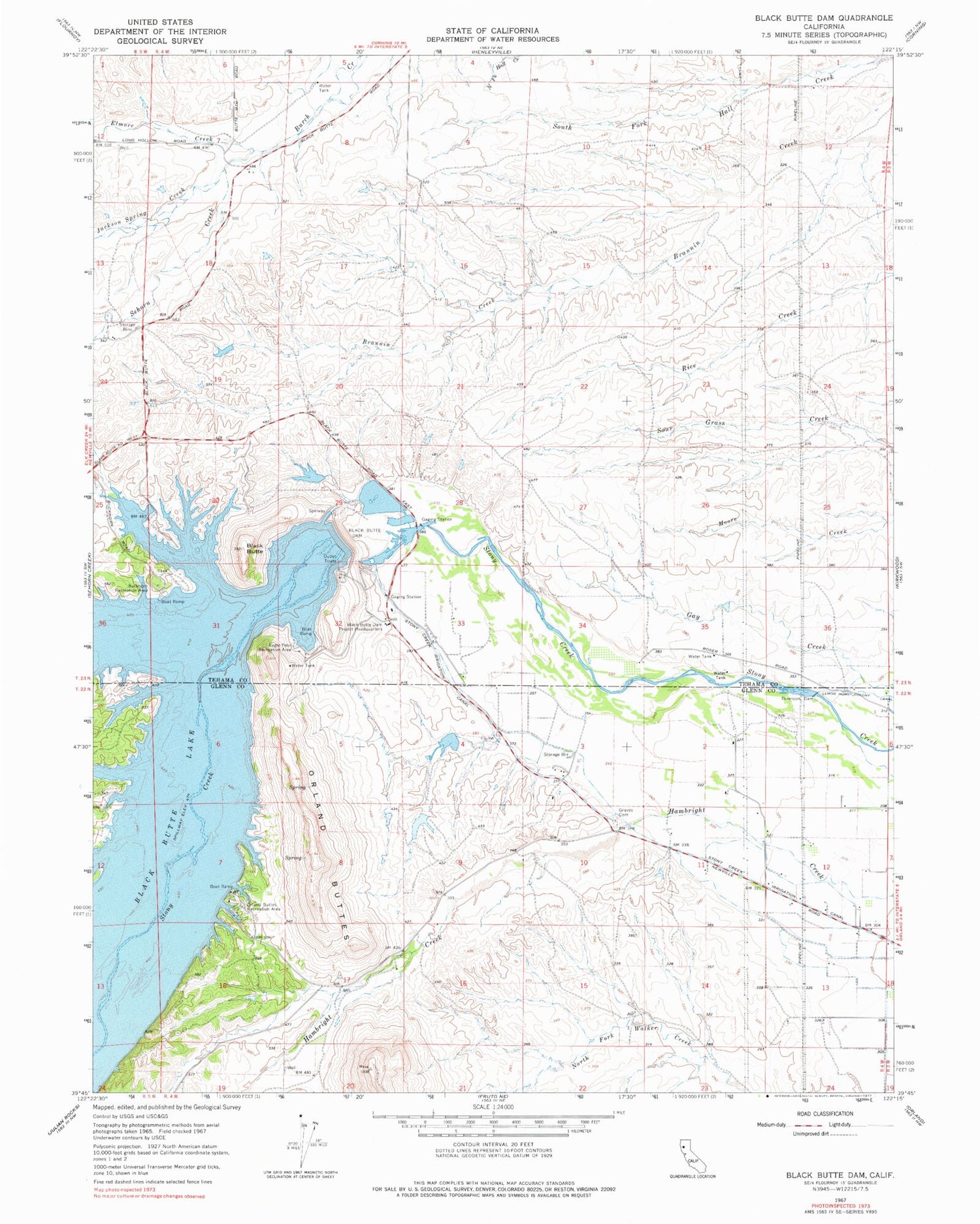
MyTopo
Classic USGS Black Butte Dam California 7.5'x7.5' Topo Map
Couldn't load pickup availability
Historical USGS topographic quad map of Black Butte Dam in the state of California. Map scale may vary for some years, but is generally around 1:24,000. Print size is approximately 24" x 27"
This quadrangle is in the following counties: Glenn, Tehama.
The map contains contour lines, roads, rivers, towns, and lakes. Printed on high-quality waterproof paper with UV fade-resistant inks, and shipped rolled.
Contains the following named places: Black Butte, Black Butte Dam, Black Butte Dam Project Headquarters, Black Butte Lake, Black Butte Lake Dam, Buckhorn Recreation Area, Eagle Pass Recreation Area, Elmore Creek, Graves Cemetery, Jackson Spring Creek, Lower Stony Creek Recreation Area, Observation Point Recreation Area, Orland Buttes, Orland Buttes Recreation Area, Sehorn Creek, South Canal Recreation Area