MyTopo
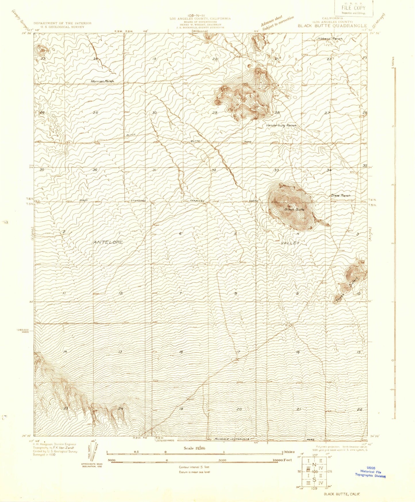
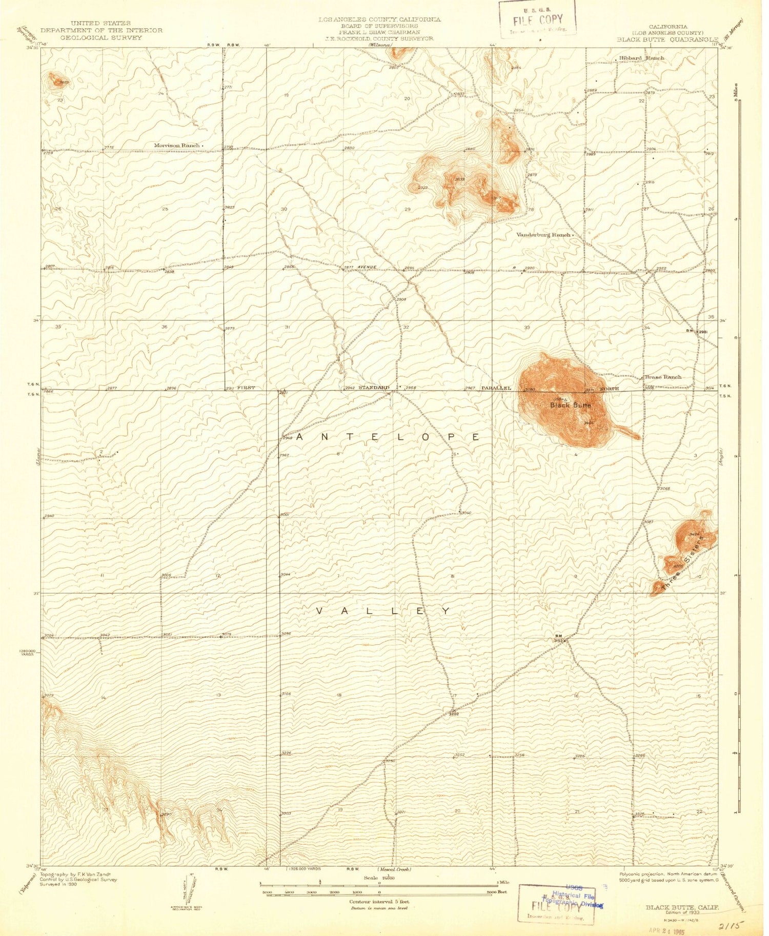
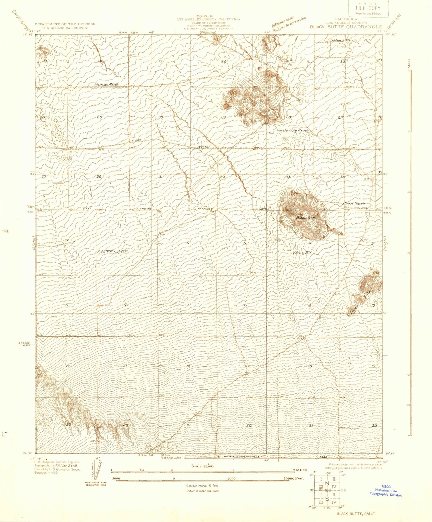
Classic USGS Black Butte California 7.5'x7.5' Topo Map
Regular price
$16.95
Regular price
Sale price
$16.95
Unit price
per
Couldn't load pickup availability
Historical USGS topographic quad map of Black Butte in the state of California. Map scale may vary for some years, but is generally around 1:24,000. Print size is approximately 24" x 27"
This quadrangle is in the following counties: Los Angeles.
The map contains contour lines, roads, rivers, towns, and lakes. Printed on high-quality waterproof paper with UV fade-resistant inks, and shipped rolled.
Contains the following named places: Black Butte, Brase Ranch, Brian Ranch Airport, Hibbard Ranch, Mescal Creek, Morrison Ranch, Pomona Superior Court Heliport, Three Sisters, Vanderburg Ranch