MyTopo
Classic USGS Black Butte Montana 7.5'x7.5' Topo Map
Couldn't load pickup availability
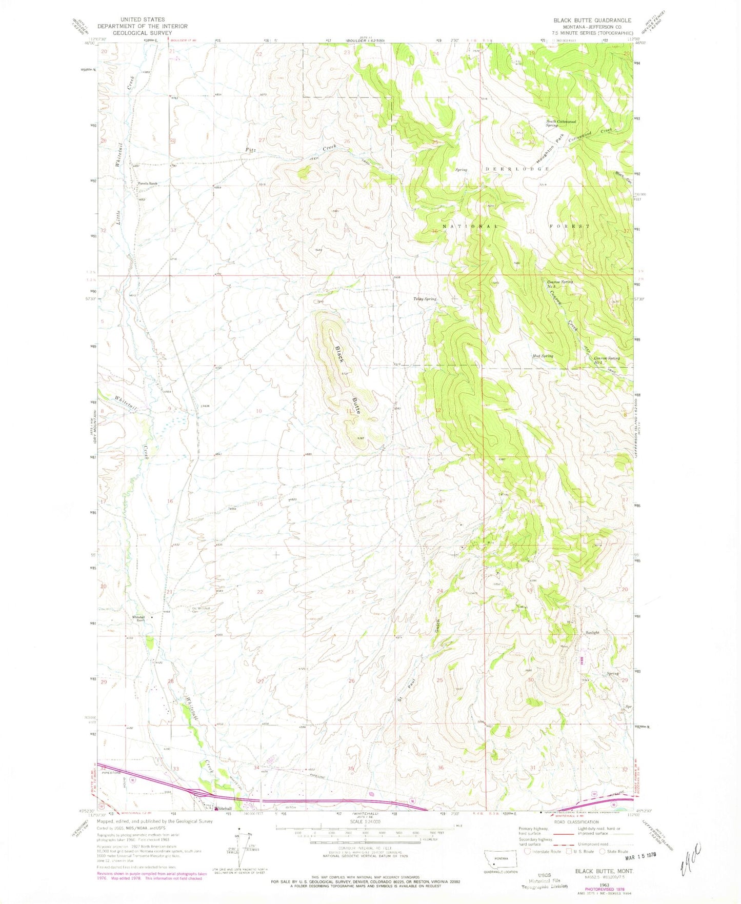
Historical USGS topographic quad map of Black Butte in the state of Montana. Map scale may vary for some years, but is generally around 1:24,000. Print size is approximately 24" x 27"
This quadrangle is in the following counties: Jefferson.
The map contains contour lines, roads, rivers, towns, and lakes. Printed on high-quality waterproof paper with UV fade-resistant inks, and shipped rolled.
Contains the following named places: 02N04W04DCCC01 Well, Battle Creek, Black Butte, Brookes, Carbonate Mine, Conrow Spring Number One, Conrow Spring Number Two, Correa Ranch, Examiner Mine, Fitz Creek, Forcella Ranch, Gem Mine, Golden Mine, Houghton Park, Iron Side Mine, Jefco Skypark, Jefferson Ranger District Office, Little Whitetail Creek, Luck Heat Mine, Minerva Mine, Mud Spring, NW NE Section 13 Mine, Old Whitehall Cemetery, Parrott Mine, Perhaps Mine, Saint Paul Gulch, SE NE Section 24 Mine, SE NW Section 13 Mine, SE SE Section 13 Mine, SE SW Section 12 Mine, Sheep Rock, South Cottonwood Spring, Sunlight, Sunlight Mine, SW SW Section 18 Mine, Tebay Spring, United States Forest Service Law Enforcement Whitehall Office, White Tail Deer, Whitehall Division, Whitehall Ranch, Whitetail Ditch