MyTopo
Classic USGS Black Coulee Montana 7.5'x7.5' Topo Map
Couldn't load pickup availability
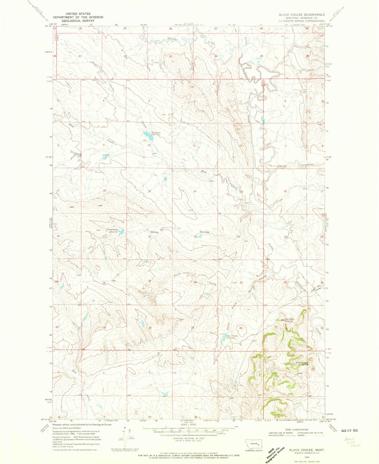
Historical USGS topographic quad map of Black Coulee in the state of Montana. Map scale may vary for some years, but is generally around 1:24,000. Print size is approximately 24" x 27"
This quadrangle is in the following counties: Rosebud.
The map contains contour lines, roads, rivers, towns, and lakes. Printed on high-quality waterproof paper with UV fade-resistant inks, and shipped rolled.
Contains the following named places: Black Coulee, Black Coulee Reservoir, Black Coulee Reservoir Dam, Cherry Creek, Corny Coulee, Corny Coulee Reservoir, Gruner School, Hay Creek, Hay Creek Reservoir, Hay Creek Reservoir Dam, Hillside School, Little Porcupine School, North Prong Black Coulee, North Prong Hay Creek, Porcupine Lookout, Schoolmarm Buttes, Sims Number 1 Dam, South Prong Black Coulee, Stellar Creek, Wagon Box Coulee