MyTopo
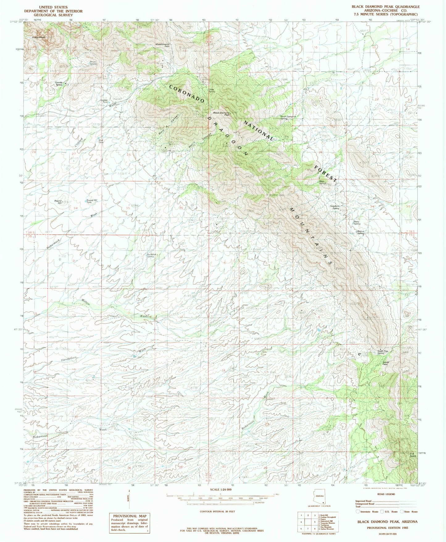
Classic USGS Black Diamond Peak Arizona 7.5'x7.5' Topo Map
Couldn't load pickup availability
Historical USGS topographic quad map of Black Diamond Peak in the state of Arizona. Map scale is 1:24000. Print size is approximately 24" x 27"
This quadrangle is in the following counties: Cochise.
The map contains contour lines, roads, rivers, towns, and lakes. Printed on high-quality waterproof paper with UV fade-resistant inks, and shipped rolled.
Contains the following named places: Bennett Ranch, Black Diamond, Black Diamond Peak, Black Diamond Tank, Buckshot Spring, Caslink Spring, Diamond Spring, Dragoon Camp, Dragoon Camp Tank, Escapule Mine, Festerling Mine, Forest Tank, Gilda Spring, Goodrich Spring, Gordon Tank, Granite Spring, Henry Canyon, Kendall Ranch, Majo Spring, Mary A Canyon, Middlemarch Canyon, Middlemarch Pass, Neely Spring, OK Notch, Old Home Ranch, Old Robertson Ranch, Pinon Spring, Sala Ranch, Sheepshead, South Pass, South Pass Spring, Standard Tungsten Mine, Tomcat Tank, Walnut Springs