MyTopo
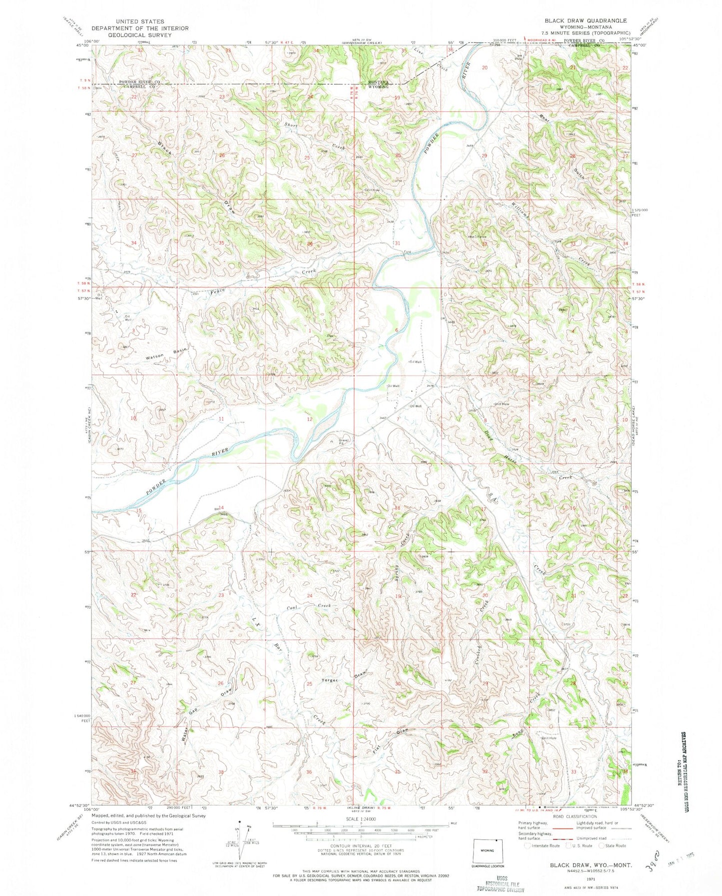
Classic USGS Black Draw Wyoming 7.5'x7.5' Topo Map
Couldn't load pickup availability
Historical USGS topographic quad map of Black Draw in the states of Wyoming, Montana. Map scale may vary for some years, but is generally around 1:24,000. Print size is approximately 24" x 27"
This quadrangle is in the following counties: Campbell, Powder River.
The map contains contour lines, roads, rivers, towns, and lakes. Printed on high-quality waterproof paper with UV fade-resistant inks, and shipped rolled.
Contains the following named places: Bear Gulch, Black Draw, Coal Creek, Crooked Creek, Dead Horse Creek, ER Cemetery, Fence Creek, Flat Draw, Greenough Dam, Greenough Reservoir, L X Bar Creek, Line Creek, Long Creek, SA Creek, Short Creek, Spring Creek, Warren Dam, Warren Reservoir, Water Gap Draw, Watson Basin, Williams Creek, Yerger Draw