MyTopo
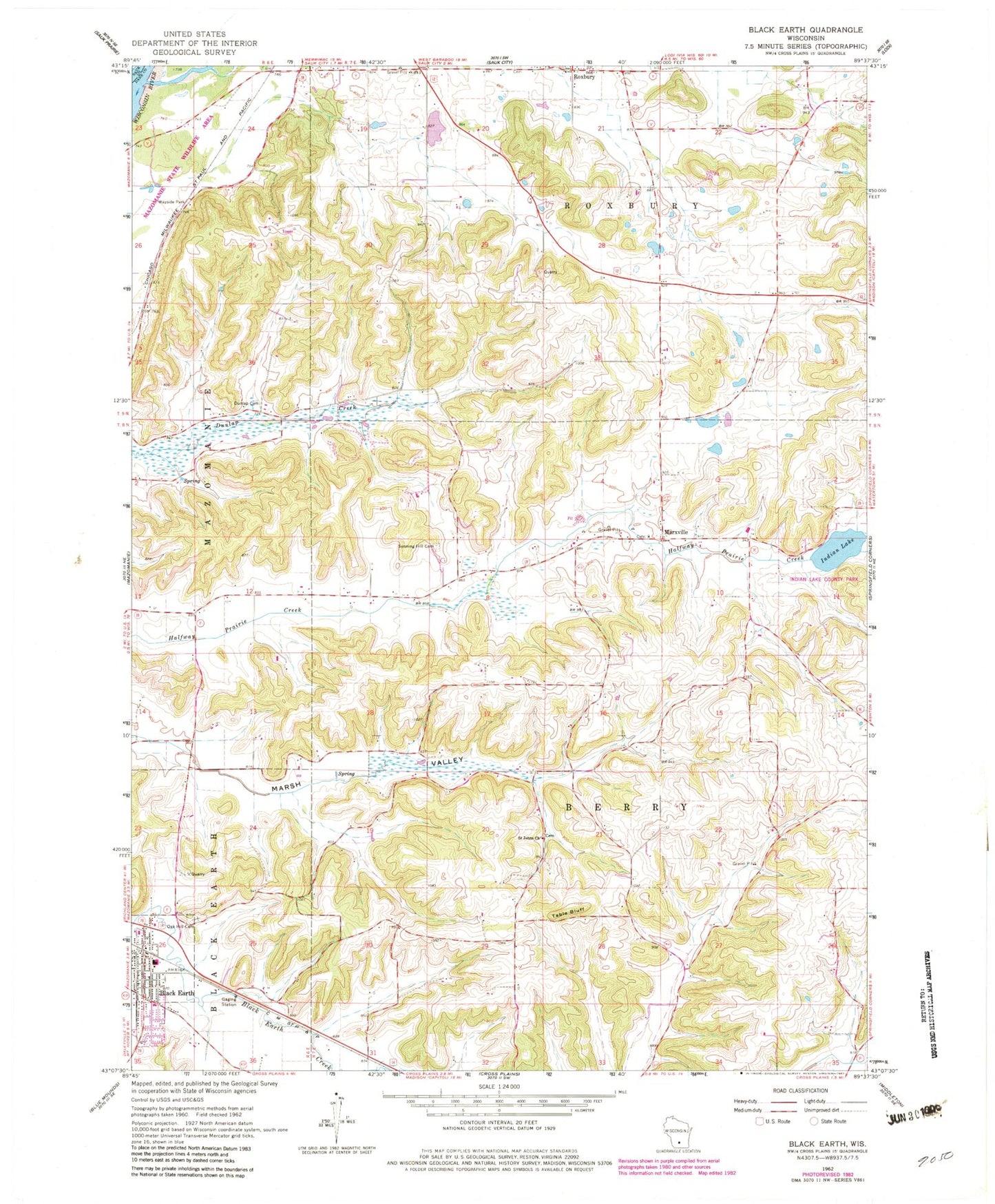
Classic USGS Black Earth Wisconsin 7.5'x7.5' Topo Map
Couldn't load pickup availability
Historical USGS topographic quad map of Black Earth in the state of Wisconsin. Typical map scale is 1:24,000, but may vary for certain years, if available. Print size: 24" x 27"
This quadrangle is in the following counties: Dane, Sauk.
The map contains contour lines, roads, rivers, towns, and lakes. Printed on high-quality waterproof paper with UV fade-resistant inks, and shipped rolled.
Contains the following named places: Black Earth, Dunlap Cemetery, Indian Lake, Marxville, Oak Hill Cemetery, Roxbury, Roxbury Creek, Saint Johns Church, Sunning Hill Cemetery, Table Bluff, Town of Berry, Village of Black Earth, Town of Roxbury, Aldens Corners (historical), Black Earth Congregational Church, Black Earth Elementary School, Indian Lake County Park, Mazomanie Oak Barrens State Natural Area, Black Earth Fire Department, Black Earth Police Department, Saint John's Lutheran Church Cemetery, Old Black Earth Cemetery, Saint Norbert's Cemetery, Saint Paul Cemetery, Black Earth Post Office