
MyTopo
Classic USGS Black Forest Colorado 7.5'x7.5' Topo Map
Couldn't load pickup availability
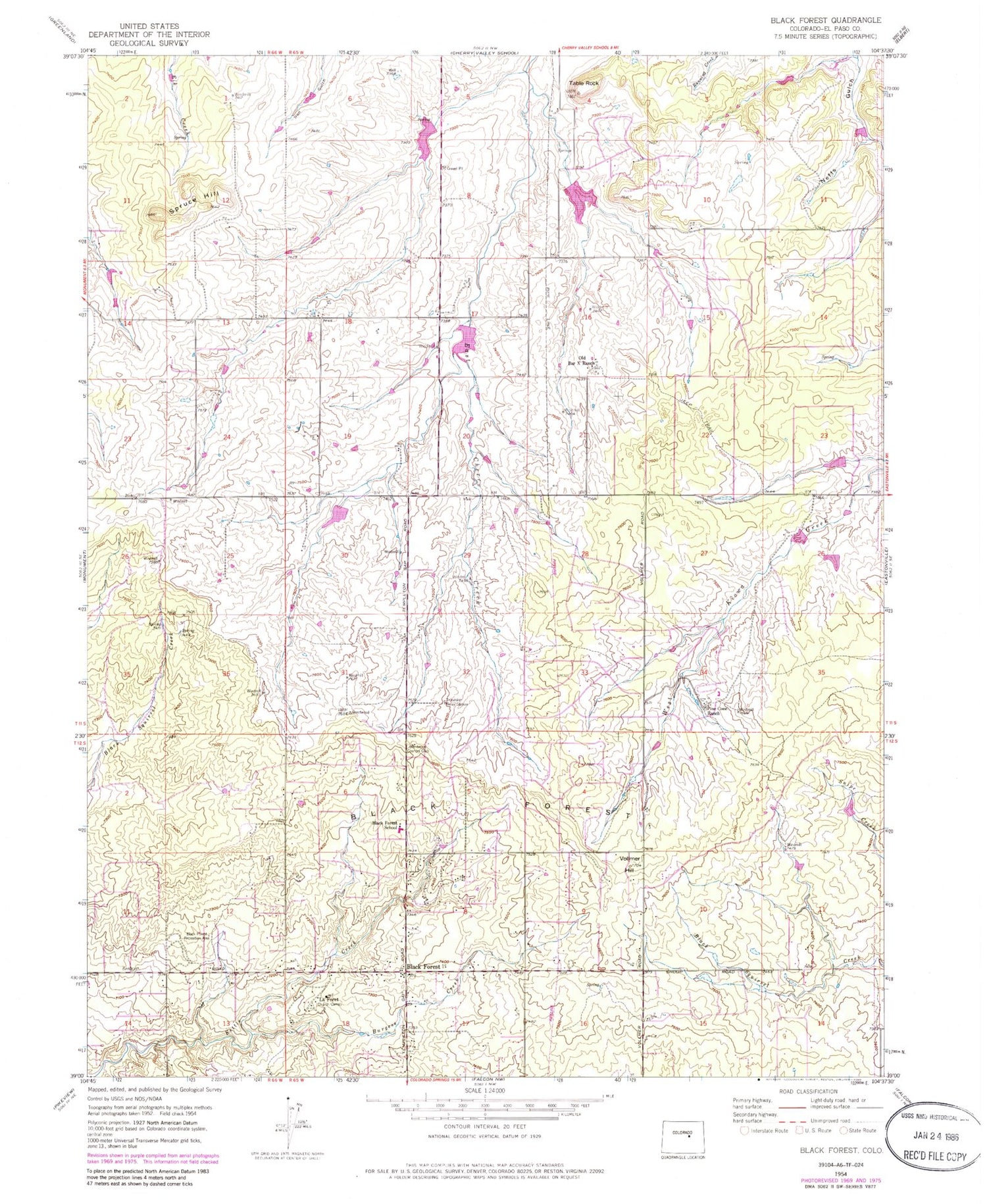
Historical USGS topographic quad map of Black Forest in the state of Colorado. Typical map scale is 1:24,000, but may vary for certain years, if available. Print size: 24" x 27"
This quadrangle is in the following counties: El Paso.
The map contains contour lines, roads, rivers, towns, and lakes. Printed on high-quality waterproof paper with UV fade-resistant inks, and shipped rolled.
Contains the following named places: Black Forest, Black Forest, Brentwood Country Club, Blackforest School, Spruce Hill, Table Rock, Old Bar X Ranch, Pine Cone Ranch, Burgess River, Vollmer Hill, La Foret, Black Forest Recreation Area, Kiowa Creek Watershed 1-G-20 Dam, Kiowa Creek Watershed 1-G-20 Reservoir, Kiowa Creek Watershed 1-G-30 Dam, Kiowa Creek Watershed 1-G-30 Reservoir, Kiowa Creek Watershed 1-N-10 Dam, Kiowa Creek Watershed 1-N-10 Reservoir, Kiowa Creek Watershed 1-P-10 Dam, Kiowa Creek Watershed 1-P-10 Reservoir, Kiowa Creek Watershed 1-P-20 Dam, Kiowa Creek Watershed 1-P-20 Reservoir, Franktown Parker FPE-2 Dam, Franktown Parker FPE-2 Reservoir, Franktown Parker FPE-3 Dam, Franktown Parker FPE-3 Reservoir, Franktown Parker FPE-4 Dam, Franktown Parker FPE-4 Reservoir, Franktown Parker FPE-5 Dam, Franktown Parker FPE-5 Reservoir, Franktown Parker FPE-6 Dam, Franktown Parker FPE-6 Reservoir, KSSS-AM (Colorado Springs), Table Rock Cemetery, Edith Wolford Elementary School, Ray E Kilmer Elementary School, Black Forest Regional Park, Black Forest Census Designated Place, Mountain View Ranch Airport, Black Forest Fire - Rescue Protection District Station 2, Jasper Ridge Ranch Airport (historical)


