MyTopo
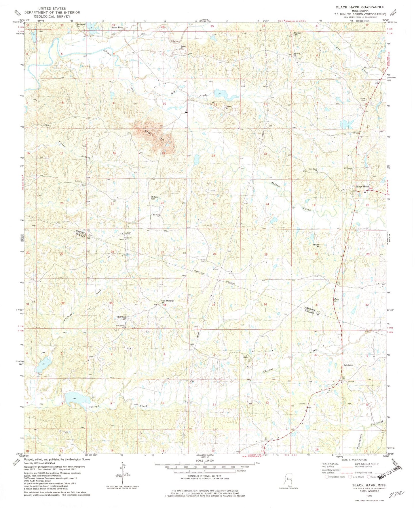
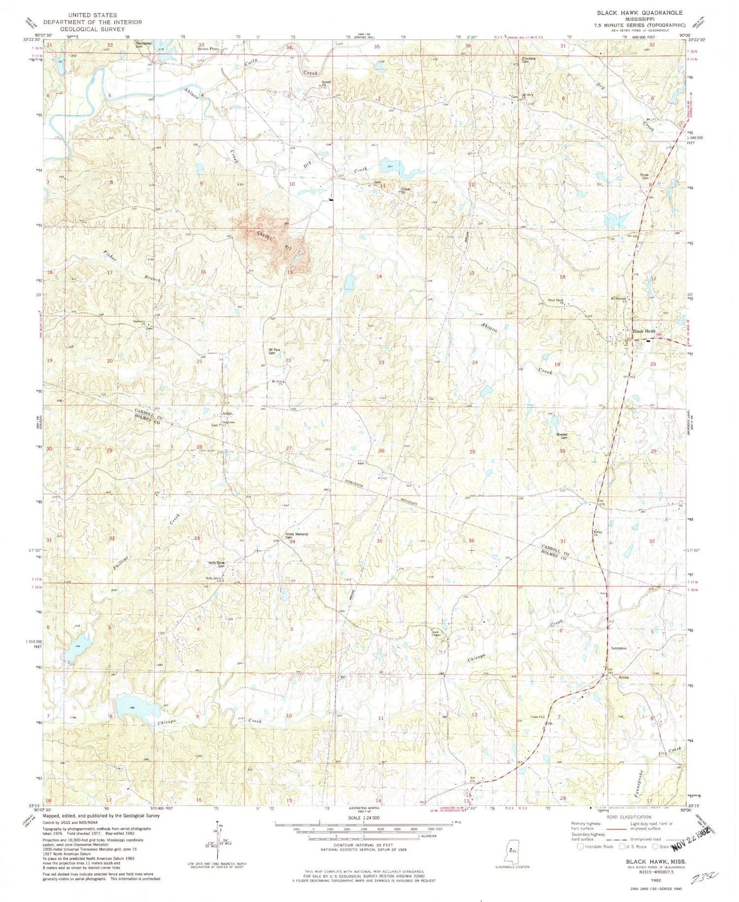
Classic USGS Black Hawk Mississippi 7.5'x7.5' Topo Map
Couldn't load pickup availability
Historical USGS topographic quad map of Black Hawk in the state of Mississippi. Map scale may vary for some years, but is generally around 1:24,000. Print size is approximately 24" x 27"
This quadrangle is in the following counties: Carroll, Holmes.
The map contains contour lines, roads, rivers, towns, and lakes. Printed on high-quality waterproof paper with UV fade-resistant inks, and shipped rolled.
Contains the following named places: Abiaca Watershed Y-34-10 Dam, Abiaca Watershed Y-34-2 Dam, Abiaca Watershed Y-34-21 Dam, Abiaca Watershed Y-34-23 Dam, Abiaca Watershed Y-34-25 Dam, Abiaca Watershed Y-34-28 Dam, Abiaca Watershed Y-34-29 Dam, Abiaca Watershed Y-34-36 Dam, Abiaca Watershed Y-34-38 Dam, Abiaca Watershed Y-34-43 Dam, Abiaca Watershed Y-34-7 Dam, Acona, Acona Methodist Cemetery, Adair, Bethel Christian Methodist Episcopal Cemetery, Bethel Church, Black Hawk, Black Hawk Church, Black Watershed Y-36-53 Dam, Black Watershed Y-36-54 Dam, Blackhawk Cemetery, Coila Creek, Dry Creek, Ellandale Cemetery, Ellandale Church, Harmony Baptist Church, Harmony Cemetery, Hines Memorial Cemetery, Holly Grove Cemetery, Holly Grove Church, Holly Grove School, Keirn Cemetery, Mount Olive Cemetery, Mount Olive Church, Mount Pera Cemetery, Mount Pera Church, Mount Pleasant Cemetery, Mount Pleasant Church, Oak Grove School, Oklahoma Church, Phillips Creek, Seven Pines, Shute Cemetery, Stanton Brothers Lake Dam, Steal Chapel, Streater Cemetery, Supervisor District 3, Union Church, Vanhoughton Cemetery