MyTopo
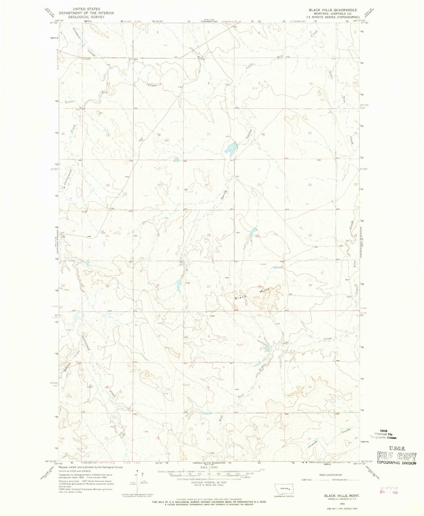
Classic USGS Black Hills Montana 7.5'x7.5' Topo Map
Couldn't load pickup availability
Historical USGS topographic quad map of Black Hills in the state of Montana. Map scale may vary for some years, but is generally around 1:24,000. Print size is approximately 24" x 27"
This quadrangle is in the following counties: Garfield.
The map contains contour lines, roads, rivers, towns, and lakes. Printed on high-quality waterproof paper with UV fade-resistant inks, and shipped rolled.
Contains the following named places: 14N40E07BCBD01 Well, Aybee Dam, Badlands Coulee, Beecher Number 1 Dam, Beecher Number 3 Dam, Black Hills, Bob Number 2 Dam, Bob Number 3 Dam, Cottonwood Creek, East Fork Post Office, Knudson Coulee, Lone Tree Creek, Smith Ranch 2 Dam, Smith Ranch Number 1 Dam, Smith Ranch Number 5 Dam, Spring Coulee