MyTopo
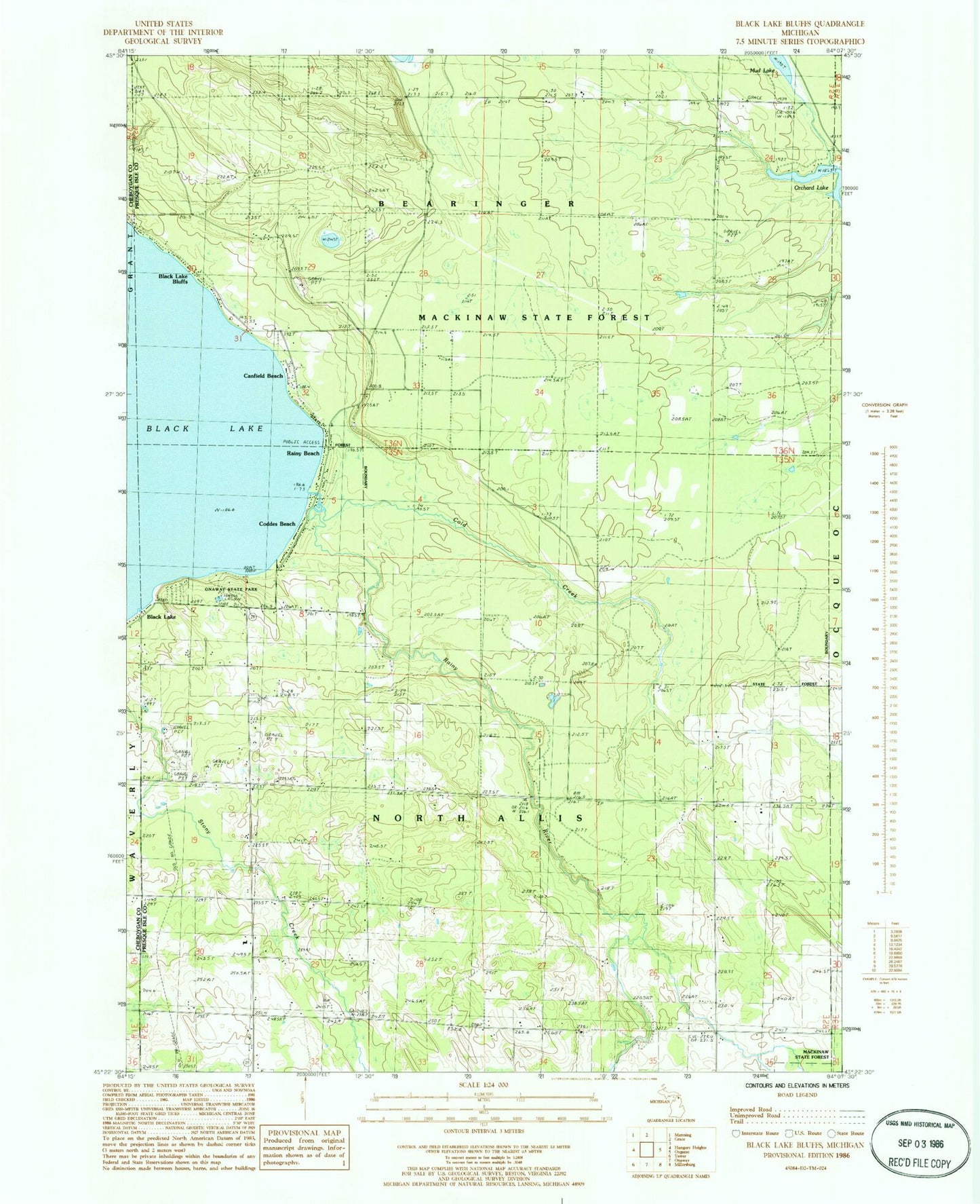
Classic USGS Black Lake Bluffs Michigan 7.5'x7.5' Topo Map
Couldn't load pickup availability
Historical USGS topographic quad map of Black Lake Bluffs in the state of Michigan. Map scale may vary for some years, but is generally around 1:24,000. Print size is approximately 24" x 27"
This quadrangle is in the following counties: Cheboygan, Presque Isle.
The map contains contour lines, roads, rivers, towns, and lakes. Printed on high-quality waterproof paper with UV fade-resistant inks, and shipped rolled.
Contains the following named places: Allis Post Office, Bearinger Union School Historical Marker, Black Lake, Black Lake Bluffs, Canfield Beach, Coddes Beach, Cold Creek, Grace School, Joy Community Church, Michigan Department of Natural Resources Onaway Field Office, North Allis Cemetery, Onaway State Park, Orchard Lake, Rainy Beach, Rainy River, Roberts School, Rowe School, Township of North Allis