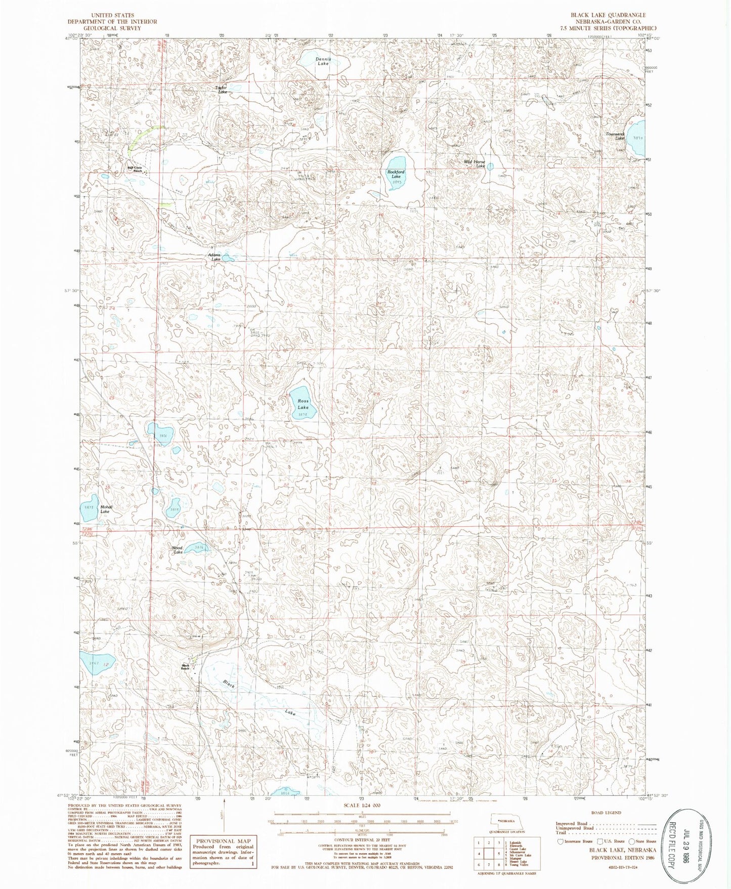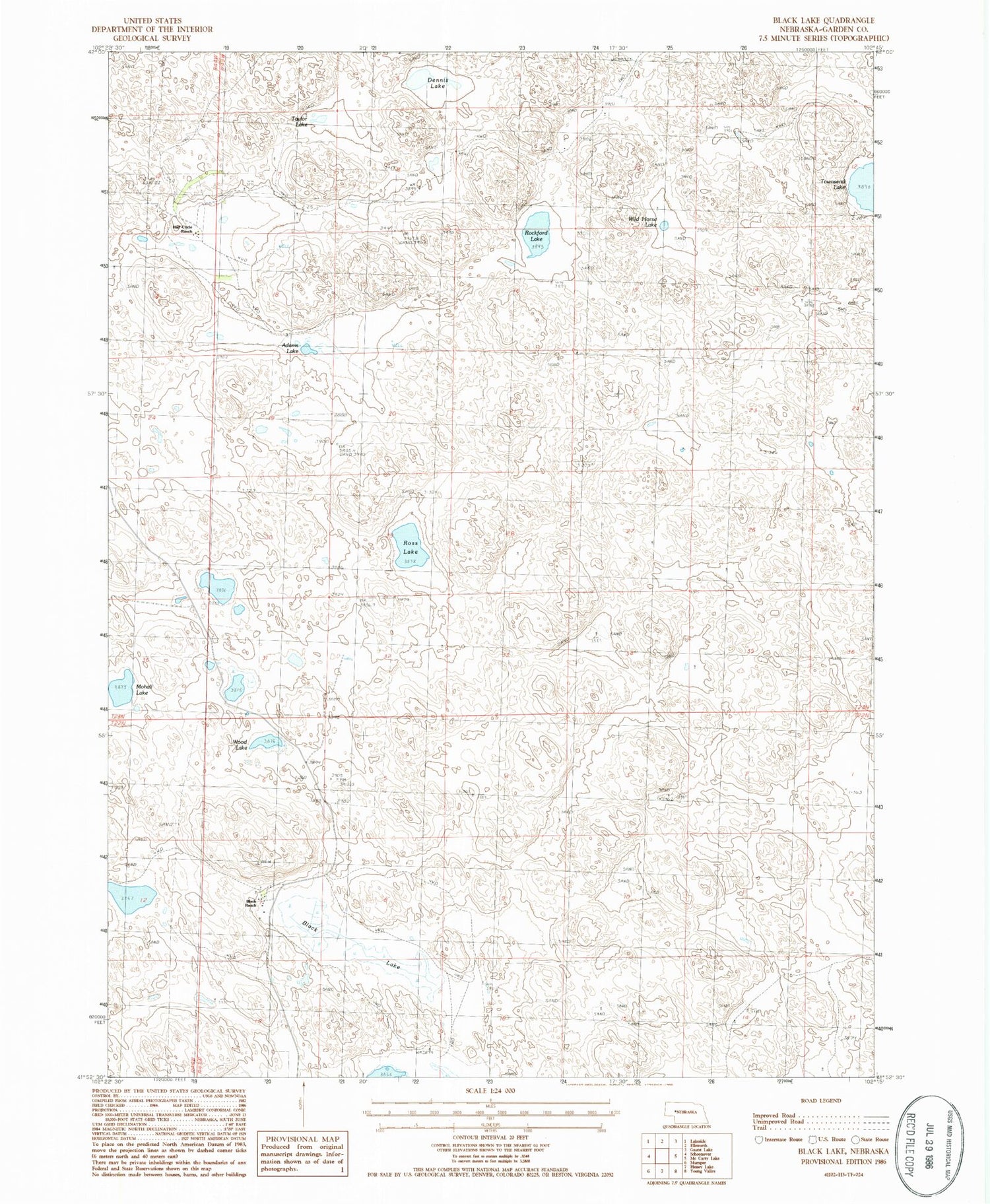
MyTopo
Classic USGS Black Lake Nebraska 7.5'x7.5' Topo Map
Regular price
$16.95
Regular price
Sale price
$16.95
Unit price
per
Couldn't load pickup availability
Historical USGS topographic quad map of Black Lake in the state of Nebraska. Map scale may vary for some years, but is generally around 1:24,000. Print size is approximately 24" x 27"
This quadrangle is in the following counties: Garden.
The map contains contour lines, roads, rivers, towns, and lakes. Printed on high-quality waterproof paper with UV fade-resistant inks, and shipped rolled.
Contains the following named places: Adams Lake, Adams Ranch, Black Lake, Black Ranch, Dennis Lake, Half Circle Ranch, Hills Ranch, McCullock Ranch, Mohall Lake, Rockford Lake, Ross Lake, School Number 78, Taylor Lake, Townsend Lake, Wild Horse Lake, Wood Lake