MyTopo
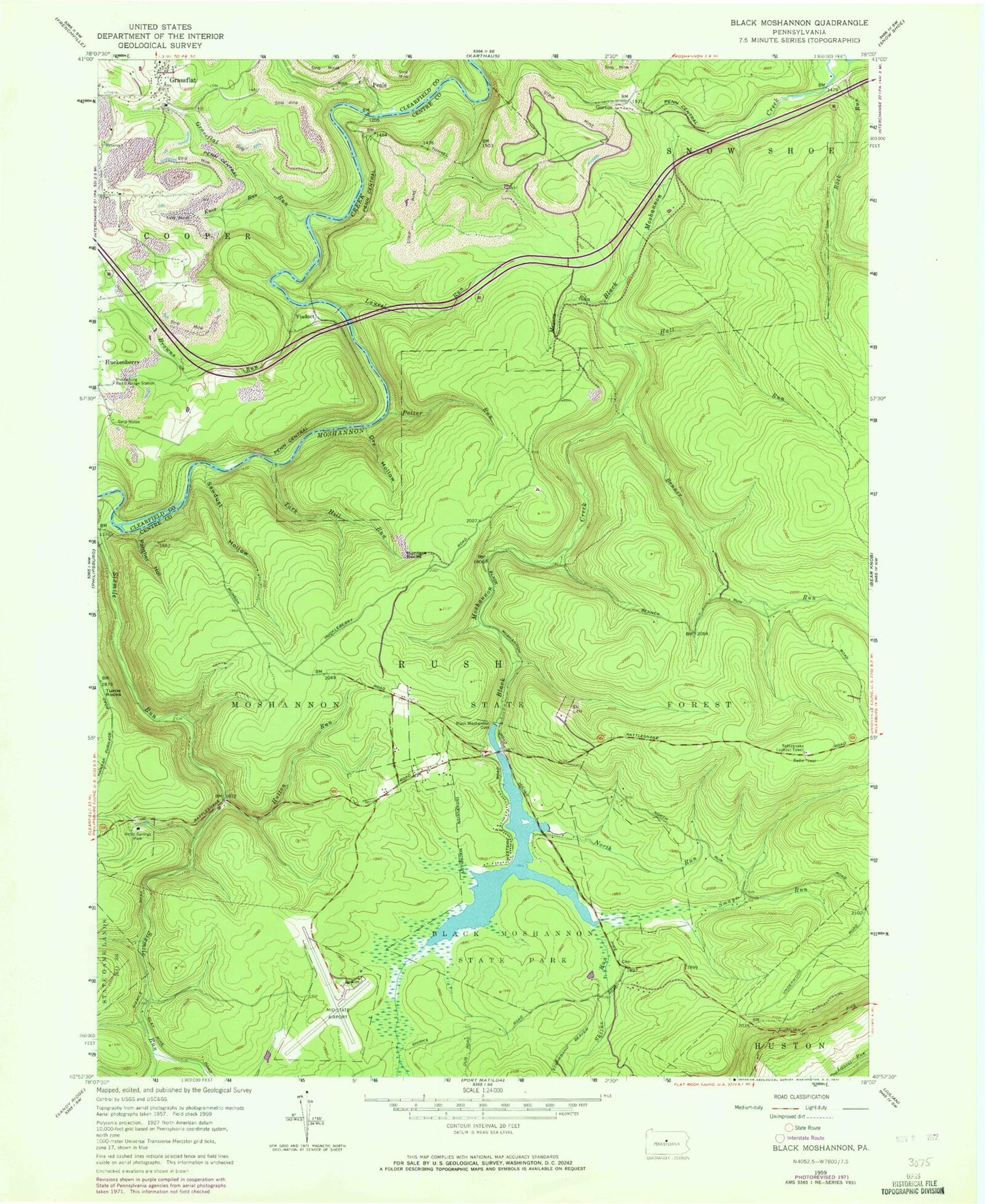
Classic USGS Black Moshannon Pennsylvania 7.5'x7.5' Topo Map
Couldn't load pickup availability
Historical USGS topographic quad map of Black Moshannon in the state of Pennsylvania. Typical map scale is 1:24,000, but may vary for certain years, if available. Print size: 24" x 27"
This quadrangle is in the following counties: Centre, Clearfield.
The map contains contour lines, roads, rivers, towns, and lakes. Printed on high-quality waterproof paper with UV fade-resistant inks, and shipped rolled.
Contains the following named places: Arctic Springs Park, Benner Run, Black Moshannon Dam, Black Moshannon State Park, Browns Run, Dry Hollow, East Branch Rock Run, Grassflat Run, Hall Run, Hunters Rocks, Hutton Run, Knox Run, Laurel Run, Meyers Run, North Run, Philipsburg Radio Range Station, Potter Run, Sawdust Hollow, Smays Run, Tark Hill Run, Turtle Rocks, Viaduct, Middle Branch Rock Run, Rock Run, Shirks Run, Sixmile Run, Mid-State Airport, Black Moshannon Lake, Kephart Dam, Panther Hollow, Arctic Springs, Beaver Mills, Groe Run, Gorton, Peale, Old Huckleberry Trail, Short Trail, Dry Hollow Trail, Rattlesnake Trail, North Run Trail, Smays Trail, Moshannon State Forest, Antes, Rattlesnake Lookout Tower, Beaver Mills Cemetery