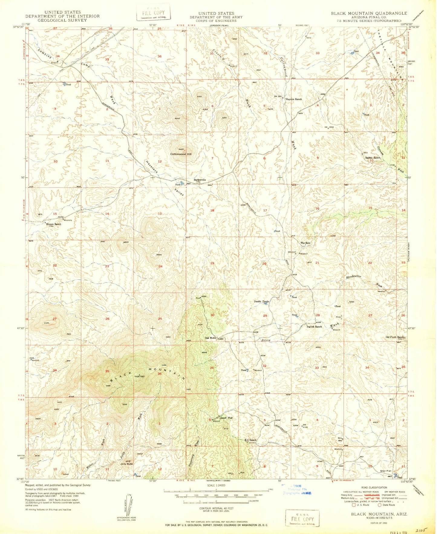
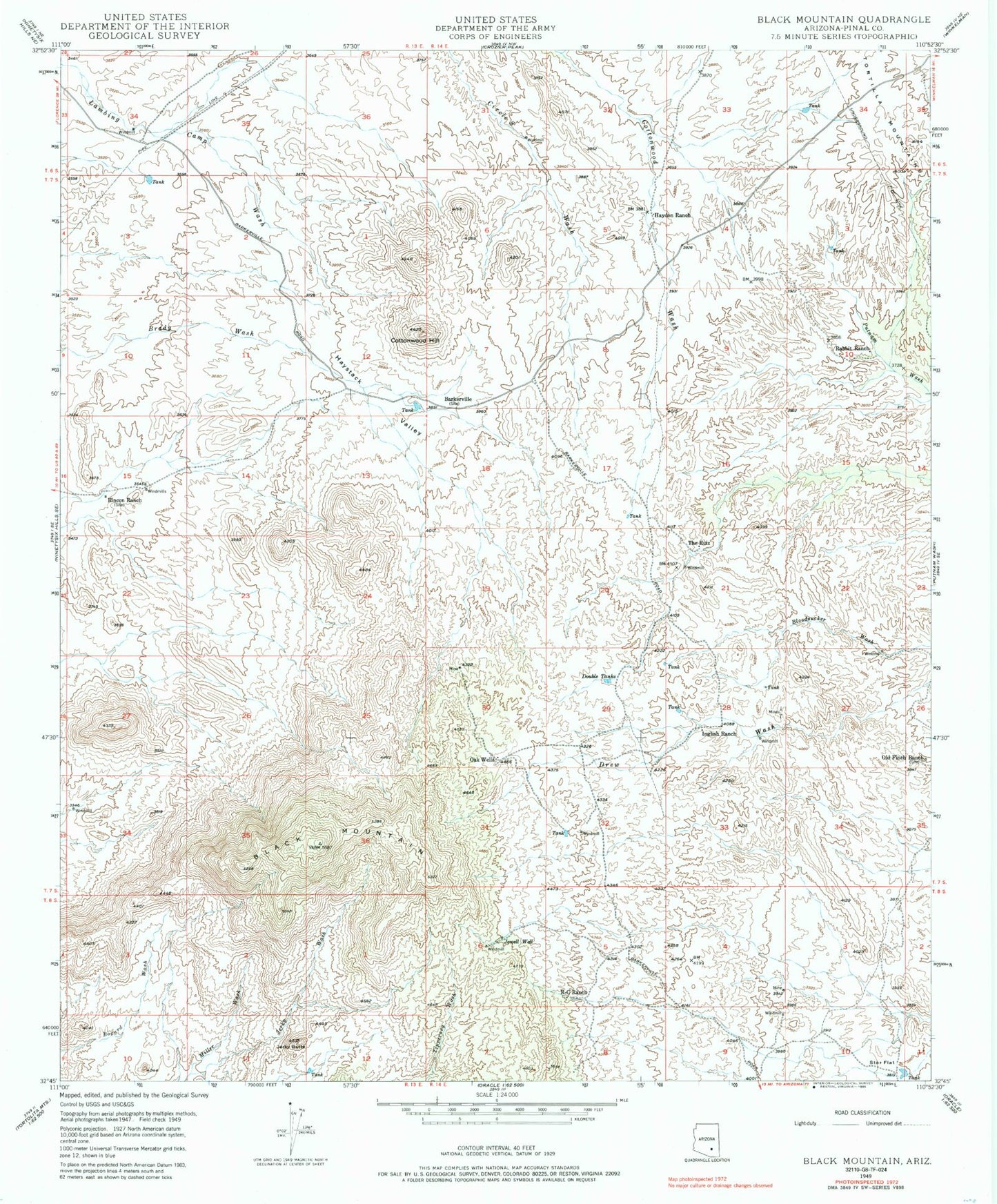
MyTopo
Classic USGS Black Mountain Arizona 7.5'x7.5' Topo Map
Regular price
$16.95
Regular price
Sale price
$16.95
Unit price
per
Couldn't load pickup availability
Historical USGS topographic quad map of Black Mountain in the state of Arizona. Map scale may vary for some years, but is generally around 1:24,000. Print size is approximately 24" x 27"
This quadrangle is in the following counties: Pinal.
The map contains contour lines, roads, rivers, towns, and lakes. Printed on high-quality waterproof paper with UV fade-resistant inks, and shipped rolled.
Contains the following named places: Barkerville, Black Mountain, Cottonwood Hill, Double Tanks, Haydon Ranch, Haystack Valley, Inglish Ranch, Jerky Butte, Jerky Wash, Jewell Well, Oak Wells, Old Finch Ranch, Oracle Microwave Station, Rabbit Ranch, R-C Ranch, Rincon Ranch, Star Flat, The Ruiz