

MyTopo
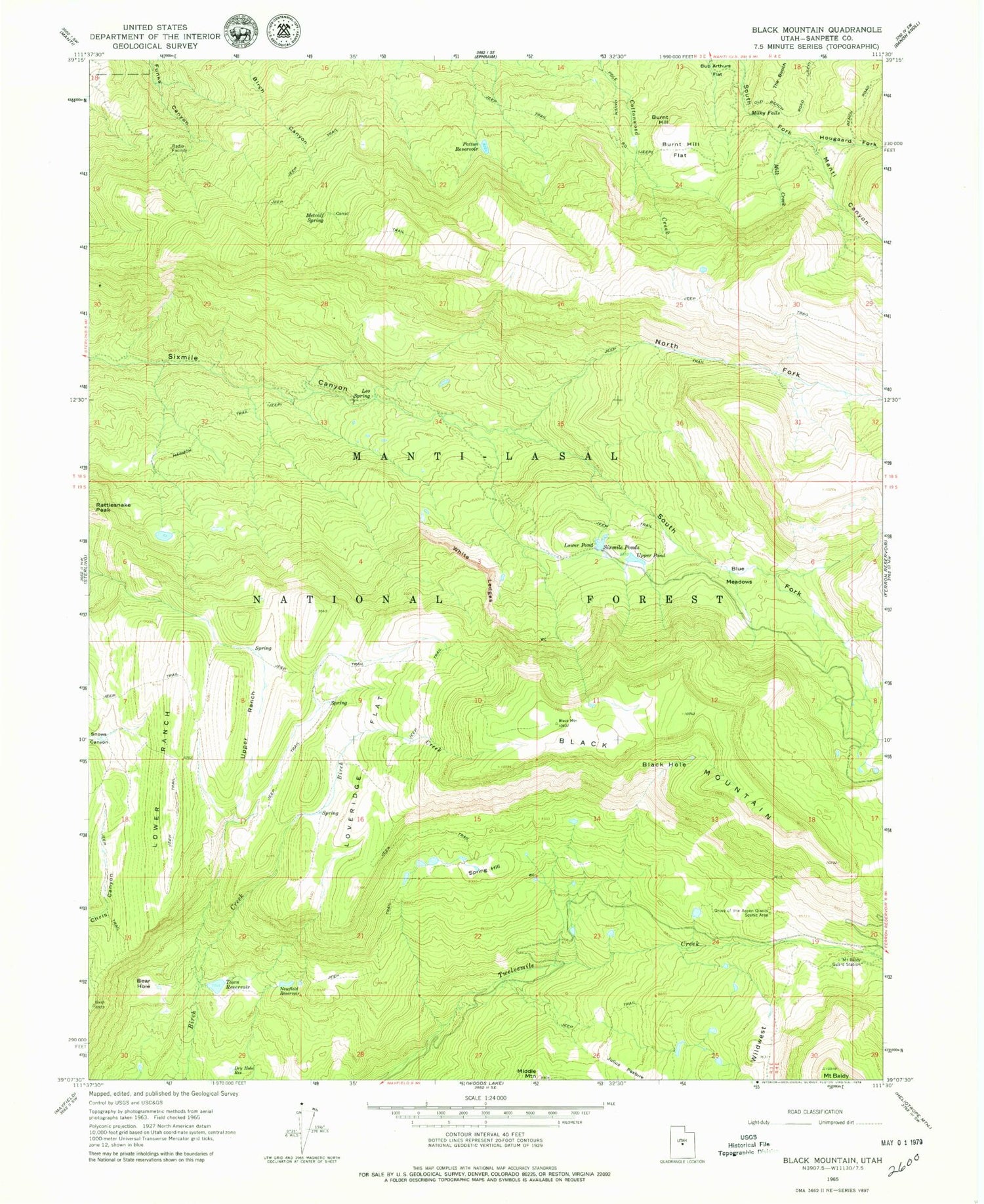
Classic USGS Black Mountain Utah 7.5'x7.5' Topo Map
Couldn't load pickup availability
Historical USGS topographic quad map of Black Mountain in the state of Utah. Typical map scale is 1:24,000, but may vary for certain years, if available. Print size: 24" x 27"
This quadrangle is in the following counties: Sanpete.
The map contains contour lines, roads, rivers, towns, and lakes. Printed on high-quality waterproof paper with UV fade-resistant inks, and shipped rolled.
Contains the following named places: Mount Baldy, Bear Hole, Black Hole, Black Mountain, Blue Meadows, Bub Arthurs Flat, Burnt Hill, Burnt Hill Flat, Dry Hole Reservoir, Grove of the Aspen Giants Scenic Area, Harmon Trail, Hougaard Fork, Julius Pasture, Leo Spring, Loveridge Flat, Lower Pond, Lower Ranch, Metcalf Spring, Middle Mountain, Milk Creek, Milky Falls, Mount Baldy Guard Station, Newfield Reservoir, North Fork Sixmile Canyon, Patton Reservoir, Sixmile Ponds, South Fork Sixmile Canyon, Spring Hill, Town Reservoir, Upper Pond, Upper Ranch, White Ledges, Wildwest, Town Reservoir Dam, Peacock Wildlife Management Area, Ephraim-Manti Division


