MyTopo
Classic USGS Black Pine Peak Idaho 7.5'x7.5' Topo Map
Couldn't load pickup availability
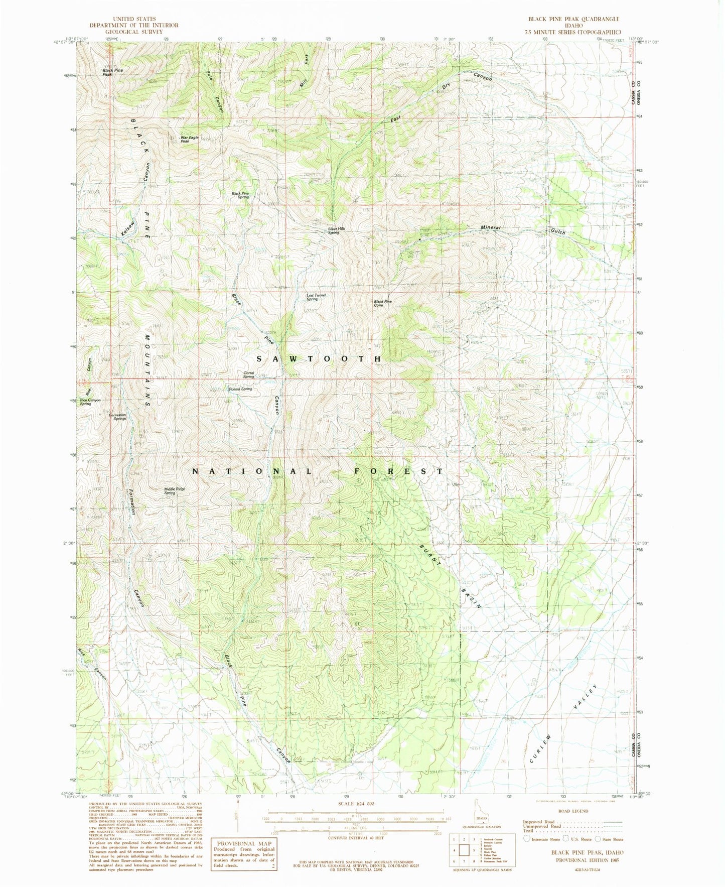
Historical USGS topographic quad map of Black Pine Peak in the state of Idaho. Map scale may vary for some years, but is generally around 1:24,000. Print size is approximately 24" x 27"
This quadrangle is in the following counties: Cassia, Oneida.
The map contains contour lines, roads, rivers, towns, and lakes. Printed on high-quality waterproof paper with UV fade-resistant inks, and shipped rolled.
Contains the following named places: Black Pine Canyon, Black Pine Cone, Black Pine Mountains, Black Pine Peak, Black Pine Spring, Burnt Basin, Corral Spring, Formation Canyon, Formation Springs, Hazel Pine Mine, Lost Tunnel Spring, Middle Ridge Spring, Mineral Gulch, Pollard Spring, Rice Canyon, Ruth Mine, Silver Hills Mine, Silver Hills Spring, Tallman Mine, War Eagle Peak