MyTopo
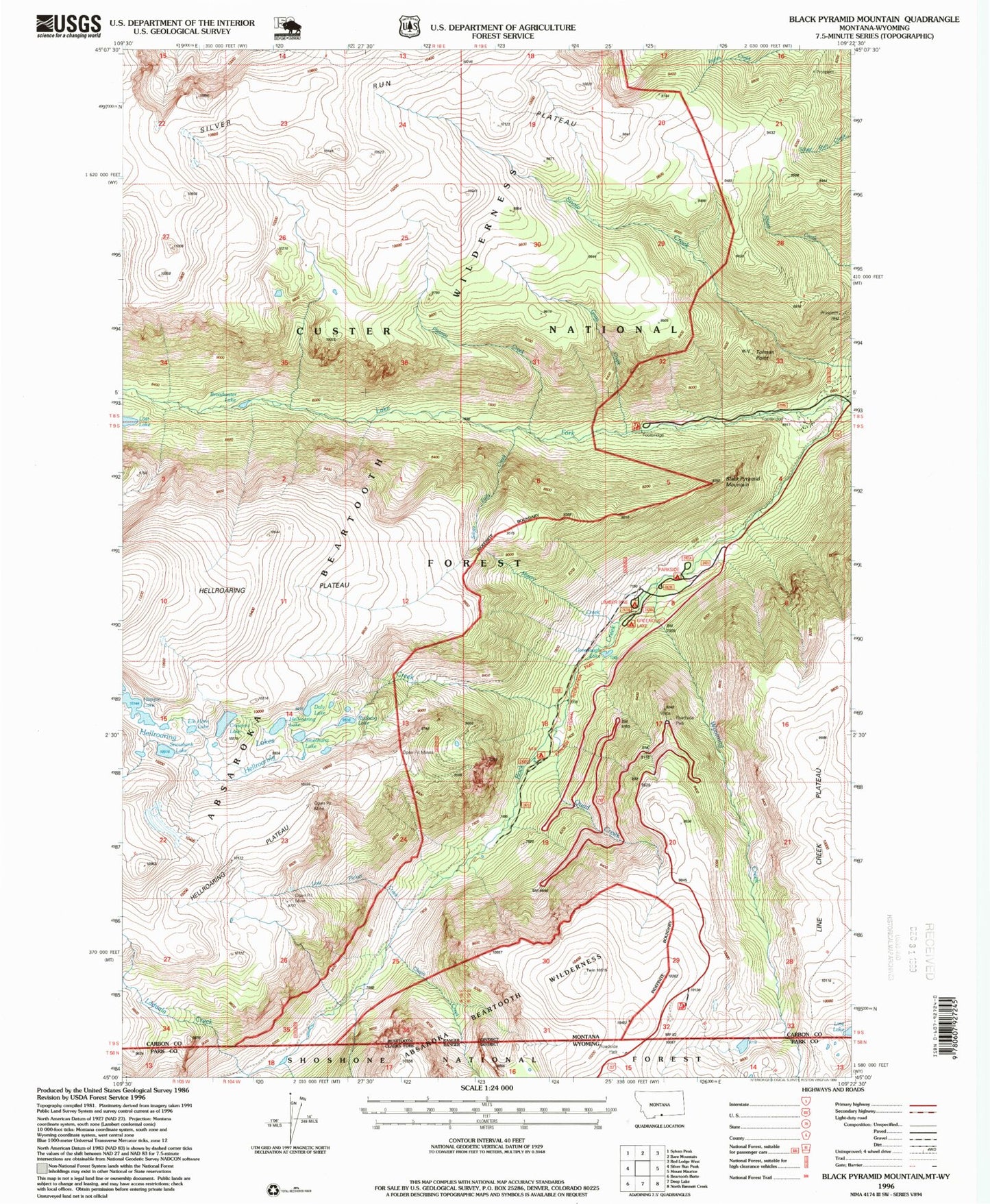
USGS Classic Black Pyramid Mountain Montana 7.5'x7.5' Topo Map
Couldn't load pickup availability
Historical USGS topographic quad map of Black Pyramid Mountainin the states of Montana, Wyoming. Scale: 1:24000. Print size: 24" x 27"
This quadrangle is in the following counties: Carbon, Park.
The map contains contour lines, roads, rivers, towns, lakes, and grids including latitude / longitude and UTM / MGRS. Printed on high-quality waterproof paper with UV fade-resistant inks.
Contains the following named places: Lake Fork, Black Pyramid Mountain, Broadwater Lake, Buena Vista Campground, Chain Creek, Grass Creek, Greenough Lake, Hellroaring Creek, Hellroaring Lakes, Hellroaring Plateau, Lions Club Camp, Misery Creek, Parkside Campground, Plateau Creek, Quad Creek, Richel Lodge, Silver Falls Creek, Silver Run Plateau, Wyoming Creek, Snowbank Lake, Laduala Creek, Lost Picket Creek, Crescent Lake, Elk Horn Lake, Smethurst Lake, Hellroaring Lake, Tolman Point, Rydberg Lake, Daly Lake, Gallon Jug Mine, Edsel Mine, Line Lake, M-K Recreation Site, Greenough Lake Recreation Site, Limberpine Recreation Site, Greenough Lake Campground, Limber Pine Campground, M-K Campground, Richel Lodge (historical), Chain Creek, Wyoming Creek, Laduala Creek