
MyTopo
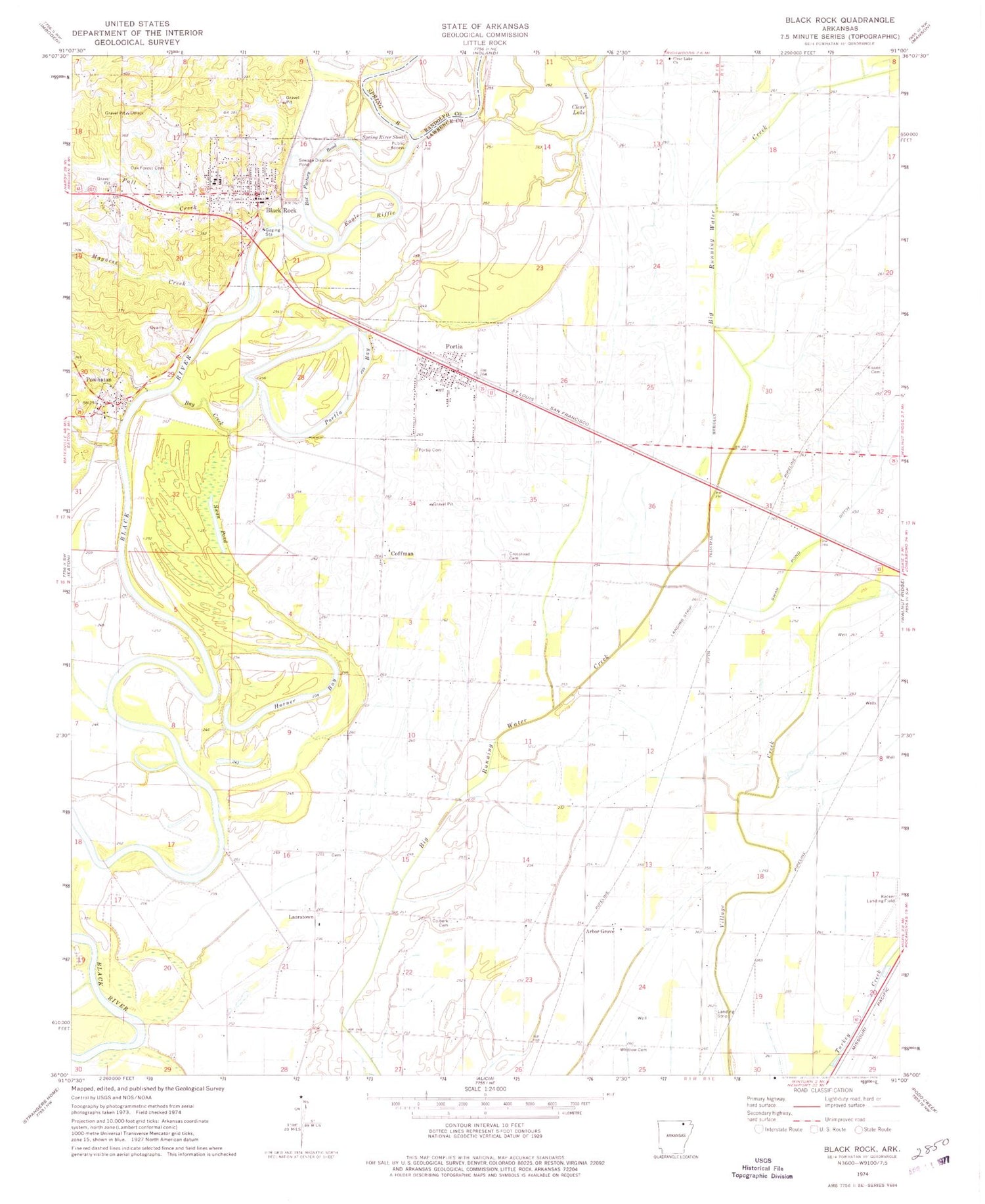
Classic USGS Black Rock Arkansas 7.5'x7.5' Topo Map
Couldn't load pickup availability
Historical USGS topographic quad map of Black Rock in the state of Arkansas. Map scale may vary for some years, but is generally around 1:24,000. Print size is approximately 24" x 27"
This quadrangle is in the following counties: Lawrence, Randolph.
The map contains contour lines, roads, rivers, towns, and lakes. Printed on high-quality waterproof paper with UV fade-resistant inks, and shipped rolled.
Contains the following named places: Arbor Grove, Arbor Grove Cemetery, Arbor Grove Church, Bay Creek, Black Rock, Black Rock Elementary School, Black Rock High School, Black Rock Police Department, Black Rock Post Office, Black Rock Volunteer Fire Department, Box Factory Bend, City of Black Rock, Clear Lake, Clear Lake Church, Clear Lake School, Coffman, Coffman School, Colberk Cemetery, Crossroad Cemetery, Eagle Riffle, Fall Creek, Horner Bay, Kissee Cemetery, Lauderdale Cemetery, Lauderdale Church, Lauderdale School, Lauratown, Lawrence County, Magness Creek, Oak Forest Cemetery, Portia, Portia Bay, Portia Cemetery, Portia Post Office, Portia School, Portia Volunteer Fire Department, Powhatan, Powhatan Courthouse, Powhatan Historic State Park, Powhatan Jail, Powhatan Male and Female Academy, Powhatan Post Office, Recker Landing Field, Spring River, Spring River Shoal, Swan Pond, Telephone Exchange Building, Town of Portia, Town of Powhatan, Township of Duty, Whitlow Cemetery, ZIP Codes: 72433, 72457


