
MyTopo
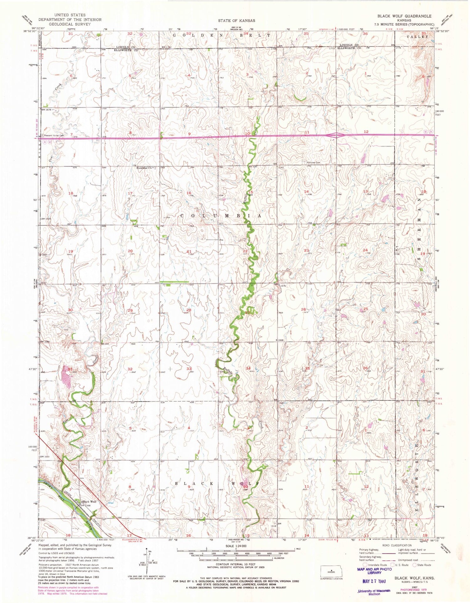
Classic USGS Black Wolf Kansas 7.5'x7.5' Topo Map
Couldn't load pickup availability
Historical USGS topographic quad map of Black Wolf in the state of Kansas. Map scale may vary for some years, but is generally around 1:24,000. Print size is approximately 24" x 27"
This quadrangle is in the following counties: Ellsworth, Lincoln.
The map contains contour lines, roads, rivers, towns, and lakes. Printed on high-quality waterproof paper with UV fade-resistant inks, and shipped rolled.
Contains the following named places: Black Wolf, Black Wolf School, Buffalo School, Cow Creek, Ellsworth Co - Operative Grain Elevator Number 2, Excelsior Lutheran Cemetery, Excelsior Lutheran Church, Fairview Cemetery, Pleasant Valley Cemetery, Saint Paul Lutheran Church, Saint Paul School, Saint Pauls Lutheran Cemetery, Township of Columbia


