MyTopo
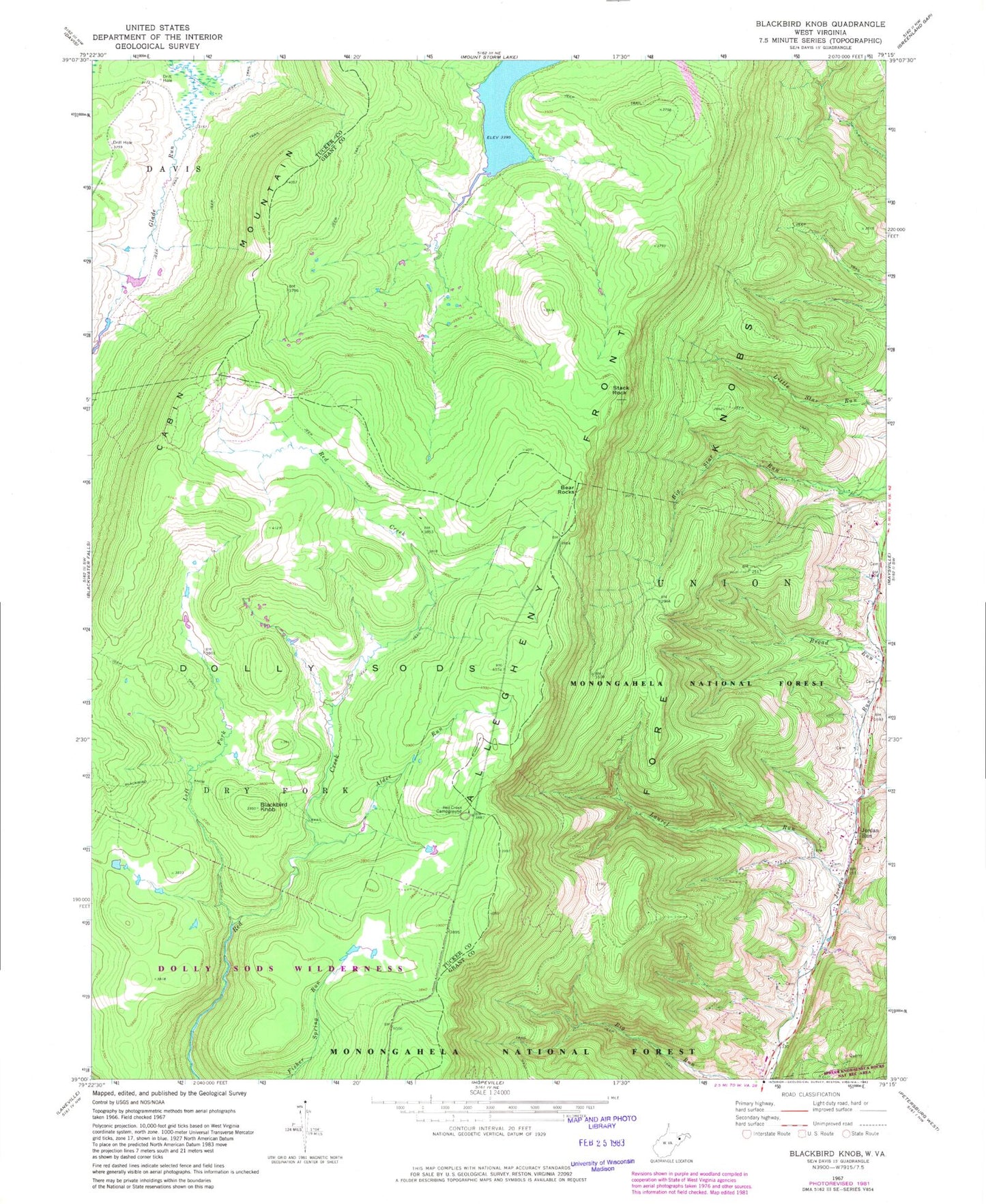
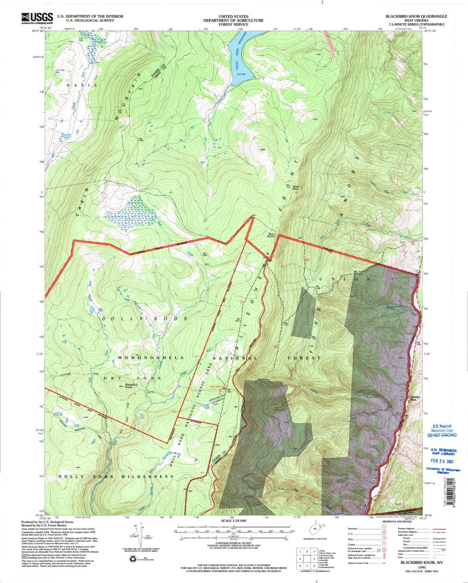
USGS Classic Blackbird Knob West Virginia 7.5'x7.5' Topo Map
Regular price
$16.95
Regular price
Sale price
$16.95
Unit price
per
Couldn't load pickup availability
Historical USGS topographic quad map of Blackbird Knobin the states of West Virginia, Virginia. Scale: 1:24000. Print size: 24" x 27"
This quadrangle is in the following counties: Grant, Tucker.
The map contains contour lines, roads, rivers, towns, lakes, and grids including latitude / longitude and UTM / MGRS. Printed on high-quality waterproof paper with UV fade-resistant inks.
Contains the following named places: Alder Run, Bear Rocks, Blackbird Knob, Blackbird Knob Trail, Broad Run, Dolly Sods, Laurel Run, Left Fork Red Creek, Red Creek Campground, Stack Rock, Dolly Sods Wilderness, Breathed Mountain Trail, Jordan Run, Camp 88 (historical), Rohrbaugh School (historical), Broadway Police Department