MyTopo
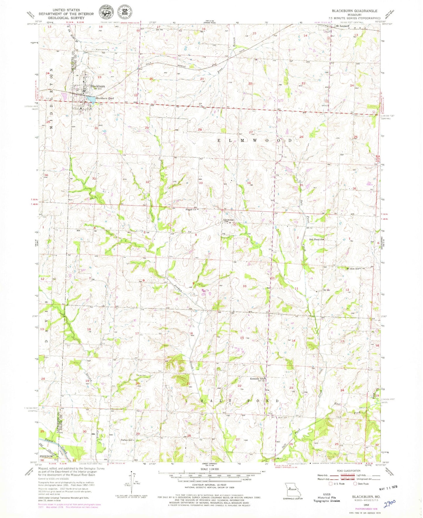
Classic USGS Blackburn Missouri 7.5'x7.5' Topo Map
Couldn't load pickup availability
Historical USGS topographic quad map of Blackburn in the state of Missouri. Map scale may vary for some years, but is generally around 1:24,000. Print size is approximately 24" x 27"
This quadrangle is in the following counties: Lafayette, Saline.
The map contains contour lines, roads, rivers, towns, and lakes. Printed on high-quality waterproof paper with UV fade-resistant inks, and shipped rolled.
Contains the following named places: Allen Cemetery, Blackburn, Blackburn Cemetery, Blackburn Pond, Blackburn Pond Dam, Blackburn Post Office, Blackburn Rural Fire Protection Association, Carmean School, City of Blackburn, East Fork Salt Pond Creek, Elmwood, Forbes School, Gross Cemetery, Halley School, Kennedy School, Logsdon School, Mount Leonard, Mount Zion School, Pisgah Church, Pony Creek, Prairie View School, Salt Pond Church, Salt Pond School, Stoll Lake, Stoll Lake Dam, Township of Elmwood, ZIP Code: 65321