MyTopo
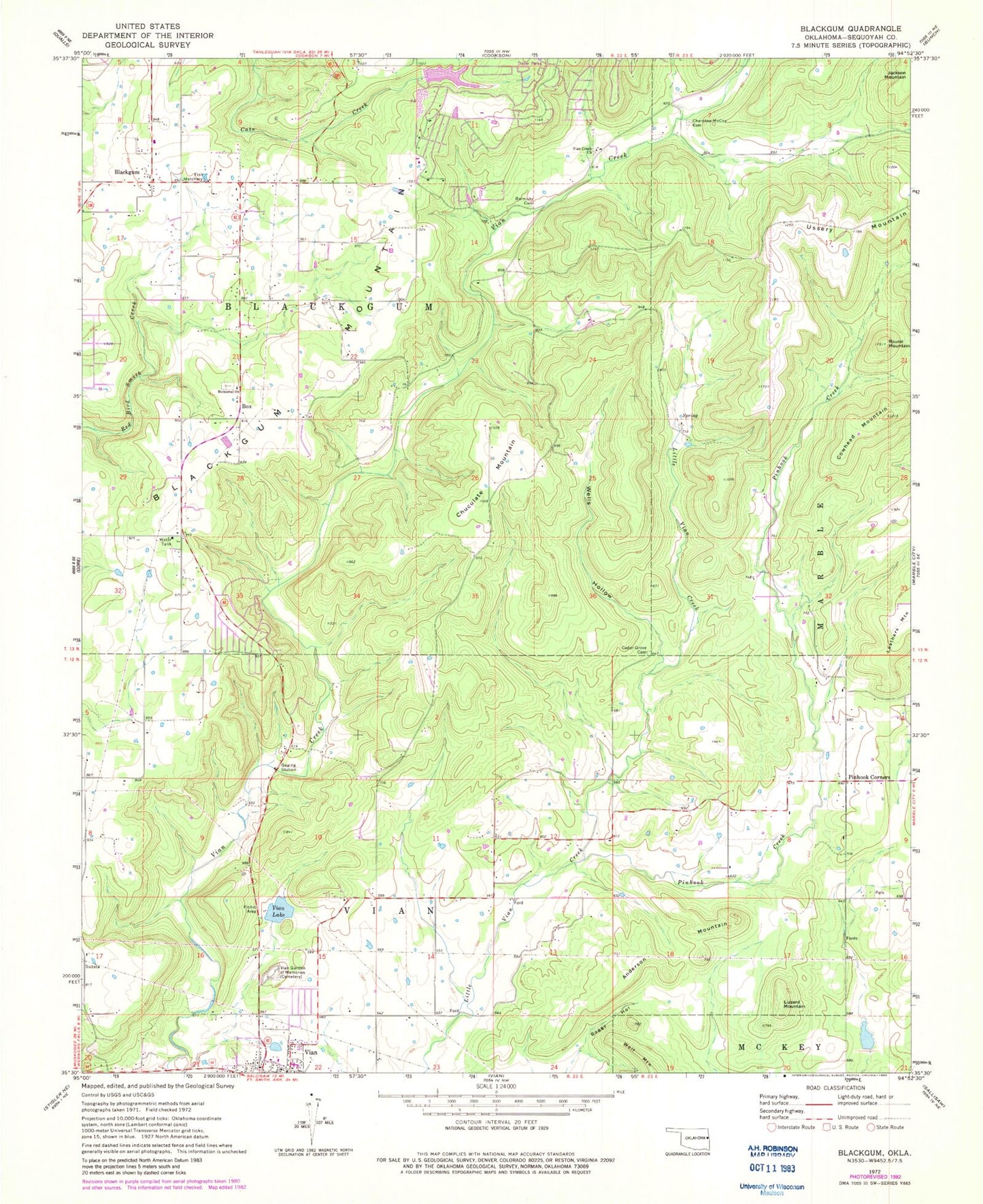
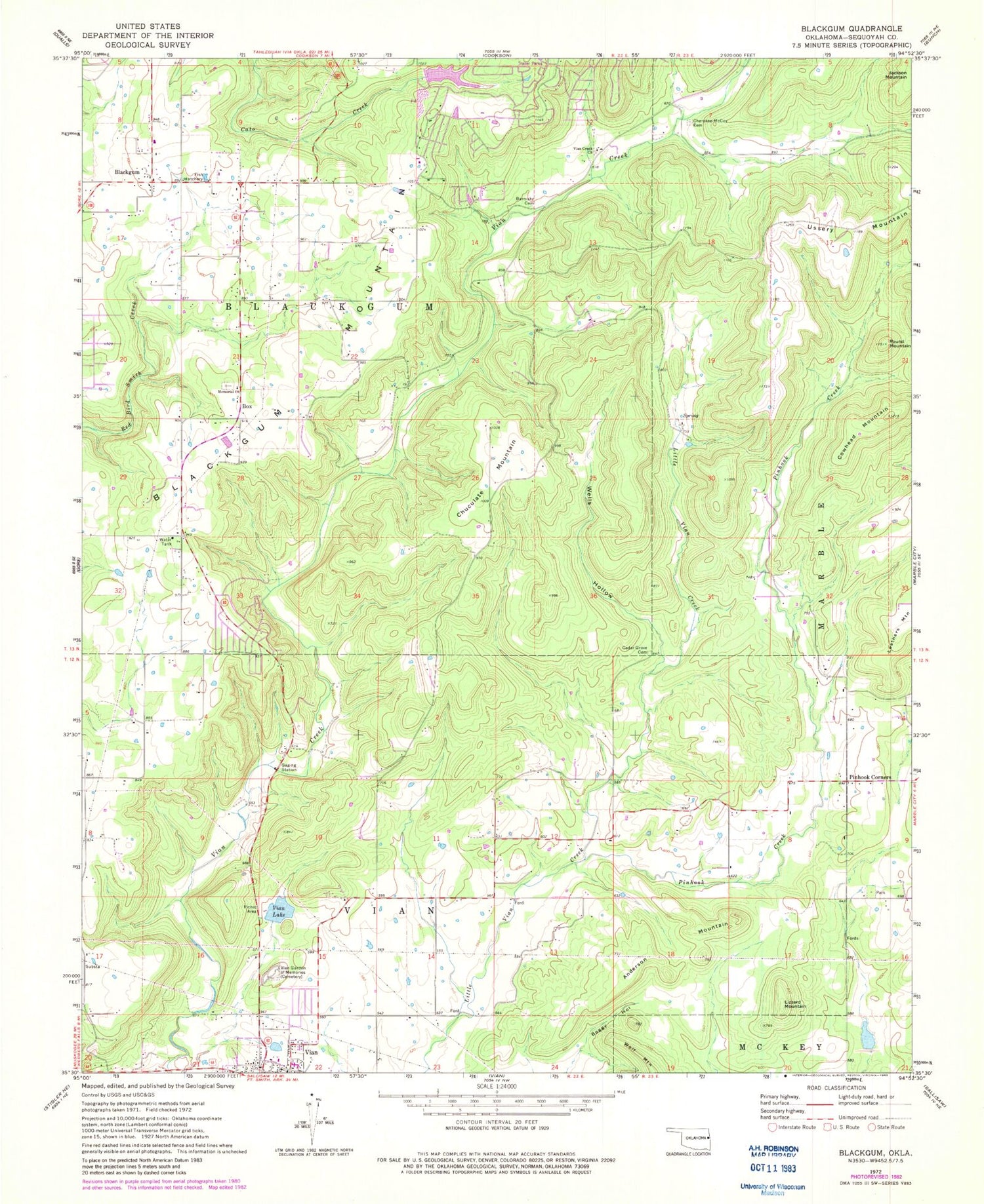
Classic USGS Blackgum Oklahoma 7.5'x7.5' Topo Map
Couldn't load pickup availability
Historical USGS topographic quad map of Blackgum in the state of Oklahoma. Map scale may vary for some years, but is generally around 1:24,000. Print size is approximately 24" x 27"
This quadrangle is in the following counties: Sequoyah.
The map contains contour lines, roads, rivers, towns, and lakes. Printed on high-quality waterproof paper with UV fade-resistant inks, and shipped rolled.
Contains the following named places: Anderson Mountain, Barnoskie Cemetery, Blackgum, Blackgum Census Designated Place, Blackgum Mountain, Blackgum Mountain Volunteer Fire Department Station 2, Blackgum Mountain Volunteer Fire Department Station 3, Boggy Hollow, Box, Box Cemetery, Box Census Designated Place, Cedar Grove Cemetery, Cherokee - McCoy Cemetery, Chuculate Mountain, Cowhead Mountain, Evening Shade, Evening Shade Census Designated Place, Lizzard Mountain, Pinhook Corner, Pinhook Corner Census Designated Place, Pinhook Creek, Round Mountain, Sallisaw Creek Site 3 Dam, Sallisaw Creek Site 3 Reservoir, Sycamore, Sycamore Census Designated Place, Town of Vian, Township of Blackgum, Vian Creek Church, Vian Division, Vian Garden of Memories, Vian Lake, Wells Hollow, ZIP Code: 74962