
MyTopo
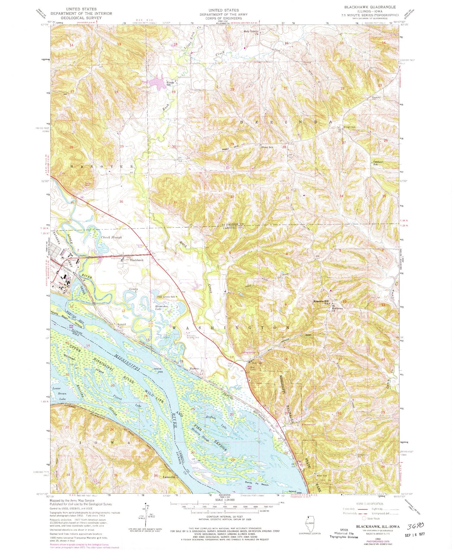
Classic USGS Blackhawk Illinois 7.5'x7.5' Topo Map
Couldn't load pickup availability
Historical USGS topographic quad map of Blackhawk in the states of Illinois, Iowa. Map scale may vary for some years, but is generally around 1:24,000. Print size is approximately 24" x 27"
This quadrangle is in the following counties: Carroll, Jackson, Jo Daviess.
The map contains contour lines, roads, rivers, towns, and lakes. Printed on high-quality waterproof paper with UV fade-resistant inks, and shipped rolled.
Contains the following named places: Albright Cemetery, Apple River, Arnold, Arnold Landing, Big Soup Bone Island, Blackhawk, Buffalo Lake, Cheek Slough, Fitzgerald Lake, Fitzgerald Lake Dam-East Dam, Fitzgerald Lake West Dam, Gillispie School, Heer Hill, Hickory Slough, Holy Trinity Church, Horseshoe Lake, Island Number 259, Knapp School, Lainsville, Lainsville Slough, Little Rush Creek, Little Soup Bone Island, Lower Brown Lake, Lundy Lake, Marcus, Massbach Cemetery, Millers Lake, Mississippi Palisades State Park, Morrison Cemetery, Mosquito Hill Cemetery, Mosquito Hill School, NYA Camp, Oak Grove School, Oakland School, Oliver School, Palisades Country Club, Pinoak Lake, Railroad Island, Running Slough, Rush Creek, Saint Mathews Church, Santa Fe Beach, Santa Fe Island, Savanna Army Depot Activity Fire Station, Scarborough Lake, Sentinel Nature Preserve, Township of Derinda, Township of Washington, WCCI-FM (Savanna), West Hickory Lake, Woodland Valley Courts


