MyTopo
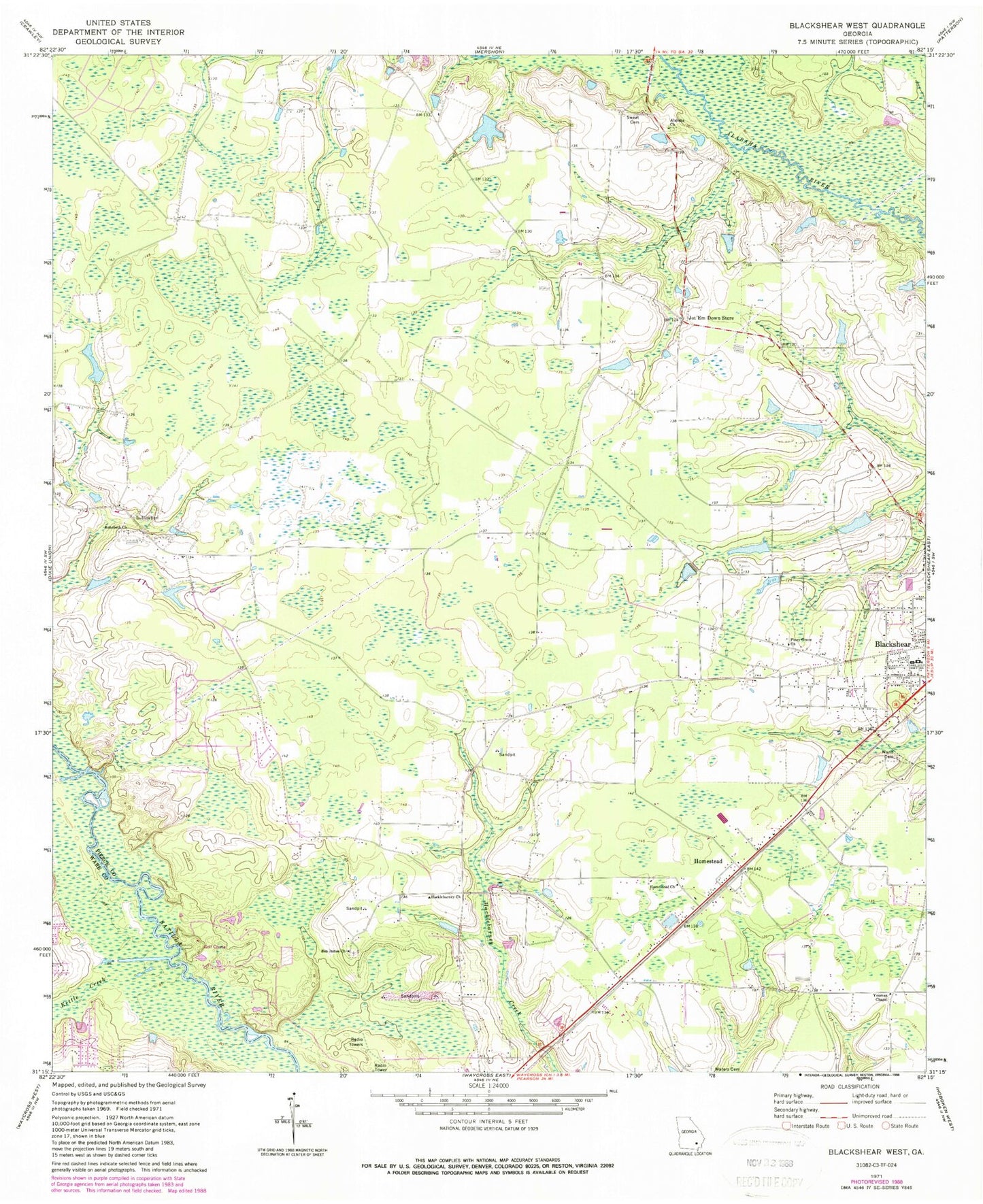
Classic USGS Blackshear West Georgia 7.5'x7.5' Topo Map
Couldn't load pickup availability
Historical USGS topographic quad map of Blackshear West in the state of Georgia. Map scale may vary for some years, but is generally around 1:24,000. Print size is approximately 24" x 27"
This quadrangle is in the following counties: Pierce, Ware.
The map contains contour lines, roads, rivers, towns, and lakes. Printed on high-quality waterproof paper with UV fade-resistant inks, and shipped rolled.
Contains the following named places: Alabaha Cemetery, Alabaha Freewill Baptist Church, Alabaha School, Baxley School, Ben James Cemetery, Ben James Church, Bethel Temple Holiness Church, Blackshear Division, Deans Still, Greater Saint James African Methodist Episcopal Church, Hacklebarney Church, Hacklebarney Volunteer Fire Department, Homestead, Homestead Church, Jordan Lake, Jordan Lake Dam, Jot'Em Down Store, Kettle Creek, Marian Anderson Library, Martins Mobile Home Park, Nunn Cemetery, Okefenokee Golf and Country Club, Pine Bloom School, Piney Grove Church, Progress School, Rehobeth Cemetery, Rehobeth Church, Southgate Baptist Church, Sweat Cemetery, WACL-AM (Waycross), Ward Memorial Church, Ware Street Elementary School, Waters Cemetery, WKUB-FM (Blackshear), Youman, Youman Chapel, ZIP Code: 31516