MyTopo
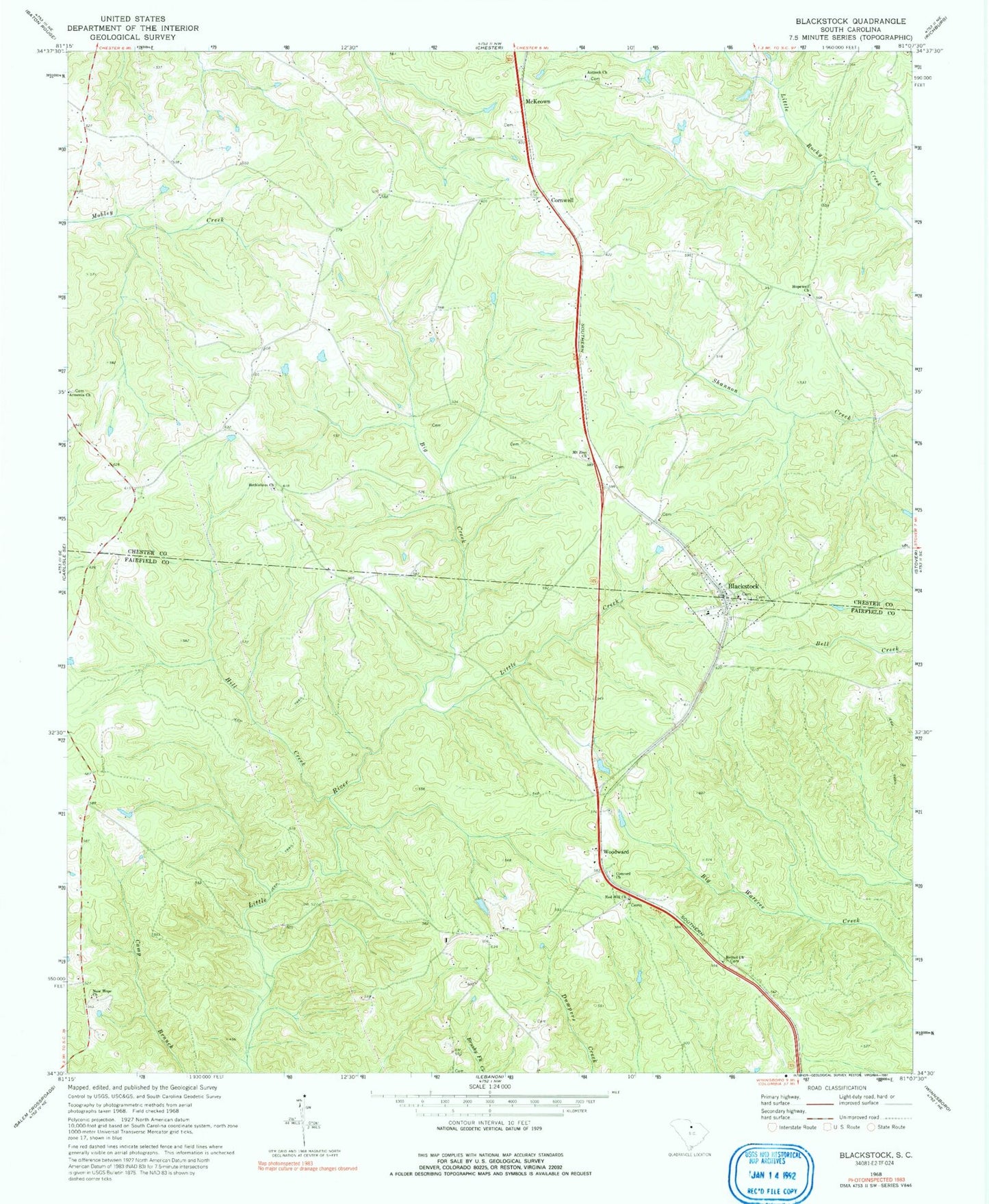
Classic USGS Blackstock South Carolina 7.5'x7.5' Topo Map
Couldn't load pickup availability
Historical USGS topographic quad map of Blackstock in the state of South Carolina. Map scale may vary for some years, but is generally around 1:24,000. Print size is approximately 24" x 27"
This quadrangle is in the following counties: Chester, Fairfield.
The map contains contour lines, roads, rivers, towns, and lakes. Printed on high-quality waterproof paper with UV fade-resistant inks, and shipped rolled.
Contains the following named places: Antioch Church, Armenia Church, Bethel Church, Bethelehem Church, Bethlehem Church, Big Creek, Blackstock, Blackstock Baptist Church, Blackstock Cemetery, Blackstock Church, Blackstock Presbyterian Church, Concord Cemetery, Concord Church, Cornwell, Cornwell Church, Coyote Creek Farm, D and D Farms, Elliots Mill, Fairfield County Fire Department Station 17 - Blackstock, Hill Creek, Hopewell Church, Hopewell School, Lees Old Mill, Little Creek, McKeown, Mount Zion Church, New Hope Cemetery, New Hope Church, Oakhill School, Red Hill Church, Russell Schhol, Saint Marys Church, South Chester Fire Department - Chester County Company 11, Woodward, Woodward School