
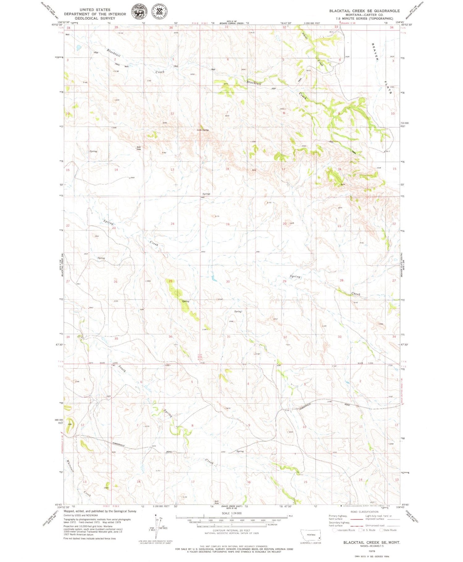
MyTopo
Classic USGS Blacktail Creek SE Montana 7.5'x7.5' Topo Map
Regular price
$16.95
Regular price
Sale price
$16.95
Unit price
per
Couldn't load pickup availability
Historical USGS topographic quad map of Blacktail Creek SE in the state of Montana. Map scale may vary for some years, but is generally around 1:24,000. Print size is approximately 24" x 27"
This quadrangle is in the following counties: Carter.
The map contains contour lines, roads, rivers, towns, and lakes. Printed on high-quality waterproof paper with UV fade-resistant inks, and shipped rolled.
Contains the following named places: 01N56E15BACA01 Well, 01N56E31CCC_01 Well, 01N56E32DCC_01 Well, 01S56E09CDC_01 Well, 01S56E15BAC_01 Well, 01S56E17AADC01 Well, 01S57E17BCB_01 Well


