MyTopo
Classic USGS Blacktail Deer Creek Wyoming 7.5'x7.5' Topo Map
Regular price
$16.95
Regular price
Sale price
$16.95
Unit price
per
Couldn't load pickup availability
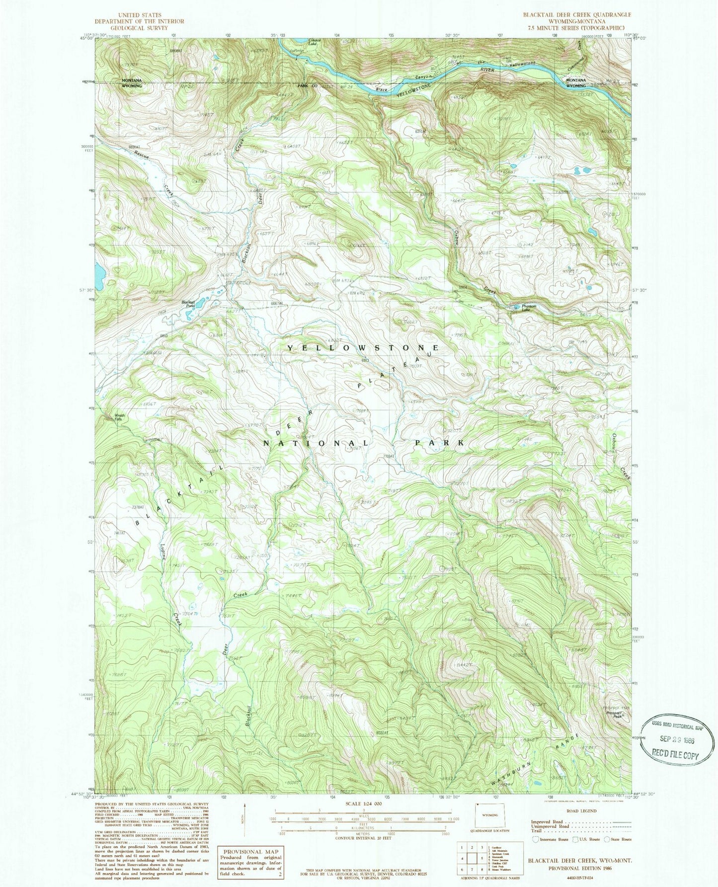
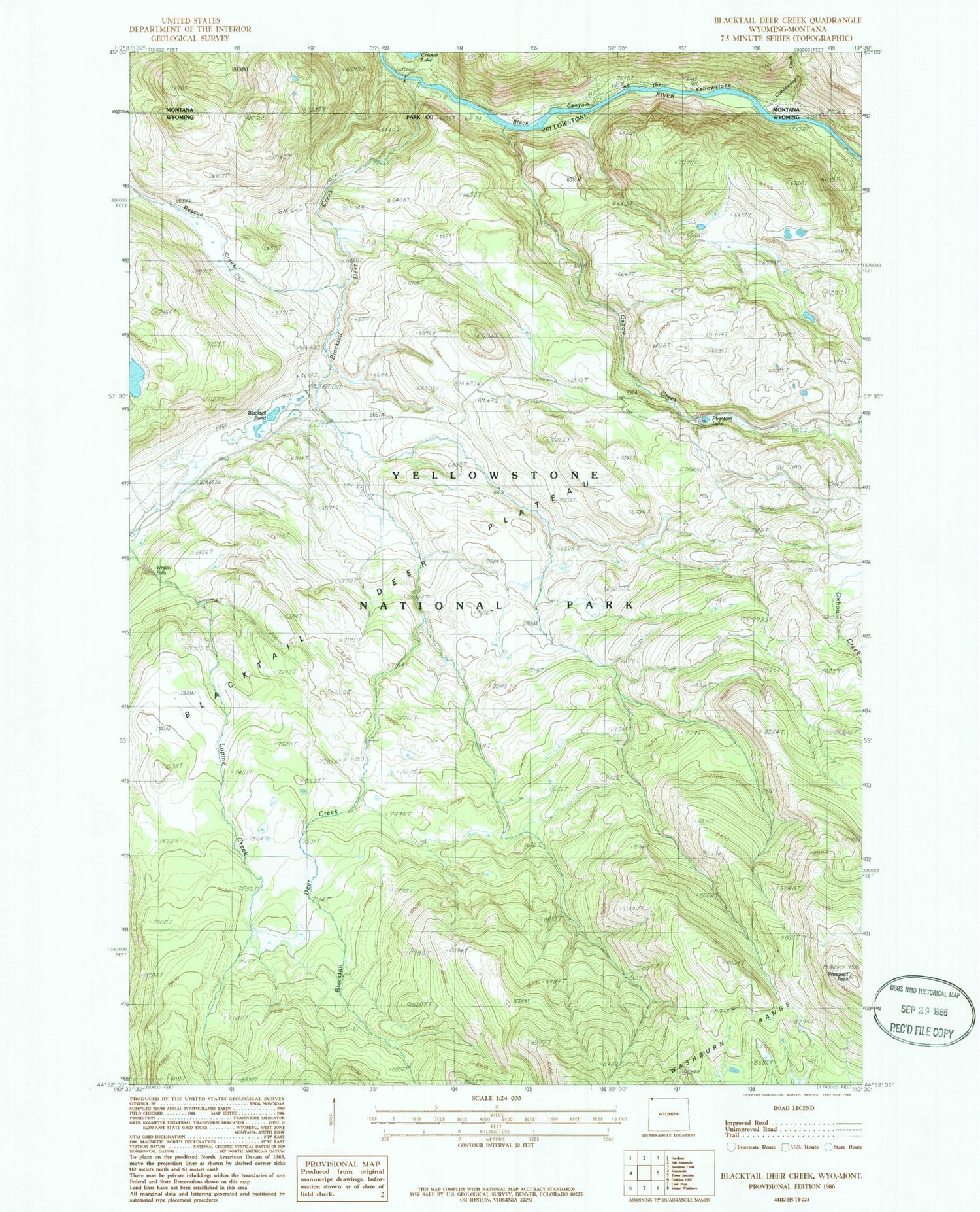
Historical USGS topographic quad map of Blacktail Deer Creek in the states of Wyoming, Montana. Typical map scale is 1:24,000, but may vary for certain years, if available. Print size: 24" x 27"
This quadrangle is in the following counties: Park.
The map contains contour lines, roads, rivers, towns, and lakes. Printed on high-quality waterproof paper with UV fade-resistant inks, and shipped rolled.
Contains the following named places: Blacktail Deer Plateau, Blacktail Pond, Lower Blacktail Trail, Oxbow Creek, Phantom Lake, Wraith Falls, Rescue Creek Trail, Prospect Peak, Rescue Creek, Blacktail Bridge, Blacktail Deer Creek, Cottonwood Creek, Lower Blacktail Trail