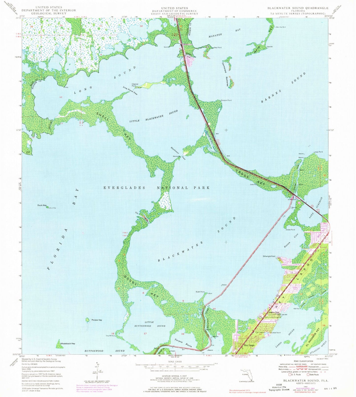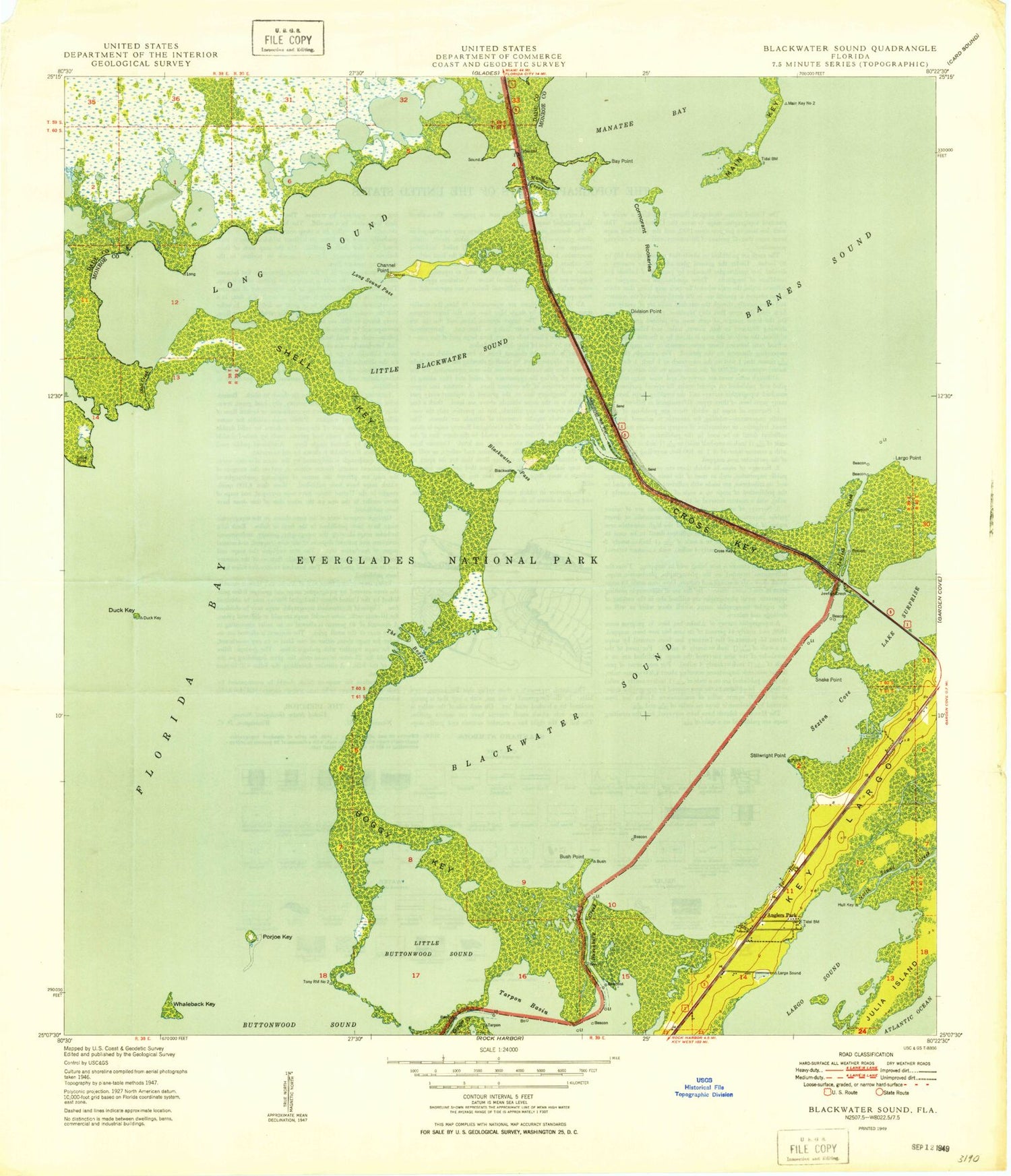

MyTopo
Classic USGS Blackwater Sound Florida 7.5'x7.5' Topo Map
Couldn't load pickup availability
Historical USGS topographic quad map of Blackwater Sound in the state of Florida. Map scale may vary for some years, but is generally around 1:24,000. Print size is approximately 24" x 27"
This quadrangle is in the following counties: Miami-Dade, Monroe.
The map contains contour lines, roads, rivers, towns, and lakes. Printed on high-quality waterproof paper with UV fade-resistant inks, and shipped rolled.
Contains the following named places: Anglers Park, Barnes Sound, Bay Point, Blackwater Pass, Blackwater Sound, Boggy Key, Bush Point, Channel Point, Cormorant Rookeries, Cross Key, Division Point, Duck Key, Dusenbury Creek, Family Paradise Island Marina, Jewfish, Jewfish Creek, Key Largo Convention Center, Key Largo Marina, Key Largo School, Key Largo Volunteer Fire Department, Kings Kamp Campground Marina, Lake Surprise, Largo Point, Largo Sound, Little Blackwater Sound, Little Buttonwood Sound, Long Sound, Long Sound Pass, Main Key, Manatee Cove Mobile Home Park, Manatee Creek, Marvin D Adams Waterway, Pelican Cay Harbor Marina, Porjoe Key, Port Largo Plaza, Sexton Cove, Shell Creek, Shell Key, Snake Point, Stellrecht Point, The Boggies, The Tradewinds Shopping Center, Thursday Cove, Whaleback Key, ZIP Code: 33037