
MyTopo
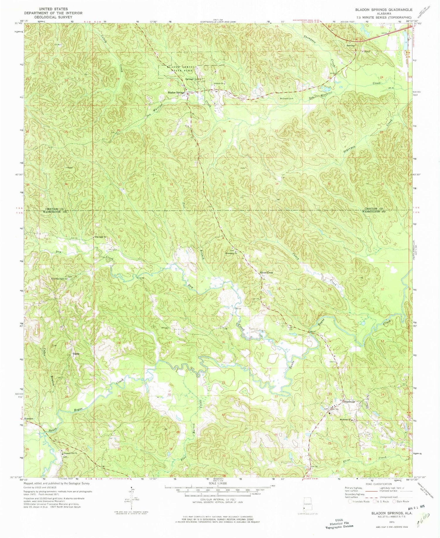
Classic USGS Bladon Springs Alabama 7.5'x7.5' Topo Map
Couldn't load pickup availability
Historical USGS topographic quad map of Bladon Springs in the state of Alabama. Map scale may vary for some years, but is generally around 1:24,000. Print size is approximately 24" x 27"
This quadrangle is in the following counties: Choctaw, Washington.
The map contains contour lines, roads, rivers, towns, and lakes. Printed on high-quality waterproof paper with UV fade-resistant inks, and shipped rolled.
Contains the following named places: Antioch Baptist Church, Bashi, Bethany Church, Bladon Springs, Bladon Springs Cemetery, Bladon Springs Church, Bladon Springs State Park, C and J Church, Callier Branch, Caney Creek, Cedar Branch, Cullom Springs, Dry Creek, Everett Ford, Frankville, Frankville Cemetery, Frankville Church, Frankville Post Office, Frankville School, Frankville Volunteer Fire Department, Friendship Baptist Church, Friendship Cemetery, Friendship School, Goodwill Church, Grenade Cemetery, Koen Burn, McDowell Cemetery, Mount Bethel Baptist Church, Mount Bethel Cemetery, New True Light Baptist Church, Pine Barren Creek, Pleasant Hill Baptist Church, Pleasant Hill Cemetery, Pool Branch, Rocky Ford, Salt Pond, Service, Silver Cross, Thompson Creek, True Light Baptist Church, ZIP Code: 36538


