MyTopo
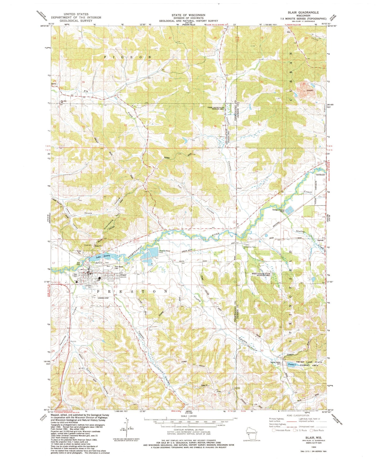
Classic USGS Blair Wisconsin 7.5'x7.5' Topo Map
Couldn't load pickup availability
Historical USGS topographic quad map of Blair in the state of Wisconsin. Map scale may vary for some years, but is generally around 1:24,000. Print size is approximately 24" x 27"
This quadrangle is in the following counties: Jackson, Trempealeau.
The map contains contour lines, roads, rivers, towns, and lakes. Printed on high-quality waterproof paper with UV fade-resistant inks, and shipped rolled.
Contains the following named places: 1 Reservoir, 54616, Blair, Blair - Preston Volunteer Fire Department, Blair - Taylor Elementary School, Blair - Taylor Middle - High School, Blair Airport, Blair Mill Dam, Blair Police Department, Blair Post Office, Chier Sand Company 3WC78804 Dam, City of Blair, Corness Cemetery, Finn School, First Lutheran Church, Fly Creek School, French Creek, Gransberg Hill, Lake Henry, Lake Henry 173, Memorial Park, Pleasant View School, Rest Haven Cemetery, Reynolds Coulee, Reynolds Coulee Creek, Saint Ansgar Catholic Church, Salva Coulee, Shepherd School, Skunk Hollow, Skutley Creek, Soset Charter School, Sunnyside School, Tappen Coulee, Tappen Coulee Creek, Taylor Pit, Trempealeau Valley Church, Trump Coulee, Trump Coulee Cemetery, Trump Coulee Creek, Trump Coulee School, Trump Lake, Trump Lake 1, Trump Lake G12.224 Dam, Trump Lake State Fishery Area, Turi Coulee, Valley View School, Vosse Coulee, Vosse Coulee Creek, Vosse Coulee State Wildlife Area, West Taylor State Wildlife Area, Zion Lutheran Cemetery, Zion Lutheran Church