MyTopo
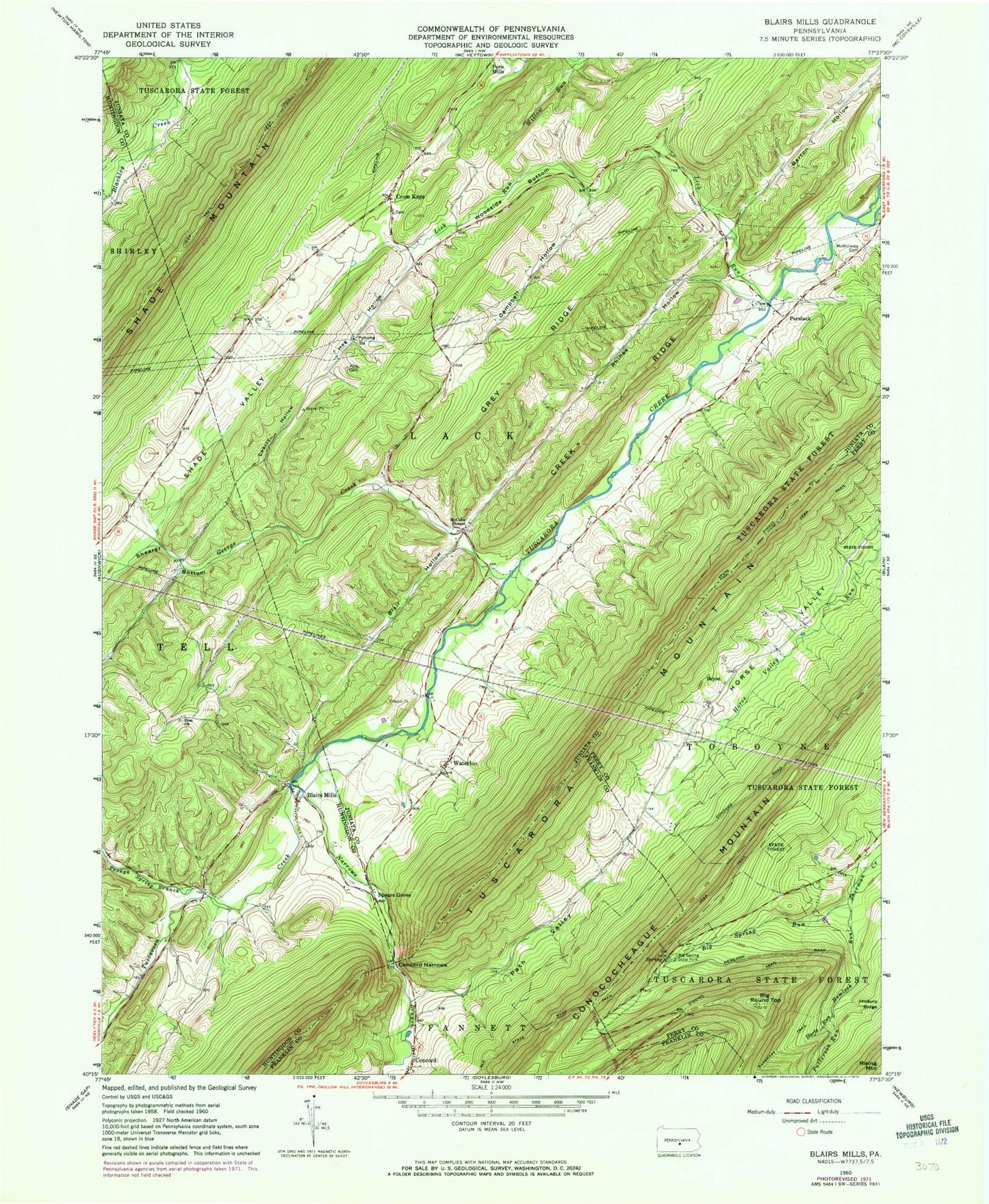
Classic USGS Blairs Mills Pennsylvania 7.5'x7.5' Topo Map
Couldn't load pickup availability
Historical USGS topographic quad map of Blairs Mills in the state of Pennsylvania. Map scale is 1:24000. Print size is approximately 24" x 27"
This quadrangle is in the following counties: Franklin, Huntingdon, Juniata, Perry.
The map contains contour lines, roads, rivers, towns, and lakes. Printed on high-quality waterproof paper with UV fade-resistant inks, and shipped rolled.
Contains the following named places: Barton Hollow, Beers Trail, Big Round Top, Big Roundtop Trail, Big Spring, Big Spring Run, Big Spring State Park, Blair Hollow, Blairs Mills, Blairs Mills Post Office, Burns Valley Overlook, Campbell Hollow, Cherry Hollow, Colter School, Concord, Concord Narrows, Creek Ridge, Cross Keys, Cross Keys Methodist Cemetery, Cross Keys Path, Elf Cemetery, George Creek, Grey Ridge, Harts Run, Hemlock Run, Hog Hollow, Iron Horse Trail, Jeffries Cemetery, Lick Run, McCabe Chapel, McCabe School, McCaskey Graves, McWilliams Cemetery, Mount Zion Church Cemetery, Narrows Branch Tuscarora Creek, O'Donel Trail, Old State Road Trail, Patterson Run, Perulack, Polk Cemetery, Rhines Hollow, Seyoc, Shade Valley, Shearer Bottom, Spears Grove, Township of Lack, Trough Spring Branch, Upper Tuscarora Presbyterian Cemetery, Waterloo, Waterloo Cemetery, Wistie, Zion Church