MyTopo
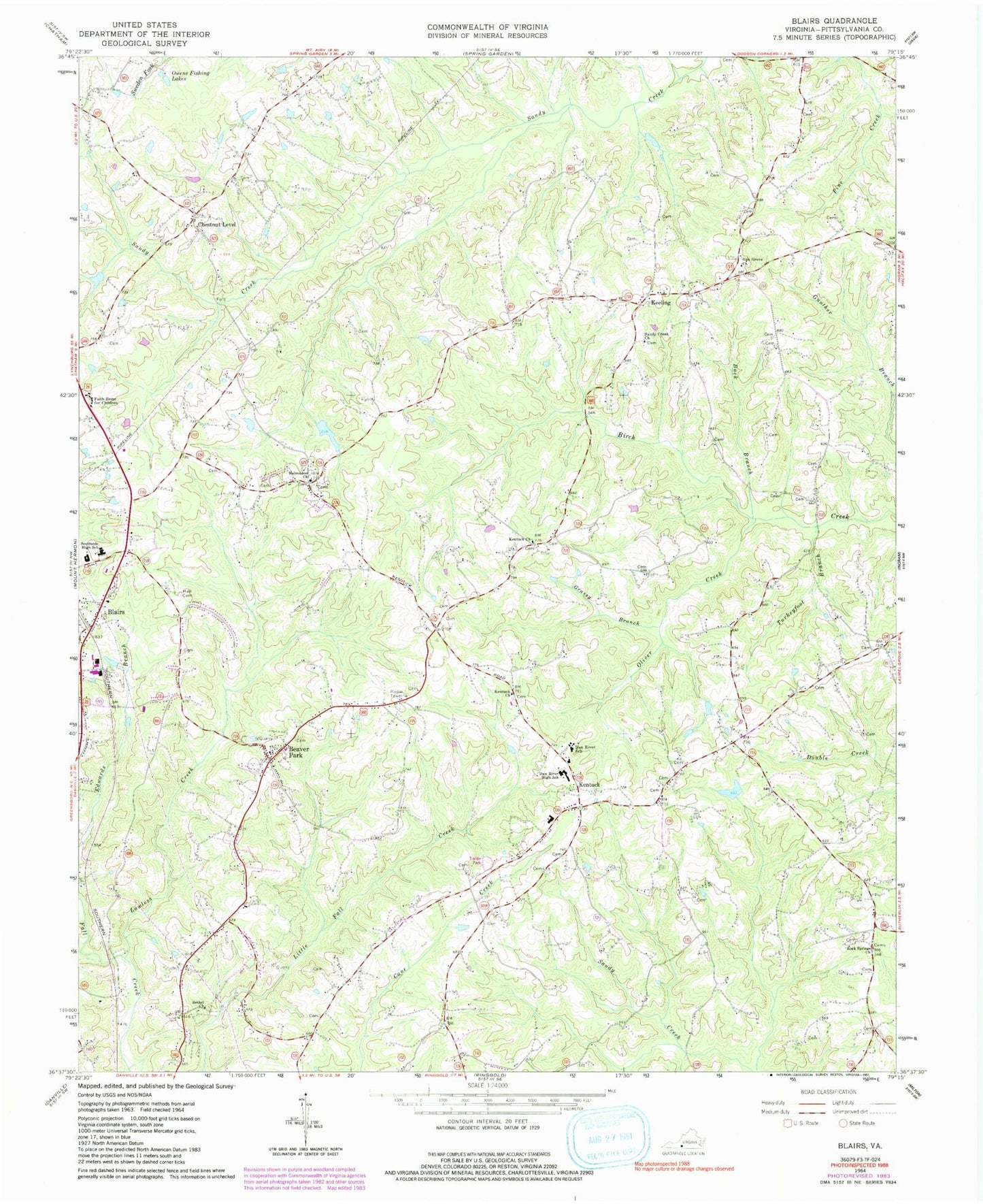
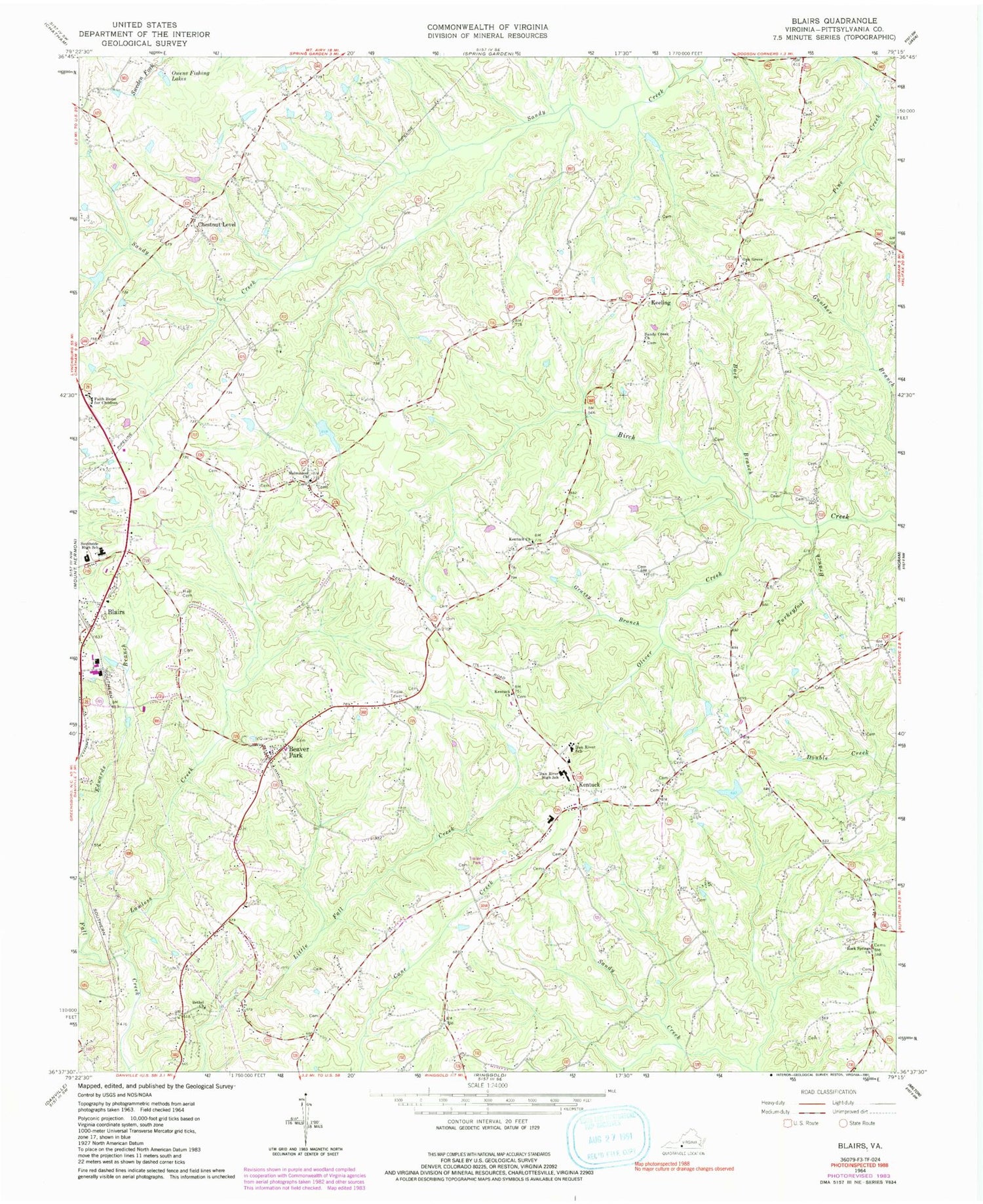
Classic USGS Blairs Virginia 7.5'x7.5' Topo Map
Couldn't load pickup availability
Historical USGS topographic quad map of Blairs in the state of Virginia. Map scale may vary for some years, but is generally around 1:24,000. Print size is approximately 24" x 27"
This quadrangle is in the following counties: Danville (city), Pittsylvania.
The map contains contour lines, roads, rivers, towns, and lakes. Printed on high-quality waterproof paper with UV fade-resistant inks, and shipped rolled.
Contains the following named places: Back Branch, Beaver Park, Beaver School, Bennetts Store, Bethel Church, Blairs, Blairs Post Office, Blairs Volunteer Fire Department, Chestnut Level, Chestnut Level School, Dan River District, Dan River Elementary School, Dan River High School, Dan River Middle School, Evans Store, Faith Home for Children, Gibsons Store, Grassy Branch, Kadesh School, Keeling, Keeling Post Office, Keeling Volunteer Fire Department, Kentuck, Kentuck Church, Kentuck Elementary School, Kentuck Volunteer Fire Department, KOA Camp Dam, KOA Camp Lake, Lawless Creek, Malmaison Church, Oak Grove Church, Oak Grove School, Oliver Creek, Owens Fishing Lakes, Pittston School, Rock Springs Church, Sanderson School, Sandy Creek Church, Southside Elementary School, Thornton Dam, Turkeyfoot Branch, White Oak School, ZIP Codes: 24527, 24566