MyTopo
Classic USGS Blairstown Missouri 7.5'x7.5' Topo Map
Couldn't load pickup availability
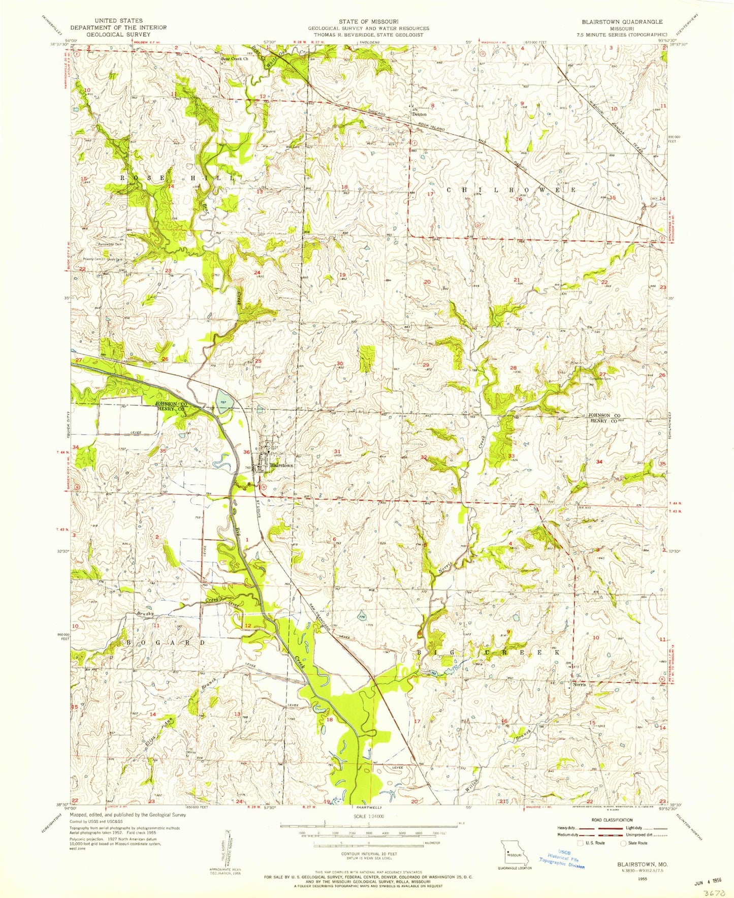
Historical USGS topographic quad map of Blairstown in the state of Missouri. Map scale may vary for some years, but is generally around 1:24,000. Print size is approximately 24" x 27"
This quadrangle is in the following counties: Henry, Johnson.
The map contains contour lines, roads, rivers, towns, and lakes. Printed on high-quality waterproof paper with UV fade-resistant inks, and shipped rolled.
Contains the following named places: Bear Creek, Bear Creek Church, Blairstown, Blairstown Cemetery, Blairstown Post Office, Blairstown School, Blairstown Volunteer Fire Department, Brushy Church, Brushy Creek, Brushy School, Carpenter Cemetery, City of Blairstown, Compromise School, Denton, Denton School, Eliza ann Branch, Farnsworth Cemetery, Landis, Norris, Norris Creek, Norris School, Old Channel Big Creek, Priestly Cemetery, Quick Cemetery, Star School, Township of Big Creek, ZIP Code: 64726