MyTopo
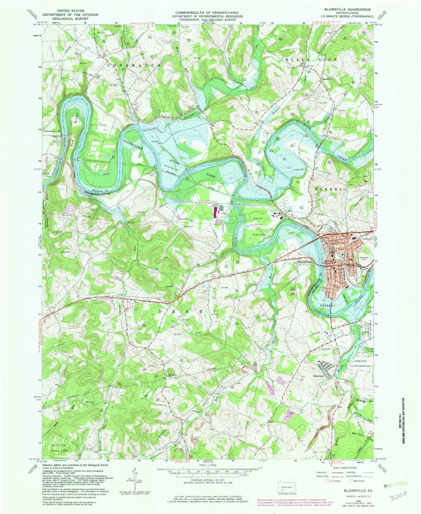
Classic USGS Blairsville Pennsylvania 7.5'x7.5' Topo Map
Couldn't load pickup availability
Historical USGS topographic quad map of Blairsville in the state of Pennsylvania. Map scale may vary for some years, but is generally around 1:24,000. Print size is approximately 24" x 27"
This quadrangle is in the following counties: Indiana, Westmoreland.
The map contains contour lines, roads, rivers, towns, and lakes. Printed on high-quality waterproof paper with UV fade-resistant inks, and shipped rolled.
Contains the following named places: Aultmans Run, Bairdstown, Bear Cave Hollow, Blacklick Creek, Blairsville, Blairsville Cemetery, Blairsville Junior High School, Blairsville Post Office, Blairsville Young Mens Volunteer Fire Company Station 120, Boatyard Run, Borough of Blairsville, Bow, Brenizer, Brenizer Elementary School, Burrell, Citizens Ambulance Service Blairsville Station 20, Cokeville, Conemaugh Dam, Conemaugh Lake National Recreation Area, Conemaugh River Lake, DeLuca Field, Dunlea Airpark, Fillmore, Greys Run, Harbridge Run, Hopewell Cemetery, Hopewell Church, Jellison, Livermore, Livermore Baptist Church Cemetery, McGee Run, Miller Run, Mount Carmel Cemetery, Old Salem Cemetery, Old Salem Church, Roaring Run, Saints Simon and Jude Catholic School, Saints Simon and Jude Cemetery, Shirey Run, Snyder, Spruce Run, Stewart Run, Stony Run, Third Ward Elementary School, Township of Black Lick, Township of Derry