MyTopo
Classic USGS Blakely Island Washington 7.5'x7.5' Topo Map
Couldn't load pickup availability
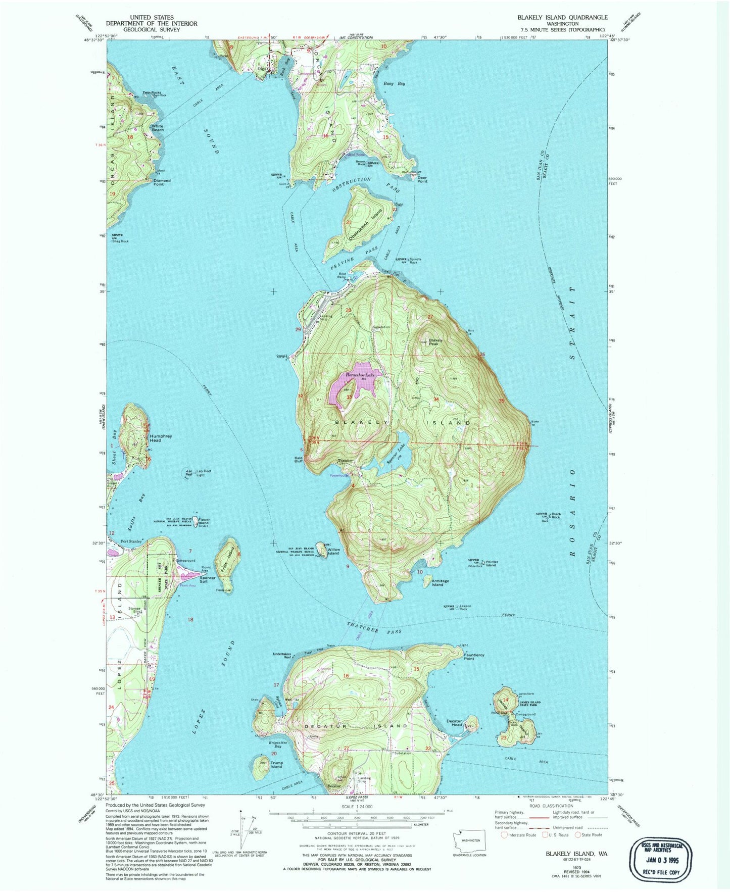
Historical USGS topographic quad map of Blakely Island in the state of Washington. Map scale is 1:24000. Print size is approximately 24" x 27"
This quadrangle is in the following counties: San Juan, Skagit.
The map contains contour lines, roads, rivers, towns, and lakes. Printed on high-quality waterproof paper with UV fade-resistant inks, and shipped rolled.
Contains the following named places: Armitage Island, Bald Bluff, Black Rock, Blakely Island, Blakely Island Airport, Blakely Island General Store Marina, Blakely Island Shoal, Blakely Peak, Brigantine Bay, Brown Rock, Buck Bay, Buoy Bay, Cascade Creek, Davis Bay, Decatur, Decatur /Jones Airport, Decatur Head, Decatur Island, Deer Point, Deer Point Airport (historical), Diamond Point, Fauntleroy Point, Flower Island, Frost Island, Green Bank, Horseshoe Lake, Humphrey Head, James Island, James Island State Park, James Island State Park Boat Dock, Lawson Rock, Leo Reef, Leo Reef Light, Lieber Haven Resort and Marina, Lopez Sound, Lydia Shoal, Obstruction Island, Obstruction Pass, Olga, Olga Marina, Olga Marine State Park, Olga Post Office, Peavine Pass, Pointer Island, Port Stanley, San Elmo, San Juan County Fire District 2 / Orcas Island Fire and Rescue Station 25 Olga / Obstruction Pass, Spencer Lake, Spencer Spit, Spencer Spit State Park, Spencer's Landing Marina, Spindle Rock, Swifts Bay, Sylvan Cove, Thatcher, Thatcher Bay, Thatcher Pass, The Pointers, Trump Island, Turek Dam, Twin Rocks, Undertakers Reef, White Beach, Willow Island