MyTopo
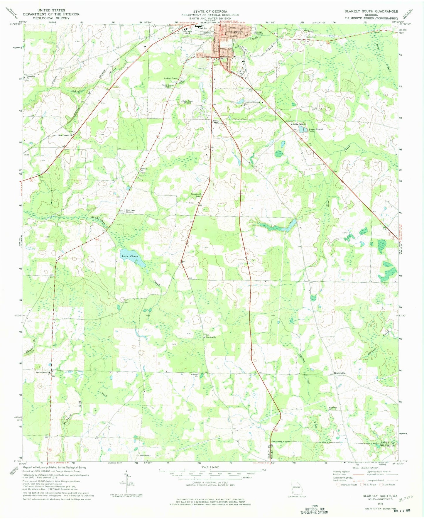
Classic USGS Blakely South Georgia 7.5'x7.5' Topo Map
Couldn't load pickup availability
Historical USGS topographic quad map of Blakely South in the state of Georgia. Map scale may vary for some years, but is generally around 1:24,000. Print size is approximately 24" x 27"
This quadrangle is in the following counties: Early, Miller.
The map contains contour lines, roads, rivers, towns, and lakes. Printed on high-quality waterproof paper with UV fade-resistant inks, and shipped rolled.
Contains the following named places: Alex Howell Baseball Park, Baptist Branch, Bethlehem Church, Blakely - Early County Sheriff's Office, Blakely Cemetery, Blakely Regional Youth Development Center, Bridges Lake, Bridges Lake Dam, Byron School, Calvary Baptist Church, Centerville, Centerville Methodist Cemetery, Centerville Methodist Church, Church of Christ, Church of God, Early County, Early County High School, First Free Will Baptist Church, Friendship Church, Jerusalem Church, King Plaza Shopping Center, Lake Clara, Lake Clara Dam, Langston Chapel, LifeBrite Community Hospital of Early, Macedonia Church, Maddox Memorial Library, McLendon, New Prospect Church, New Prospect Church Cemetery, Pine Lawn Gardens, Pineview Church, Saint Johns Church, Saint Maryland Church, Saint Pauls Church, Sawhatchee Church, Southside Baptist Church, Standifer Field, Town and Country Club, Town and Country Golf Course, WBBK-AM (Blakely), ZIP Code: 39823