MyTopo
Classic USGS Blakeslee Ohio 7.5'x7.5' Topo Map
Couldn't load pickup availability
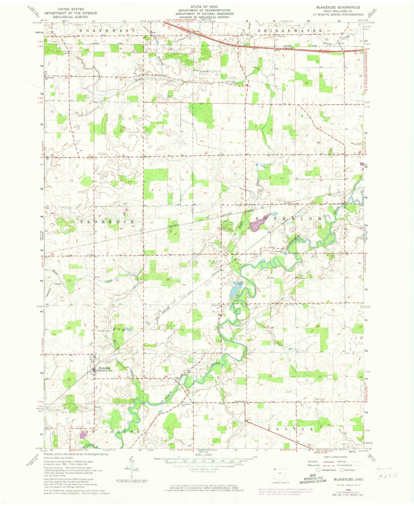
Historical USGS topographic quad map of Blakeslee in the state of Ohio. Map scale may vary for some years, but is generally around 1:24,000. Print size is approximately 24" x 27"
This quadrangle is in the following counties: Williams.
The map contains contour lines, roads, rivers, towns, and lakes. Printed on high-quality waterproof paper with UV fade-resistant inks, and shipped rolled.
Contains the following named places: Bear Creek, Bethlehem Christian Union Church, Blakeslee, Blakeslee Post Office, Bratton School, Browns Recreation Lake, Browns Recreation Lake Dam, Creek Farms, Eagle Creek, Eagle Creek Cemetery, Farm Service Agency Interest of Ohio, Fetter School, Hepker Cemetery, Heritage Cemetery, Marvin Thiel Field, Mount Olive Church, North Branch Eagle Creek, Saint Joseph Catholic Church, Saint Joseph Cemetery, Saint Joseph School, School Number 1, School Number 10, School Number 11, School Number 12, School Number 3, School Number 4, School Number 5, School Number 6, School Number 7, School Number 8, School Number 9, Township of Florence, Township of Superior, Union Chapel Cemetery, Union Corners, Village of Blakeslee, West Buffalo, West Buffalo Cemetery, West Woodly Addition, ZIP Codes: 43505, 43543