MyTopo
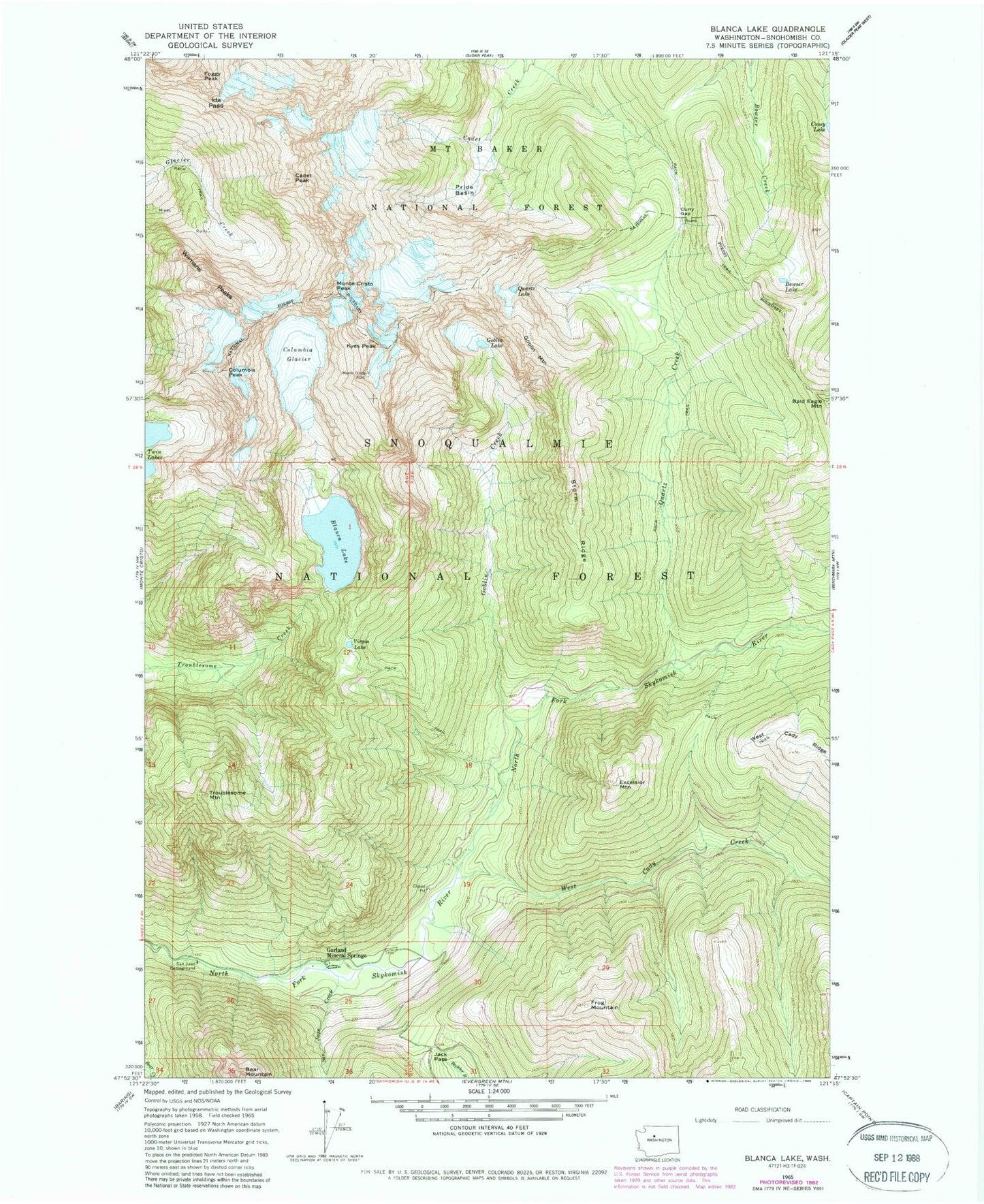
Classic USGS Blanca Lake Washington 7.5'x7.5' Topo Map
Couldn't load pickup availability
Historical USGS topographic quad map of Blanca Lake in the state of Washington. Typical map scale is 1:24,000, but may vary for certain years, if available. Print size: 24" x 27"
This quadrangle is in the following counties: Snohomish.
The map contains contour lines, roads, rivers, towns, and lakes. Printed on high-quality waterproof paper with UV fade-resistant inks, and shipped rolled.
Contains the following named places: Ida Pass, Bald Eagle Mountain, Blanca Lake, Bowser Lake, Cadet Peak, Columbia Glacier, Columbia Peak, Coney Lake, Curry Gap, Excelsior Mountain, Foggy Peak, Frog Mountain, Garland Mineral Springs, Goblin Creek, Goblin Lake, Goblin Mountain, Jack Pass, Kyes Peak, Monte Cristo Peak, Pride Basin, Quartz Creek, Quartz Lake, San Juan Campground, San Juan Creek, Storm Ridge, Troublesome Mountain, Virgin Lake, West Cady Creek, Wilmans Peaks, Glacier Basin, Mystery Hill (not official)