
MyTopo
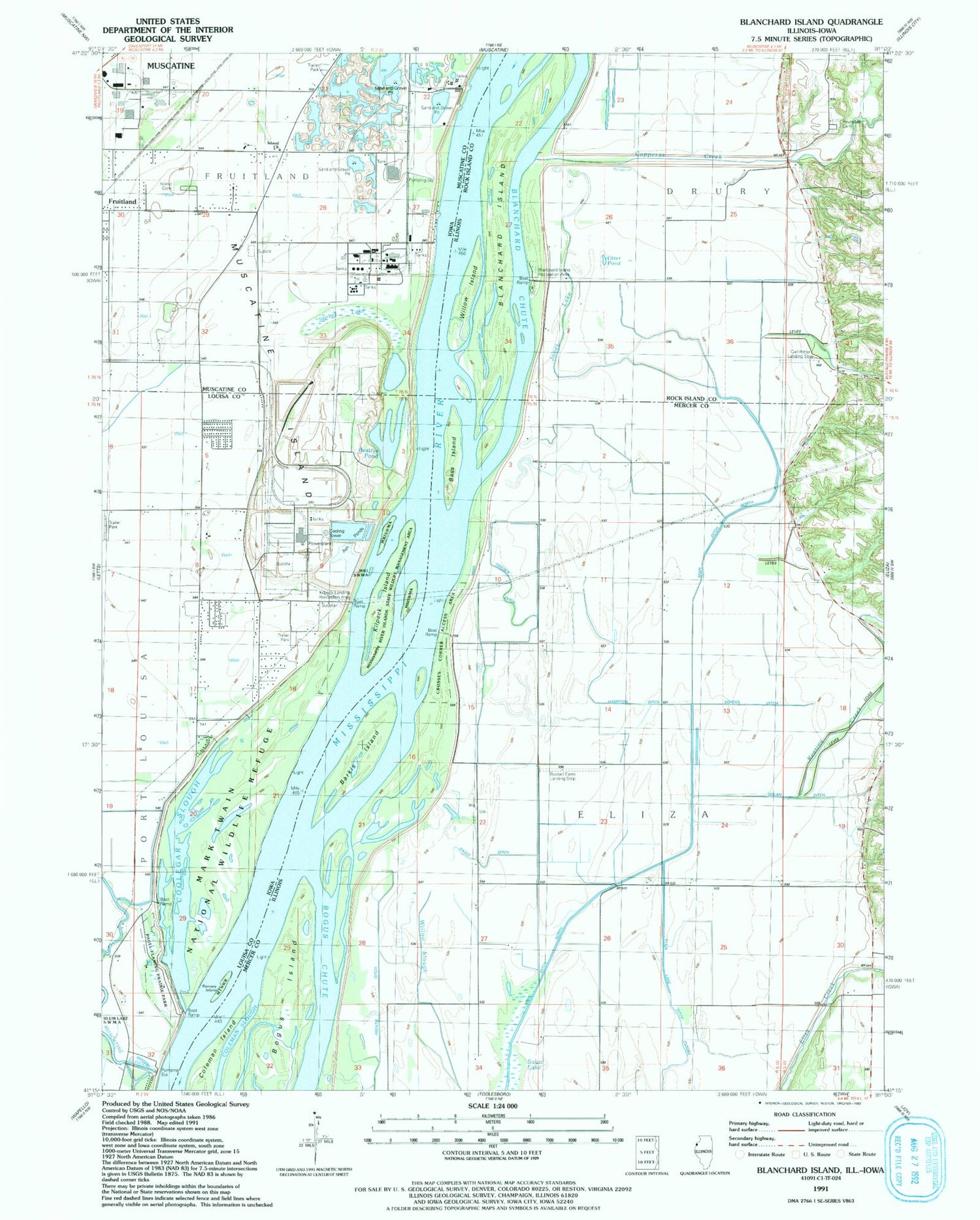
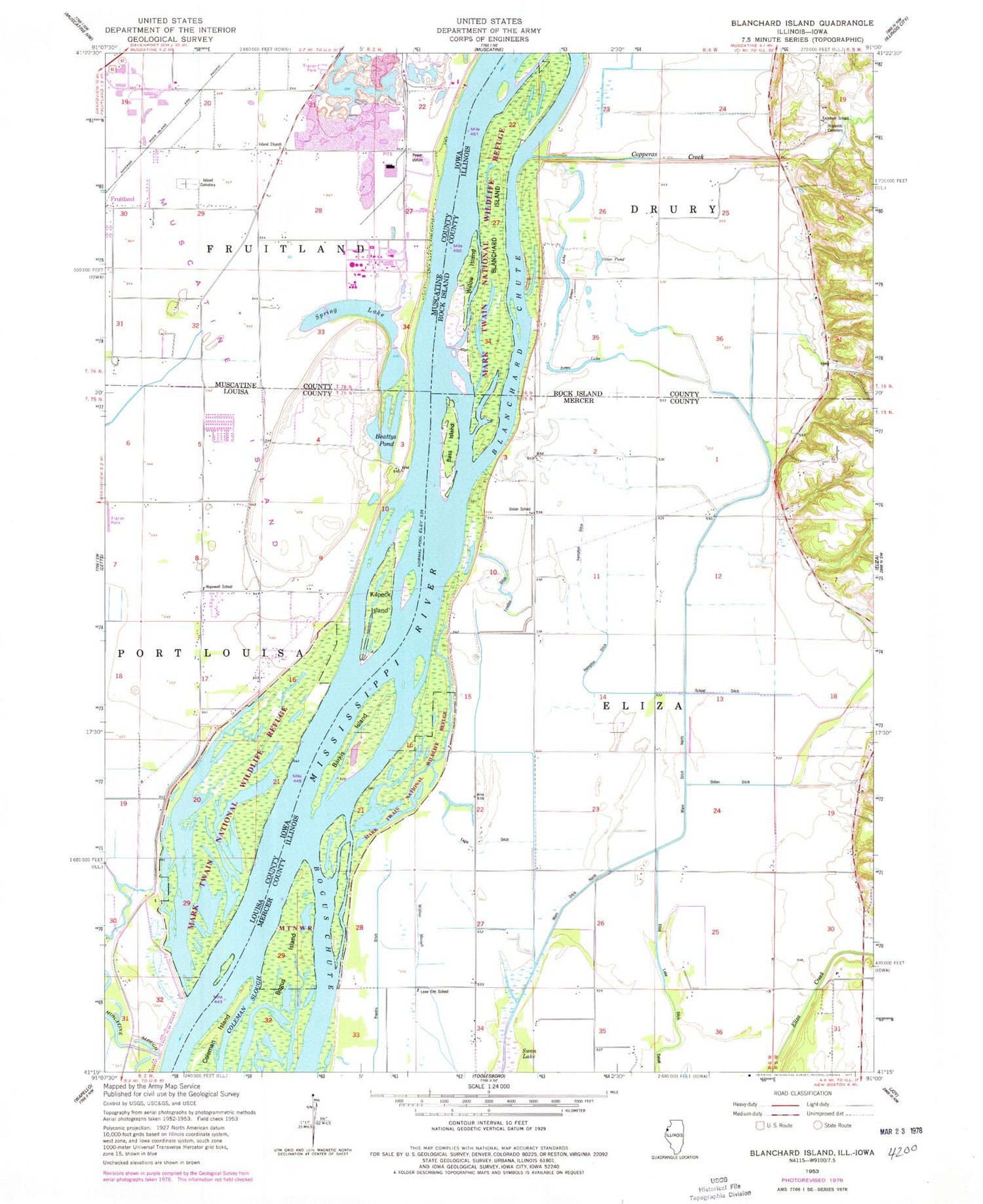
Classic USGS Blanchard Island Illinois 7.5'x7.5' Topo Map
Couldn't load pickup availability
Historical USGS topographic quad map of Blanchard Island in the states of Illinois, Iowa. Map scale may vary for some years, but is generally around 1:24,000. Print size is approximately 24" x 27"
This quadrangle is in the following counties: Louisa, Mercer, Muscatine, Rock Island.
The map contains contour lines, roads, rivers, towns, and lakes. Printed on high-quality waterproof paper with UV fade-resistant inks, and shipped rolled.
Contains the following named places: Barkis Island, Barkis Island Chute, Bass Island, Beattys Pond, Blanchard Chute, Blanchard Island, Blanchard Island Recreation Area, Bogus Island, Clear Lake, Coleman Island, Coolegar Slough, Copperas Creek, Crosses Corner Access Area, Dolan Creek, Dolan Ditch, Eagle Ditch, Eagle Fill, Excelsior School, Frieden Ditch, Fruitland Volunteer Fire Department, Glancey Cemetery, Glancey Lake, Hampton Ditch, Hopewell School, Island Cemetery, Island Church, Island Number 347, Jones Lake, Kammerer Trailer Court, Keating Creek, Kilpeck Island, Kilpeck Landing Recreation Area, Lone Elm School, Maas Airstrip, Main Ditch North, Mark Twain National Wildlife Refuge, Mid American Energy Company Louisa Generating Station, Mississippi River Islands State Wildlife Management Area, Muscatine Island, Muscatine Slough, Otter Pond, Pagel Flaming Prairie Park, Prentis Ditch, Ramsey Island, Reynolds Cemetery, Ritter Field, School Ditch, Spring Lake, Township of Fruitland, Union School, Upper Eliza Lake, Willow Island, ZIP Code: 61272


